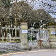
Porthkerry Country Park, Country park in Vale of Glamorgan, Wales.
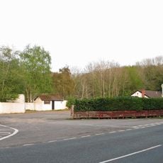
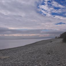
Porthkerry Country Park is a 220-acre area with woodlands, meadows, a pebble beach, and coastal cliffs overlooking the Bristol Channel. The park is crisscrossed by numerous walking trails that lead through different landscapes.
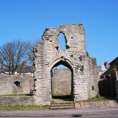
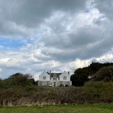
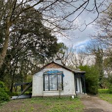
The Romilly family acquired the land starting in 1412 and developed it into a model farm with worker cottages, stables, and a sawmill. This early agricultural shaping left building remains and traces that are still visible in the landscape today.
The park holds the remains of a medieval village and old mill buildings that speak to the area's farming and craft heritage. Walking through the woodlands and meadows today, visitors follow paths where people lived and worked for hundreds of years.
The park has well-developed trails suited for different walking levels. Visitors should wear weather-appropriate clothing and be aware that the terrain is hilly with steep access to the beach and cliffs that requires care.
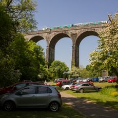
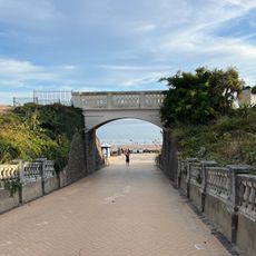
The Porthkerry Viaduct, built around 1900, is a striking stone arch bridge that spans across the landscape and is visible from many angles. This engineering achievement often goes unnoticed by visitors despite being a prominent feature of the terrain.
Location: Vale of Glamorgan
Inception: 1972
GPS coordinates: 51.39390,-3.31360
Latest update: December 12, 2025 16:41
Barry Island Pleasure Park
2.7 km
Barry Tourist Railway
2.7 km
Barry Castle
1.4 km
Porthkerry Viaduct
295 m
Barry Memorial Hall
2.9 km
Welsh Hawking Centre
2.4 km
The Bulwarks, Porthkerry
765 m
King's Square
3.5 km
Friars Point House,
2.3 km
All Saints' Church
1.8 km
Aberthaw Terrace English Wesleyan Methodist Chapel
1.9 km
St Mary's Church
3.4 km
Church Of St Curig
557 m
Barry Library, Cardiff & Vale College
2.8 km
Lodge to Friars Point House, Friars Road (W End), Barry Island
2.4 km
Pedestrian Bridge
2.9 km
Cenotaph (Including Area Walls and Steps), Gladstone Road (N Side)
2.9 km
Holy Trinity English Presbyterian Chapel
2.5 km
Cross in the Churchyard of the Church of St Curig
556 m
Seafront Wall
2.8 km
East Shelter
3 km
West Shelter and Amusement Arcade
2.5 km
Gates and Gatepiers at Drive Entrance to Friars Point House, Friars Road (W End), Barry Island
2.4 km
Tabernacle Welsh Independent Chapel
3.5 km
Bethel English Baptist Chapel
1.8 km
No 69, High Street (S Side) Barry
2.1 km
Barry Island Viaduct
2.5 km
Public Convenience
2.9 kmVisited this place? Tap the stars to rate it and share your experience / photos with the community! Try now! You can cancel it anytime.
Discover hidden gems everywhere you go!
From secret cafés to breathtaking viewpoints, skip the crowded tourist spots and find places that match your style. Our app makes it easy with voice search, smart filtering, route optimization, and insider tips from travelers worldwide. Download now for the complete mobile experience.
A unique approach to discovering new places❞
— Le Figaro
All the places worth exploring❞
— France Info
A tailor-made excursion in just a few clicks❞
— 20 Minutes