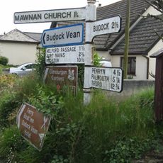
Port Navas Creek, Tidal creek in Cornwall, England
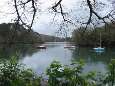
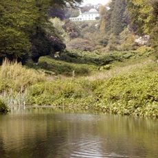
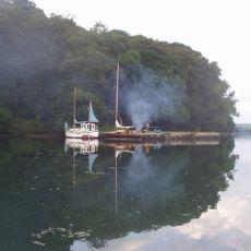
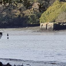
Port Navas Creek is a tidal inlet that flows through a narrow valley for about one kilometer as part of the larger Helford River system. Three separate arms branch off in different directions, creating a complex waterway with steep banks and small sheltered bays.
The area developed as a mining center in the 1800s when the Wheal Anna Maria Mine operated from 1833 to 1882, extracting copper, lead, and silver. This industrial activity shaped the local landscape and economy, with remnants of mining operations still visible today.
The name comes from Cornish origins meaning 'creek of the house of elm trees' and reflects the area's deep connection to local fishing traditions. Residents use the waterway as a working harbor where boats still gather for maritime activities.
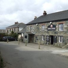
Access to the creek is centered around the Grade II listed Port Navas Quay, which serves boats and offers a good starting point for exploring. The best way to experience the area is to walk the shoreline and observe the tidal patterns that shape the waterway throughout the day.
The creek supports active oyster beds that continue to supply local seafood production and remain an important part of the marine economy. This ongoing harvesting practice demonstrates how traditional maritime activities still sustain the area.
Location: Cornwall
GPS coordinates: 50.10090,-5.14090
Latest update: December 12, 2025 12:07
Trebah
1.3 km
Glendurgan Garden
1.8 km
Meneage
3.7 km
St Mawnan and St Stephen's Church, Mawnan
3.3 km
Trenarth Bridge
1.2 km
Church of Saint Michael
2.8 km
Church of St Constantine
3.1 km
Church of St Martin
3.9 km
Church of Saint Anthony
3.1 km
Church of Saint Manacca
2.2 km
The Prince Of Wales Public House
4.1 km
Glendurgan Maze
1.8 km
The Red Lion
2.9 km
Halamana Cottage
3.3 km
The Shipwright's Arms Public House
901 m
Tremayne Quay
2.3 km
Part of a promontory fort with Civil War fieldworks known as Little Dennis
3.5 km
Gear Farmhouse And Garden Wall To Front
3.9 km
Inscribed Stone At Approximately 5 Metres South Of Church Of St Martin
3.9 km
Gate Piers, Flanking Walls And Stile At Approximately 16 Metres West Of Church Of St Martin
3.9 km
Corner House
4.1 km
Guide Post At Sw 764253
2 km
Guidepost At Sw 756 247
2.3 km
Guide Post At The Principal Village Road Junction
2.2 km
Guide Post At Sw774280
2.3 km
Merthen Quay Including Revetment Adjoining On South West
2.5 km
Guide Post About 50 Metres West Of Green Dale
3.2 km
Guide Post Sw778287
2.9 kmVisited this place? Tap the stars to rate it and share your experience / photos with the community! Try now! You can cancel it anytime.
Discover hidden gems everywhere you go!
From secret cafés to breathtaking viewpoints, skip the crowded tourist spots and find places that match your style. Our app makes it easy with voice search, smart filtering, route optimization, and insider tips from travelers worldwide. Download now for the complete mobile experience.
A unique approach to discovering new places❞
— Le Figaro
All the places worth exploring❞
— France Info
A tailor-made excursion in just a few clicks❞
— 20 Minutes