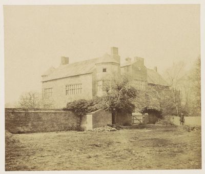
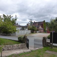
Poole Hall, Grade II* listed English country house in Poole, United Kingdom.
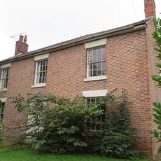
Poole Hall is a two-storey red brick country house with a three-bay entrance front and six-bay south side, topped with hipped slate roofs. Inside, it displays classical design with stone slab flooring, Corinthian columns in the drawing room, and geometric staircases with limestone treads in the entry hall.
The house was built in 1817 and reflects the architectural language of the Regency era. Its Grade II* listing status in 1967 recognised its exceptional design quality and importance to the local heritage landscape.
The name reflects its location in Poole, where it has held a prominent place in local architecture since the early 1800s. Visitors can still observe the skilled craftsmanship evident in details such as the geometric staircases and cast iron railings throughout the entry hall.
The building is visible from outside and easily recognisable by its distinctive red brick facade and slate roofs. Visitors should note the classical proportions of the front elevation to locate entrances and windows.
The entrance porch is supported by Ionic columns bearing a flat roof, a detail that underscores the house's classical refinement. The narrow boarded oak door and large recessed windows with flat arches show a subtle yet sophisticated architectural language.
Location: Poole
GPS coordinates: 53.09230,-2.53080
Latest update: December 14, 2025 11:41
Rookery Hall
1.6 km
St Mary's Church, Acton
2.5 km
Snugburys
2.4 km
Nantwich Workhouse
1.9 km
Nantwich Aqueduct
2.6 km
St Oswald's Church, Worleston
1.8 km
Poole Methodist Chapel
1.1 km
The Star Inn
2.5 km
Hurleston Bridge Number 1
2.5 km
Llangollen Branch of the Shropshire Union Canal Hurleston Lock Number 3
2.2 km
Shropshire Union Canal Main Line Nantwich Junction Bridge Number 92
2.3 km
Dorfold Hall Lodge and entrance gates
2.6 km
Willow Farmhouse
2.4 km
Sundial in St. Mary's Churchyard north-east of the Church
2.5 km
Almhouses in St Mary's churchyard north of the church
2.4 km
Basin End
2.4 km
Llangollen Branch of the Shropshire Union Canal Hurleston Lock Number 4 (West)
2.2 km
St. Mary's Churchyard Wall
2.4 km
Llangollen Branch of the Shropshire Union Canal Hurleston Lock Number 2
2.1 km
Pinfold 150 Yards North West Of Poole Bank
698 m
Church Farm House
2.4 km
Llangollen Branch of the Shropshire Union Canal Hurleston Lock Number 1 (East)
2 km
Glebe House
2.5 km
K6 telephone kiosk east of Monks Lane and the parish church
2.4 km
Shropshire Union Canal Main Line Canal Mile Post By Nantwich Junction Bridge
2.3 km
Shropshire Union Canal Main Line Lock Gate North Side Of Nantwich Junction Bridge
2.3 km
Milepost, S of Park Farm
813 m
Milepost, Main Road at SJ6580656425
1.8 kmVisited this place? Tap the stars to rate it and share your experience / photos with the community! Try now! You can cancel it anytime.
Discover hidden gems everywhere you go!
From secret cafés to breathtaking viewpoints, skip the crowded tourist spots and find places that match your style. Our app makes it easy with voice search, smart filtering, route optimization, and insider tips from travelers worldwide. Download now for the complete mobile experience.
A unique approach to discovering new places❞
— Le Figaro
All the places worth exploring❞
— France Info
A tailor-made excursion in just a few clicks❞
— 20 Minutes