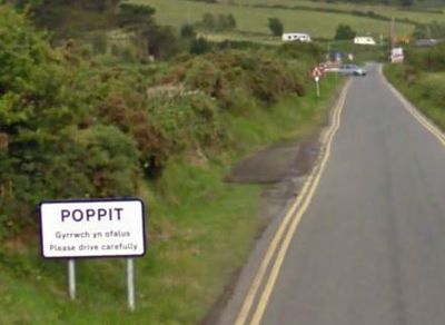
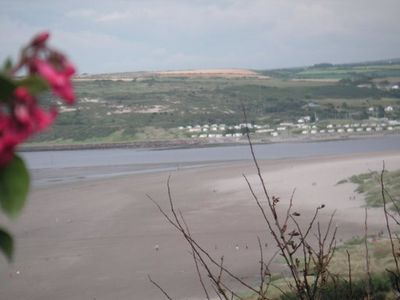
Poppit Sands, Sandy beach at northern Pembrokeshire, Wales
Poppit Sands is a sandy beach on the northern coast of Pembrokeshire, stretching along the southern bank of the Teifi Estuary. The shore features extensive dunes and offers views toward Cardigan Island and the settlement of Gwbert.
The site contains a V-shaped fish trap structure from around the 10th century, discovered by archaeologists using aerial photography. This ancient structure reveals that the bay has been used for fishing for over 1,000 years.
The location marks the starting or ending point of the Pembrokeshire Coast Path, a popular walking route traced by thousands of visitors annually. Those who begin or finish their journey here become part of a long tradition of coastal walkers.
The beach has a car park, café, and toilets for visitor convenience. A concrete ramp with a wooden walkway provides easier access to the shore and is helpful during wet weather or for those with limited mobility.
The waters off this shore attract bottlenose dolphins, porpoises, and Atlantic grey seals during the summer months, offering visitors chances to spot marine wildlife. This makes it a notable location for observing sea animals in their natural habitat.
Location: Pembrokeshire
GPS coordinates: 52.10700,-4.69600
Latest update: December 9, 2025 18:45
River Teifi
3.3 km
Our Lady of Cardigan
3.7 km
St Dogmaels Abbey
3.1 km
Albro Castle
2.2 km
Guildhall
3.5 km
Bethania Welsh Baptist Church
3.6 km
St Pedrog's Church
3 km
Mount Zion English Baptist Church
3.6 km
Tabernacl Chapel
3.5 km
Cardigan Library
3.7 km
The Black Lion Hotel, High Street
3.6 km
The Grosvenor Hotel, Bridge Street
3.7 km
Canfas
3.7 km
Castle Chambers (Previously Listed With The Gosvenor Hotel) Bridge Street
3.7 km
New Mill Full Gospel Church
3.6 km
The War Memorial, Including Surrounding Fence, North Road
3.6 km
Siloam Baptist Chapel
3.1 km
No.11 High Street (Midland Bank)
3.6 km
Graystone, Priory Street
3.6 km
Pantywylan, Cambrian Quay
3.7 km
Tŷ Mawr, High Street
3.6 km
Bethsaida Baptist Chapel
3 km
Bryn-y-mor, bryn-y-mor
2.1 km
Stanley House, Including Garden Wall, Gatepiers and Gate, North Road
3.5 km
No.26 Quay Street
3.7 km
The Old Shire Hall, high Street
3.6 km
No.14 High Street (Lloyd's Bank)
3.6 km
Railings,gates & Gatepiers At Bethania Baptist Chapel,william Street
3.6 kmVisited this place? Tap the stars to rate it and share your experience / photos with the community! Try now! You can cancel it anytime.
Discover hidden gems everywhere you go!
From secret cafés to breathtaking viewpoints, skip the crowded tourist spots and find places that match your style. Our app makes it easy with voice search, smart filtering, route optimization, and insider tips from travelers worldwide. Download now for the complete mobile experience.
A unique approach to discovering new places❞
— Le Figaro
All the places worth exploring❞
— France Info
A tailor-made excursion in just a few clicks❞
— 20 Minutes