Log in to your account

AroundUs is a community-driven map of interesting places, built by curious explorers like you. It grows with every review, story, and photo you share.
Connect to save your favorite spots, contribute locations, and create personalized routes.
Continue with Google
Continue with Apple
Continue with X
Continue with Facebook
Continue with email
By continuing, you accept our Terms and Conditions and our Privacy Policy
Create an account
Add to collection
Map
Suggest a change
Share

Roman Rig, Linear earthwork and scheduled monument in Rotherham and Sheffield, England.

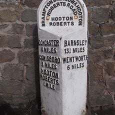
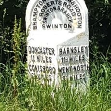
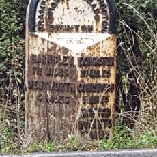
Roman Rig is a linear earthwork system stretching from Wincobank in Sheffield through Kimberworth to Mexborough across roughly 15 kilometers of South Yorkshire. Near Kimberworth, this structure splits into two parallel branches, with one passing through Greasbrough and the other running north of Swinton.

The structure was built in the first century AD by Brigantian tribes to defend against advancing Roman forces in northern England. Archaeological surveys show it connected two Iron Age forts and served as a territorial boundary.

The earthwork was known by different names across centuries, including Scotland Balk, Barber Balk, and Danes Bank, showing how local people understood it. These names reflect local stories and ideas that changed over generations.

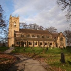
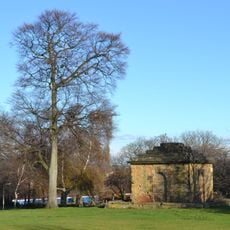
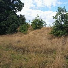
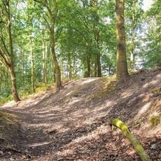
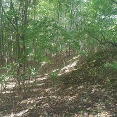
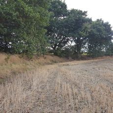
The system spans protected land in places and remains visible at many points today, with the walk passing through different landscape types. It helps to research the various sections before visiting, as the topography offers different degrees of visibility.

The structure linked two older fortified sites, one at Wincobank and another at Scholes Coppice, which may have served as control points of an ancient border. This dual function as connector and boundary made it a remarkable engineering approach to territorial defense.

Location: Rotherham

Location: Sheffield

Location: Wentworth

GPS coordinates: 53.47000,-1.33200

Latest update: December 14, 2025 09:44

Photos
Around this place
Rockingham Kiln
United Kingdom

Rockingham Kiln

1.6 km
The Rockingham Mausoleum
United Kingdom

The Rockingham Mausoleum

3.1 km
Church of St Mary
United Kingdom

Church of St Mary

3 km
Church of St Leonard
United Kingdom

Church of St Leonard

2.8 km
Church of St Mary
United Kingdom

Church of St Mary

1.6 km
Church of St Margaret
United Kingdom

Church of St Margaret

2.3 km
Mausoleum On East Side Of Newhill Park
United Kingdom

Mausoleum On East Side Of Newhill Park

3.3 km
Glossop Lodge
United Kingdom

Glossop Lodge

2.4 km
Roman Ridge: section 300yds (270m) long N of Birchwood (E of Chemical Cottages)
United Kingdom

Roman Ridge: section 300yds (270m) long N of Birchwood (E of Chemical Cottages)

964 m
Club House Of Rotherham Golf Club  Thrybergh Park
United Kingdom

Club House Of Rotherham Golf Club Thrybergh Park

2.4 km
Greasbrough War Memorial And Railed Enclosure
United Kingdom

Greasbrough War Memorial And Railed Enclosure

3.1 km
Milepost Opposite Warren House Cottage
United Kingdom

Milepost Opposite Warren House Cottage

1.6 km
Milepost Approximately 100 Metres To North West Of Junction With Highthron Road
United Kingdom

Milepost Approximately 100 Metres To North West Of Junction With Highthron Road

1.5 km
Mausoleum Lodge
United Kingdom

Mausoleum Lodge

2.9 km
Hall Farmhouse
United Kingdom

Hall Farmhouse

3.3 km
Swinton House
United Kingdom

Swinton House

2 km
Roman Ridge: section 520yds (480m) E of Dyson's Cottage to Long Plantation
United Kingdom

Roman Ridge: section 520yds (480m) E of Dyson's Cottage to Long Plantation

809 m
Milepost Approximately 100 Metres To West Of Junction With Carr Lane
United Kingdom

Milepost Approximately 100 Metres To West Of Junction With Carr Lane

2.9 km
15, Fitzwilliam Street
United Kingdom

15, Fitzwilliam Street

2.1 km
Hall Farmhouse
United Kingdom

Hall Farmhouse

1.7 km
Roman Ridge: section 140yds (130m) long in Dyson's Plantation
United Kingdom

Roman Ridge: section 140yds (130m) long in Dyson's Plantation

878 m
Milestone Approximately 30 Metres To North West Of Mausoleum Lodge
United Kingdom

Milestone Approximately 30 Metres To North West Of Mausoleum Lodge

2.9 km
Swinton Hall
United Kingdom

Swinton Hall

2 km
Hawthorne Farmhouse
United Kingdom

Hawthorne Farmhouse

2 km
Roman Ridge: section 400yds (370m) long S of Abdy Farm
United Kingdom

Roman Ridge: section 400yds (370m) long S of Abdy Farm

1.9 km
Milepost Approximately 45 Metres South West Of Junction With Abdy Lane
United Kingdom

Milepost Approximately 45 Metres South West Of Junction With Abdy Lane

1.5 km
Milepost Approximately 350 Metres To East Of Junction With Warren Vale
United Kingdom

Milepost Approximately 350 Metres To East Of Junction With Warren Vale

689 m
Dalton Main Colliery Ltd Silverwood and Roundwood Collieries WWI Memorial, Thrybergh
United Kingdom

Dalton Main Colliery Ltd Silverwood and Roundwood Collieries WWI Memorial, Thrybergh

3.2 km
Show the full map
Reviews

Visited this place? Tap the stars to rate it and share your experience / photos with the community! Try now! You can cancel it anytime.

« Roman Rig - Linear earthwork and scheduled monument in Rotherham and Sheffield, England » is provided by Around Us (aroundus.com). Images and texts are derived from Wikimedia project under a Creative Commons license. You are allowed to copy, distribute, and modify copies of this page, under the conditions set by the license, as long as this note is clearly visible.

Discover hidden gems everywhere you go!

From secret cafés to breathtaking viewpoints, skip the crowded tourist spots and find places that match your style. Our app makes it easy with voice search, smart filtering, route optimization, and insider tips from travelers worldwide. Download now for the complete mobile experience.

Around Us App Screenshot

A unique approach to discovering new places

Le Figaro

All the places worth exploring

France Info

A tailor-made excursion in just a few clicks

20 Minutes