St Wilfrid's Church, Halton-on-Lune

Log in to your account

AroundUs is a community-driven map of interesting places, built by curious explorers like you. It grows with every review, story, and photo you share.
Connect to save your favorite spots, contribute locations, and create personalized routes.
Continue with Google
Continue with Apple
Continue with X
Continue with Facebook
Continue with email
By continuing, you accept our Terms and Conditions and our Privacy Policy
Create an account

St Wilfrid's Church, Halton-on-Lune

Add to collection
Map
Suggest a change
Share

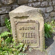
St Wilfrid's Church, Halton-on-Lune, Anglican church in Halton-on-Lune, England.

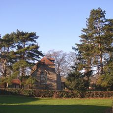
St Wilfrid's Church is an Anglican church building in Halton-on-Lune constructed in 1876-1877 with yellow sandstone walls and red tile roofing. The structure displays a prominent 55-foot tower featuring diagonal buttresses and a crenellated parapet designed in Gothic Revival style.

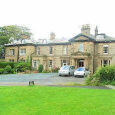
A religious site has stood here since Anglo-Saxon times, but the present building was designed by the Lancaster architects Paley and Austin in the 1870s. This reconstruction reflected the architectural tastes of the era and the community's need for expanded space.

The interior holds stained glass windows depicting religious figures created by the Lancaster-based firm Shrigley and Hunt. These works shape how the space feels and reflect the artistic traditions of the region.

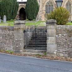
The church is open to visitors who wish to explore the building and its interior during service times or by arrangement. Planning ahead to confirm access times ensures you can fully appreciate the architecture and artwork inside.

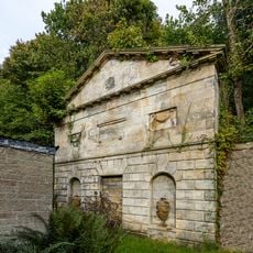
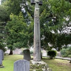
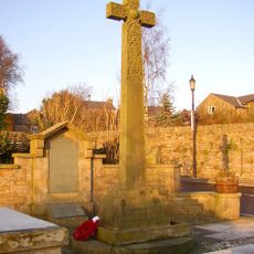
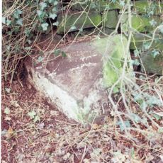
The churchyard contains a distinctive two-tiered family burial vault built into a hillside that belonged to the Bradshaw family. This underground tomb shows how burial practices were constructed during the Victorian period.

Location: Halton-with-Aughton

Inception: 1877

Architects: Sharpe, Paley and Austin

Architectural style: Gothic Revival

Website: http://stthomasgarstang.co.uk

GPS coordinates: 54.07600,-2.76720

Latest update: December 14, 2025 09:43

Photos
Around this place
Lancaster Canal
United Kingdom

Lancaster Canal

2.4 km
Escowbeck
United Kingdom

Escowbeck

2.8 km
Lancaster Carriage and Wagon Works
United Kingdom

Lancaster Carriage and Wagon Works

2.4 km
St Luke's Church, Slyne with Hest
United Kingdom

St Luke's Church, Slyne with Hest

2.8 km
St Luke's Church, Skerton
United Kingdom

St Luke's Church, Skerton

3 km
Halton narrow toll bridge
United Kingdom

Halton narrow toll bridge

444 m
Church of St Joseph
United Kingdom

Church of St Joseph

2.8 km
Beaumont Hall Bridge (Number 109)
United Kingdom

Beaumont Hall Bridge (Number 109)

2.2 km
Bradshaw Mausoleum, Halton Churchyard
United Kingdom

Bradshaw Mausoleum, Halton Churchyard

13 m
Hammerton Hall Bridge (Number 111)
United Kingdom

Hammerton Hall Bridge (Number 111)

2.8 km
Western railway bridge over the River Lune at Crook of Lune
United Kingdom

Western railway bridge over the River Lune at Crook of Lune

2.1 km
Halton Road Bridge
United Kingdom

Halton Road Bridge

1.7 km
White Lion Hotel And Coach House Adjoining To North-East
United Kingdom

White Lion Hotel And Coach House Adjoining To North-East

59 m
Manor House
United Kingdom

Manor House

2.5 km
Eastern railway bridge over the River Lune at Crook of Lune
United Kingdom

Eastern railway bridge over the River Lune at Crook of Lune

2.3 km
Milestone
United Kingdom

Milestone

1.6 km
Caton Lune Bridge
United Kingdom

Caton Lune Bridge

2.3 km
Milestone 25 Metres North Of Manor House At Ngr Sd 477 660
United Kingdom

Milestone 25 Metres North Of Manor House At Ngr Sd 477 660

2.5 km
Milestone 350 Metres North Of Beaumont Gate Farm At Ngr Sd 476 644
United Kingdom

Milestone 350 Metres North Of Beaumont Gate Farm At Ngr Sd 476 644

2.3 km
High cross in St Wilfrid's churchyard, Halton
United Kingdom

High cross in St Wilfrid's churchyard, Halton

28 m
Boundary Stone 100 Metres North Of Drive To Slyne Hall At Ngr Sd 479 663
United Kingdom

Boundary Stone 100 Metres North Of Drive To Slyne Hall At Ngr Sd 479 663

2.5 km
Manor House
United Kingdom

Manor House

458 m
Pair Of Gatepiers At Entrance To Churchyard To South Of The Church Of St Wilfrid
United Kingdom

Pair Of Gatepiers At Entrance To Churchyard To South Of The Church Of St Wilfrid

32 m
Tower House And Former Stables And Barn Adjoining
United Kingdom

Tower House And Former Stables And Barn Adjoining

65 m
The Boat House
United Kingdom

The Boat House

107 m
Halton-with-Aughton War Memorial
United Kingdom

Halton-with-Aughton War Memorial

189 m
Lancaster Canal Dolphinlee Bridge (Number 105)
United Kingdom

Lancaster Canal Dolphinlee Bridge (Number 105)

2.1 km
Milestone, Lancaster Road, at appex of main curve on Crook o' Lune, E of the Hotel
United Kingdom

Milestone, Lancaster Road, at appex of main curve on Crook o' Lune, E of the Hotel

2.4 km
Show the full map
Reviews

Visited this place? Tap the stars to rate it and share your experience / photos with the community! Try now! You can cancel it anytime.

« St Wilfrid's Church, Halton-on-Lune - Anglican church in Halton-on-Lune, England » is provided by Around Us (aroundus.com). Images and texts are derived from Wikimedia project under a Creative Commons license. You are allowed to copy, distribute, and modify copies of this page, under the conditions set by the license, as long as this note is clearly visible.

Discover hidden gems everywhere you go!

From secret cafés to breathtaking viewpoints, skip the crowded tourist spots and find places that match your style. Our app makes it easy with voice search, smart filtering, route optimization, and insider tips from travelers worldwide. Download now for the complete mobile experience.

Around Us App Screenshot

A unique approach to discovering new places

Le Figaro

All the places worth exploring

France Info

A tailor-made excursion in just a few clicks

20 Minutes