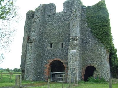
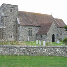
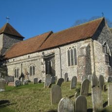
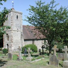
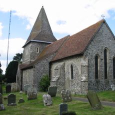
St. Radegund's Abbey, Medieval monastic ruins in Hougham Without, England.
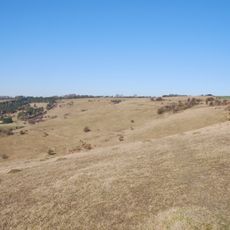
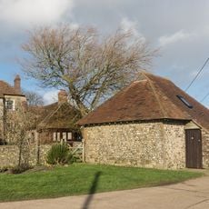
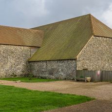
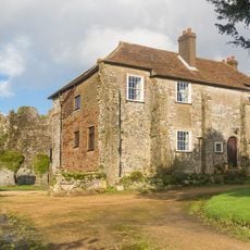
St. Radegund's Abbey is a medieval monastery whose ruins remain scattered across farmland in Kent. Stone sections of the abbey church and outbuildings stand among fields where farming continues around these historical remains.
The monastery was founded by Benedictine monks in the early 1200s and operated until the Dissolution of the Monasteries under King Henry VIII around the 1500s. The site then gradually fell into disrepair as structures were repurposed or abandoned.
The site bears the name of Saint Radegund, a 6th-century queen whose devotion inspired religious communities across medieval Europe. Walking through the remains, visitors can sense the rhythm of monastic life that once unfolded within these walls.
The site sits within an active farm, so visitors should stay on designated paths and respect ongoing agricultural use. Sturdy footwear is recommended as the ruins are spread across uneven ground among working fields.
The abbey's structures display building techniques and architectural styles from different medieval periods, visible in varying stone patterns and construction methods. This layering reveals how construction practices evolved over centuries at a single site.
Location: Hougham Without
GPS coordinates: 51.13190,1.25083
Latest update: December 13, 2025 17:03
Samphire Hoe Country Park
3.4 km
Hougham Battery
3.1 km
Lydden Spout Battery
3.2 km
St Mary's Church, Capel-le-Ferne
2.7 km
Lydden and Temple Ewell Downs
3.3 km
Alkham, Lydden and Swingfield Woods
2.3 km
Parish Church of St Andrew Buckland
3 km
Church of St Anthony the Martyr
2 km
Church of St Peter and St Paul
2.5 km
Church of St Peter
2.1 km
Church of St Lawrence
2 km
War Memorial in the Churchyard of Church of St Lawrence
2 km
Dover Transport Museum
3.3 km
St Radegund's Abbey, Poulton
68 m
Well House About 20 Metres South Of St Radegund's Abbey Farmhouse
59 m
Stone Barn At St Radegund's Abbey Farm, About 65 Metres South Of Well House
122 m
St Radegund's Abbey Farmhouse And Outhouse
22 m
Crabble Mill
2.5 km
Fortifications, Roman lighthouse and medieval chapel on Western Heights
3.8 km
Crabble Corn Mill
2.5 km
Buckland House
3 km
Former Tram Shelter At Junction With Elms Vale Road
3.3 km
Milestone, Old Dover Road, by Royal Oak PH
3.5 km
Milepost, E of roundabout intersection with A2, W of footpath to Hougham Court Farm
3 km
Milestone, Folkestone Road, by No. 239; at jct of Underdown Road
3.3 km
Milestone, Canterbury Road at TR277450
3 km
Milestone, London Road, opp. No 161, SE of jct with Temple Side
2.6 km
Milestone, London Road, Buckland, Nos 49 & 50
3.7 kmVisited this place? Tap the stars to rate it and share your experience / photos with the community! Try now! You can cancel it anytime.
Discover hidden gems everywhere you go!
From secret cafés to breathtaking viewpoints, skip the crowded tourist spots and find places that match your style. Our app makes it easy with voice search, smart filtering, route optimization, and insider tips from travelers worldwide. Download now for the complete mobile experience.
A unique approach to discovering new places❞
— Le Figaro
All the places worth exploring❞
— France Info
A tailor-made excursion in just a few clicks❞
— 20 Minutes