Lydden Spout Battery, World War II artillery battery in Kent, United Kingdom
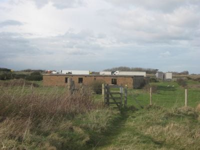
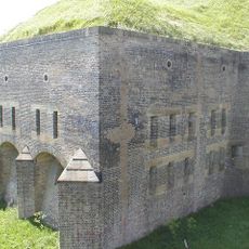
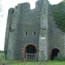
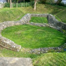
Lydden Spout Battery is a World War II artillery position on the Kent coast consisting of three gun emplacements, underground ammunition magazines, and multiple brick structures. The complex stretches across the site west of Dover and still contains the original layout of this defensive installation.
The 520 Coastal Artillery Regiment operated this position from 1941 onward with three 6-inch guns capable of long-range coastal defense. The guns were removed in the 1950s after the war ended, though the underground structures and buildings remained on the site.
The site shows how British coastal defenses were organized during the war, with separate areas for officers and enlisted men that reflected the military hierarchy of the time. Visitors walking the grounds can see how the layout separated different ranks into distinct mess buildings.
The site is open to visitors and the buildings offer a clear view of how soldiers lived and worked at a coastal battery. Wear sturdy shoes since the grounds include rolling pastureland, and you can explore the underground tunnel systems if you visit.
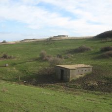
The underground gun emplacement retains its original metal ventilation trunking system that supplied air to the plotting rooms during operations. After the war, this space served as a shooting range before being repurposed for agricultural use.
Inception: 1941
GPS coordinates: 51.10400,1.26000
Latest update: December 14, 2025 11:40
Dover Western Heights
3.3 km
Battle of Britain Memorial, Capel-le-Ferne
3.8 km
Samphire Hoe Country Park
1.1 km
East Cliff and Warren Country Park
2.9 km
Hougham Battery
786 m
St. Radegund's Abbey
3.2 km
Knights Templar Church, Dover
3.5 km
Dover Marine War Memorial
4 km
Folkestone Warren
1.7 km
St Mary's Church, Capel-le-Ferne
2.8 km
Shakespeare Cliff
2.4 km
Church of St Lawrence
1.2 km
War Memorial in the Churchyard of Church of St Lawrence
1.2 km
Cinque Port Arms
3.8 km
Well House About 20 Metres South Of St Radegund's Abbey Farmhouse
3.1 km
St Radegund's Abbey, Poulton
3.1 km
Stone Barn At St Radegund's Abbey Farm, About 65 Metres South Of Well House
3.1 km
Former Customs Watch House
4 km
St Radegund's Abbey Farmhouse And Outhouse
3.2 km
Clock Tower And Former Lifeboat House
4.1 km
Fortifications, Roman lighthouse and medieval chapel on Western Heights
3.3 km
Grand Shaft Stairs And Attached Railings
3.8 km
Former Tram Shelter At Junction With Elms Vale Road
3.3 km
Archcliffe Fort
3.5 km
Milestone, Old Dover Road, opp. No.47
3.2 km
Lord Warden House
3.8 km
Milestone, Old Dover Road, by Royal Oak PH
2 km
Milestone, Folkestone Road, by No. 239; at jct of Underdown Road
3.3 kmVisited this place? Tap the stars to rate it and share your experience / photos with the community! Try now! You can cancel it anytime.
Discover hidden gems everywhere you go!
From secret cafés to breathtaking viewpoints, skip the crowded tourist spots and find places that match your style. Our app makes it easy with voice search, smart filtering, route optimization, and insider tips from travelers worldwide. Download now for the complete mobile experience.
A unique approach to discovering new places❞
— Le Figaro
All the places worth exploring❞
— France Info
A tailor-made excursion in just a few clicks❞
— 20 Minutes