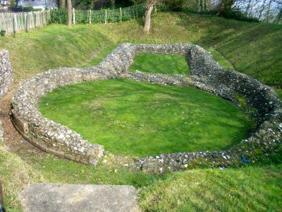
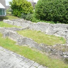
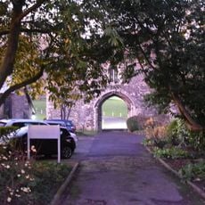
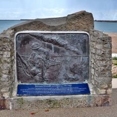
Knights Templar Church, Dover, Medieval church ruins in Western Heights, Dover, England
The Knights Templar Church is a ruined medieval church in Dover's Western Heights featuring an unusual circular floor plan with an attached rectangular chancel. The remaining walls are built from flint and show the original design of a religious site that served medieval Dover's seafaring community.
The church was built around 1001 and served Dover's religious community for centuries. Its remains were rediscovered in 1806 when fortifications were being expanded in the Western Heights.
The circular form connects to the Church of the Holy Sepulchre in Jerusalem, showing how medieval English communities felt linked to sacred places in the East.
The ruins are open during daylight hours without entrance fees, though the uneven ground requires appropriate footwear. Visitors should move carefully as loose stones and aged structures present potential hazards.
The site may have been connected to the Templars, a military-religious order that held great power in medieval times. This connection makes it a rare remnant of a religious network that once shaped all of Europe.
Location: Dover
Inception: 11 century
Website: https://english-heritage.org.uk/visit/places/knights-templar-church-dover
GPS coordinates: 51.11880,1.30449
Latest update: December 14, 2025 12:24
Dover Bronze Age Boat
862 m
Dover Western Heights
243 m
Dover Museum
920 m
Dover Priory
906 m
St Mary's Church, Dover
984 m
Dover Marine War Memorial
1 km
War Memorial in the Churchyard of the Parish Church of St Mary the Virgin, Dover
997 m
St Martin's Church
903 m
Cinque Port Arms
540 m
60th Rifles Memorial To Indian Mutiny
851 m
Unitarian Church And Vestry Adjoining
792 m
Clock Tower And Former Lifeboat House
586 m
Library, Dover College
843 m
Former Customs Watch House
714 m
Nos 1 To 9 Including Basement Area Railings
836 m
Fortifications, Roman lighthouse and medieval chapel on Western Heights
290 m
Dunkirk 1940 memorial, Dover, Kent
734 m
1-30, Waterloo Crescent
859 m
Grand Shaft Stairs And Attached Railings
325 m
New Bridge House
866 m
144, Snargate Street
562 m
Former Tram Shelter At Junction With Elms Vale Road
802 m
K6 Telephone Kiosk
861 m
Archcliffe Fort
437 m
The Market Hall
892 m
On the Crest of a Wave
855 m
Fairbairn-type crane, Wellington Dock
576 m
Milestone, Folkestone Road, by No. 239; at jct of Underdown Road
768 mVisited this place? Tap the stars to rate it and share your experience / photos with the community! Try now! You can cancel it anytime.
Discover hidden gems everywhere you go!
From secret cafés to breathtaking viewpoints, skip the crowded tourist spots and find places that match your style. Our app makes it easy with voice search, smart filtering, route optimization, and insider tips from travelers worldwide. Download now for the complete mobile experience.
A unique approach to discovering new places❞
— Le Figaro
All the places worth exploring❞
— France Info
A tailor-made excursion in just a few clicks❞
— 20 Minutes