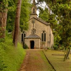
Swift's Hill SSSI, Protected grassland near Stroud, United Kingdom.
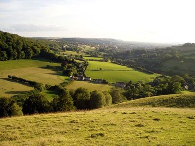
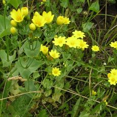
Swift's Hill is a protected grassland with limestone terrain near Stroud that covers approximately 9 hectares. The site supports over 130 wildflower species and 13 different orchid types that color the area during blooming season.
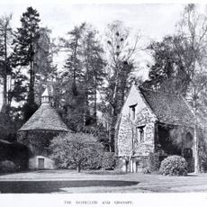
The Gloucestershire Wildlife Trust purchased this area in 1967 from F R Elliott, establishing it under the alternate name Elliott Reserve. This acquisition by the conservation organization secured the grassland as a protected scientific site.
The site sits in Slad Valley, which appears as a backdrop in the memoir Cider with Rosie, connecting the landscape to local literary tradition. Sheep graze across the grassland, shaping both the appearance and the plant life visitors encounter.
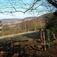
The site remains open year-round and is unfenced, allowing visitors to freely access the grounds. Sheep graze across the area as part of traditional land management, so visitors should watch for grazing animals and stay on established paths.
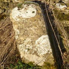
A small quarry in the northwest section contains fossil-bearing ragstone that reveals information about Middle Jurassic geology. These stone remains from deep time are preserved in the rock face and tell the story of this place's ancient past.
GPS coordinates: 51.75930,-2.17889
Latest update: December 14, 2025 18:12
Lypiatt Park
1.2 km
Bull Cross, The Frith and Juniper Hill
1.7 km
Church of All Saints
2.4 km
Snows Farm Nature Reserve
1.7 km
Church of Holy Trinity
812 m
Cemetery Chapel
2.4 km
Milestone
2 km
K6 Telephone Kiosk
789 m
Lodge And Gateway To Lypiatt Park
852 m
Lypiatt Cross
1.4 km
Red Stables
2 km
Plate To Milestone On Boundary Wall To School
795 m
School and school house with boundary walls
803 m
Abbey Farmhouse
592 m
Milestone, Bisley Road
2.3 km
Down Farmhouse
1.3 km
The Old House
1.1 km
Woodside House
670 m
Slad War Memorial
1.2 km
Milestone, Catswood Lane, 450m E Ansteads Farm entrance
1.5 km
Old Greenhouse Farm, Little Greenhouse, stable block (including Nos.1 and 2 Greenhouse Mews) and Coach House
2.1 km
Rose Bank
871 m
Vatch House
586 m
Milestone, Uplands
1.4 km
Milestone, Stepping Stone Lane
2.4 km
Milestone, Slad; 10m W of Old Sunday School, opp pair of cottages
801 m
Milestone, Wick Street; 50m N The Malt House
1.9 km
Milestone, by Redding Wood, on restricted byway between Steanbridge Lane & Catswood Lane
791 mVisited this place? Tap the stars to rate it and share your experience / photos with the community! Try now! You can cancel it anytime.
Discover hidden gems everywhere you go!
From secret cafés to breathtaking viewpoints, skip the crowded tourist spots and find places that match your style. Our app makes it easy with voice search, smart filtering, route optimization, and insider tips from travelers worldwide. Download now for the complete mobile experience.
A unique approach to discovering new places❞
— Le Figaro
All the places worth exploring❞
— France Info
A tailor-made excursion in just a few clicks❞
— 20 Minutes