Chest opened
+${chestReward.xp} XP
Explorer
NOUVEAU ×${chestReward.collectible.quantity}
tapez pour fermer

See the monuments around you in AR Open chests in the app

Around Us is built for your phone — point your camera at the streets and discover the monuments and places around you in augmented reality. Around Us is built for your phone — chests unlock when you walk, explore and capture nearby places.

Enable Location

We need your location to show you interesting places around you

Discover nearby places

Find interesting locations and hidden gems around you

Precise directions

Get accurate directions and distances to places

Your location is never shared with other users. It's only used when you tap the location button.

Log in to your account

Start exploring — it's free

Trusted by 84,001 travelers worldwide

Continue with Google
Continue with Apple
or

We will send you a code to connect

By continuing, you accept our Terms and Conditions and our Privacy Policy

Check your inbox

We've sent a pincode in your inbox. Please enter the code below.

Swinden House
Discussion Reviews Photo
1.3k Popularity

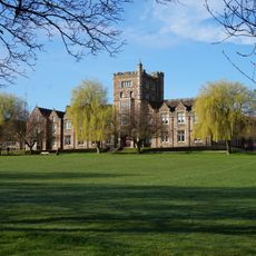
Swinden House, Grade II listed building in Moorgate district, Rotherham, England.

Swinden House is a Victorian mansion in the Moorgate district of Rotherham with nine meeting rooms accommodating 2 to 80 people. The interiors feature oak paneling sourced from Rotherham Parish Church during its construction in 1880.

Thomas W. Badger, a prominent Rotherham lawyer, built the house between 1878 and 1880, initially naming it Red House. After his departure due to financial troubles, United Steel acquired it in 1946 and renamed it after Dr. T. Swinden.

The structure changed from a private residence to a research center in 1946 when United Steel purchased it and renamed it after Dr. T. Swinden.

The building sits close to highways M1 and M18 and is near Rotherham Town Centre, making it easy to reach by car. The meeting spaces have elevators and multiple entrances to serve different visitor needs.

During World War II, the National Fire Service requisitioned the property and used it as a fire station. This wartime assignment marked a turning point in the building's shift from private residence to institutional use.

The community of curious travelers

AroundUs brings together thousands of curated places, local tips, and hidden gems, enriched daily by 60,000 contributors worldwide.

Start exploring
Location
GPS coordinates
53.41540,-1.33460
Latest update
August 2, 2026 20:20
Around this place
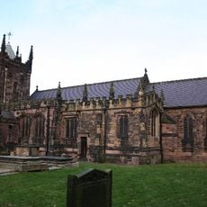
Church of St Mary Magdalene
United Kingdom

Church of St Mary Magdalene

1.4 km
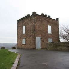
Boston Castle
United Kingdom

Boston Castle

1.4 km
Thomas Rotherham College
United Kingdom

Thomas Rotherham College

1.1 km
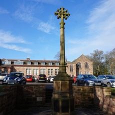
Rotherham Grammar School War Memorial
United Kingdom

Rotherham Grammar School War Memorial

1.2 km
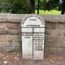
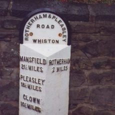
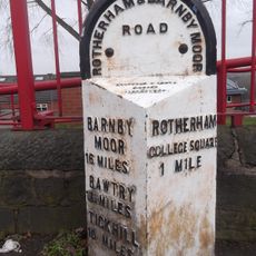
Milepost In Front Of No 229
United Kingdom

Milepost In Front Of No 229

838 m
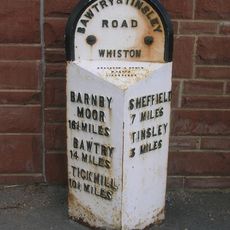
Milepost Opposite Moorgate Grove
United Kingdom

Milepost Opposite Moorgate Grove

1 km
Milepost Approximately 125 Metres South-West Of Junction With Moorgate Road
United Kingdom

Milepost Approximately 125 Metres South-West Of Junction With Moorgate Road

1 km
United Kingdom

Oakwood Hall Including Balustraded Retaining Wall Attached To Portico

726 m
United Kingdom

Whiston Hall Barn

1.2 km
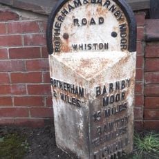
Milepost Opposite No 144
United Kingdom

Milepost Opposite No 144

803 m
United Kingdom

Clifton House

1.8 km
United Kingdom

Gate Piers At Entrance To Park From Clifton Grove

1.7 km
United Kingdom

Stable And Granary Immediately To South Of Whiston Hall

1.2 km
United Kingdom

Roman Resited To Rear Of Clifton House

1.8 km
United Kingdom

Blue Man's Bower moated site, Whiston

1.6 km
Milepost In Front Of No 214
United Kingdom

Milepost In Front Of No 214

1.3 km
United Kingdom

Moorgate Hall And Attached Outbuilding

1.5 km
United Kingdom

Canklow Hill earthworks

1 km
United Kingdom

Stable-Block With Attached Wing Walls, Immediately To East Of Clifton House

1.8 km
United Kingdom

Sundial At Centre Of Rose Garden Approximately 90 Metres To North East Of Clifton House

1.8 km
United Kingdom

Newman School

779 m
United Kingdom

Doorway Re-Erected In Rock Face Approximately 100 Metres To South East Of Boston Castle

1.3 km
United Kingdom

Village Stocks Approximately 15 Metres To West Of Tower Of Church Of St Mary Magdalene

1.4 km
United Kingdom

Whiston Hall

1.1 km
United Kingdom

Headstone To Rebekah Cutt Approximately 11 Metres To West Of Tower Of Church Of St Mary Magdalene*

1.4 km
United Kingdom

59,61, Moorgate Road

1.2 km
United Kingdom

Scenic viewpoint

1.4 km
United Kingdom

Scenic viewpoint

1.6 km
Show the full map
Reviews
Share your experience

No review yet

Discussions
Start a discussion...

No discussion yet

« Swinden House - Grade II listed building in Moorgate district, Rotherham, England » is provided by Around Us (aroundus.com). Images and texts are derived from Wikimedia project under a Creative Commons license. You are allowed to copy, distribute, and modify copies of this page, under the conditions set by the license, as long as this note is clearly visible.

Discover hidden gems everywhere you go!

From secret cafés to breathtaking viewpoints, skip the crowded tourist spots and find places that match your style. Our app makes it easy with voice search, smart filtering, route optimization, and insider tips from travelers worldwide. Download now for the complete mobile experience.

Around Us App Screenshot

A unique approach to discovering new places

Le Figaro

All the places worth exploring

France Info

A tailor-made excursion in just a few clicks

20 Minutes

Around Us
Travel Guide & Maps
Download

Send to your phone

QR Code
1

Open the camera app on your mobile.

2

Point at the QR code with your camera. A notification will appear.

3

Tap the notification to open the link.