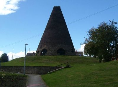
Catcliffe Glass Cone, Glass cone in Catcliffe, England
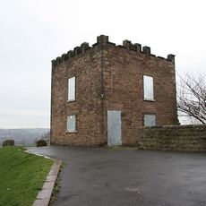
Catcliffe Glass Cone is a brick-built structure that rises approximately 70 feet (21 meters) high with multiple openings at its base designed to control airflow around the glass furnaces. The interior held the furnaces and work areas where craftsmen shaped molten glass into products.
William Fenney established the glassworks in 1740, choosing Catcliffe because it met legal requirements for distance from his previous operation. The facility operated for over two centuries before eventually closing.
The glass cone was the heart of a working community where skilled craftsmen produced glass using time-honored techniques. The building's distinctive form was essential to daily operations and defined the industrial landscape of the area.
The cone sits on private land with limited public access, but it can be viewed from nearby public roads and footpaths. Photography from a distance is possible and gives a good sense of the structure's size and proportions.
During World War I, the cone housed prisoners of war, and later it served an unexpected purpose during the 1926 general strike when it became a canteen. This dual use reveals how industrial structures were repurposed when circumstances changed.
The community of curious travelers
AroundUs brings together thousands of curated places, local tips, and hidden gems, enriched daily by 60,000 contributors worldwide.