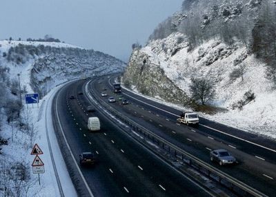
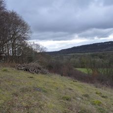
Stokenchurch Gap, Road cutting in Chiltern Hills, England
Stokenchurch Gap is a road cutting through the Chiltern Hills in Oxfordshire. The passage was carved into the chalk bedrock to make way for the M40 motorway.
The cutting was created in the 1970s as part of the M40 motorway expansion project. The work involved extensive blasting and excavation through ancient chalk bedrock.
The cutting functions as a designated Site of Special Scientific Interest, containing geological features from the Late Cretaceous period.
Visibility on this motorway section can be significantly reduced during winter months due to dense fog formation. Travelers should expect reduced sight lines and adjust their driving accordingly.
The cutting exposes chalk layers from about 88 million years ago, revealing how the environment changed during that ancient period. These old rocks remind us that this region looked completely different at that time.
Location: South Oxfordshire
GPS coordinates: 51.66167,-0.93806
Latest update: December 14, 2025 17:02
Wormsley Park
1.9 km
Shirburn Castle
3.9 km
Chinnor and Princes Risborough Railway
4.6 km
Aston Rowant NNR
904 m
St Mary's Church, Pyrton
4.9 km
All Saints Church, Shirburn
3.9 km
Aston Rowant Woods
2.5 km
Swain's Wood
4.4 km
Wormsley Chalk Banks
2.8 km
Stokenchurch War Memorial
2.6 km
Church of St Peter and St Paul
2.5 km
Church of St Peter and St Paul, Aston Rowant
2.7 km
Church of St Margaret, Lewknor
2.3 km
Church of St Nicholas
4.6 km
Church of the Nativity of the Blessed Virgin Mary
3.4 km
Watlington Methodist Church
4.9 km
Ye Olde Leathern Bottle Public House
2.4 km
Fox And Hounds Hotel And Public House
4.9 km
The Plough Inn Public House
4.8 km
St Lawrence
4 km
Aston Rowant War Memorial
2.8 km
Hampden Cottage Manor Lodge
4.8 km
Model Farm, Engine House And Attached Buildings Approximately 15 Metres South South West Of Farmhouse
4.1 km
1-7, Blenheim Road
3.6 km
1-7, Hill Road
4.9 km
Gatehouse Approximately 85 Metres South Of Shirburn Castle
3.9 km
Searleys and Simmons And Lawrence
4.9 km
Milestone, Wycombe Road; at jct. with Marlow Road, B482
2.8 kmVisited this place? Tap the stars to rate it and share your experience / photos with the community! Try now! You can cancel it anytime.
Discover hidden gems everywhere you go!
From secret cafés to breathtaking viewpoints, skip the crowded tourist spots and find places that match your style. Our app makes it easy with voice search, smart filtering, route optimization, and insider tips from travelers worldwide. Download now for the complete mobile experience.
A unique approach to discovering new places❞
— Le Figaro
All the places worth exploring❞
— France Info
A tailor-made excursion in just a few clicks❞
— 20 Minutes