Enable Location

We need your location to show you interesting places around you

Discover nearby places

Find interesting locations and hidden gems around you

Precise directions

Get accurate directions and distances to places

Your location is never shared with other users. It's only used when you tap the location button.

The White Rose Way

Log in to your account

Start exploring — it's free

Trusted by 68,335 travelers worldwide

Continue with Google
Continue with Apple
or

We will send you a code to connect

By continuing, you accept our Terms and Conditions and our Privacy Policy

Check your inbox

We've sent a pincode in your inbox. Please enter the code below.

The White Rose Way
Discussion Reviews 1 Photos
2.6k Popularity

The White Rose Way, Long-distance footpath in England

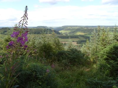
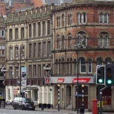
The White Rose Way is a long-distance walking trail stretching from Leeds to Scarborough across West and North Yorkshire, covering about 104 miles through varied landscapes. The route passes through grassy fields, woodlands, quiet villages, and follows waterways including the River Wharfe and Derwent River, with notable stops at Boston Spa, Tadcaster, York, and the North York Moors before reaching the seaside at South Bay in Scarborough.

The trail was created by Paul Brown, who spent a year designing a route that passes through areas tied to Yorkshire's past and natural features, deliberately incorporating sections of ancient Roman roads. The path weaves through landscapes connected to the region's historical significance and the symbolism of the white rose across centuries.

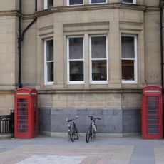
The White Rose Way takes its name from the white rose, a symbol connected to Yorkshire's history and identity. Along the route you pass through typical English villages with small houses, churches, and local shops where locals often greet travelers and share the peaceful rhythm of rural life.

The route can be walked in sections or completed as one continuous journey, allowing flexibility based on your time and fitness level. The path is clearly marked with benches at various points and passes through villages with cafes and inns where you can stop to rest and refuel along the way.

After storm damage near Wetherby, the new Woodhall Bridge was constructed to provide a safe crossing for walkers, showing how the route is continuously maintained. Along the trail walkers can obtain a free downloadable certificate of completion, documenting their achievement and encouraging many to attempt the full journey.

The community of curious travelers

AroundUs brings together thousands of curated places, local tips, and hidden gems, enriched daily by 60,000 contributors worldwide.

Start exploring
Location
GPS coordinates
53.79630,-1.54750
Latest update
February 9, 2026 08:22
Reviews
Share your experience

No review yet

Discussions
Start a discussion...

No discussion yet

« The White Rose Way - Long-distance footpath in England » is provided by Around Us (aroundus.com). Images and texts are derived from Wikimedia project under a Creative Commons license. You are allowed to copy, distribute, and modify copies of this page, under the conditions set by the license, as long as this note is clearly visible.

Discover hidden gems everywhere you go!

From secret cafés to breathtaking viewpoints, skip the crowded tourist spots and find places that match your style. Our app makes it easy with voice search, smart filtering, route optimization, and insider tips from travelers worldwide. Download now for the complete mobile experience.

Around Us App Screenshot

A unique approach to discovering new places

Le Figaro

All the places worth exploring

France Info

A tailor-made excursion in just a few clicks

20 Minutes

Around Us
Travel Guide & Maps
Download

Send to your phone

QR Code
1

Open the camera app on your mobile.

2

Point at the QR code with your camera. A notification will appear.

3

Tap the notification to open the link.