Chest opened
+${chestReward.xp} XP
Explorer
NOUVEAU ×${chestReward.collectible.quantity}
tapez pour fermer
Chest locked

Open chests in the app

Around Us is built for your phone — chests unlock when you walk, explore and capture nearby places.

Enable Location

We need your location to show you interesting places around you

Discover nearby places

Find interesting locations and hidden gems around you

Precise directions

Get accurate directions and distances to places

Your location is never shared with other users. It's only used when you tap the location button.

Log in to your account

Start exploring — it's free

Trusted by 72,893 travelers worldwide

Continue with Google
Continue with Apple
or

We will send you a code to connect

By continuing, you accept our Terms and Conditions and our Privacy Policy

Check your inbox

We've sent a pincode in your inbox. Please enter the code below.

Tantany
Discussion Reviews Photo
1.3k Popularity

Tantany, Residential district in West Bromwich, England

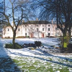
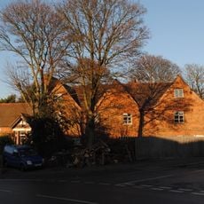
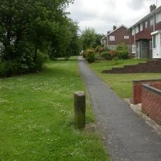
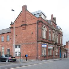
Tantany is a residential district in West Bromwich consisting mainly of terraced houses spread across multiple streets north of the town center. The homes range in age and character, forming the appearance of a traditional English working-class neighborhood.

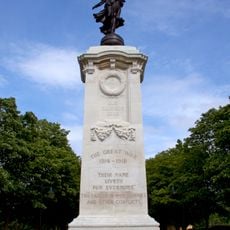
The area grew from 1920 onward as a municipal housing initiative, when West Bromwich created its first residential settlements. During the Second World War, the district experienced air raids that damaged numerous homes, leading to reconstruction afterward.

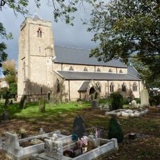
Local community spaces like churches and neighborhood centers host regular gatherings and events that shape how people connect. These places remain part of everyday life, reflecting the social bonds among residents.

The town center is reachable via direct roads, and several bus stops serve the area regularly. The rail station sits within easy walking distance and provides connections to nearby areas.

Many homes were rebuilt after wartime damage, giving the district a mixed age of structures. This reconstruction shaped the current streetscape and reflects postwar resilience.

The community of curious travelers

AroundUs brings together thousands of curated places, local tips, and hidden gems, enriched daily by 60,000 contributors worldwide.

Start exploring
GPS coordinates
52.52600,-1.99700
Latest update
December 14, 2025 17:44
Around this place
The Public
United Kingdom

The Public

834 m
Oak House, West Bromwich
United Kingdom

Oak House, West Bromwich

1.3 km
Sandwell Valley Country Park
United Kingdom

Sandwell Valley Country Park

2.2 km
West Bromwich Town Hall
United Kingdom

West Bromwich Town Hall

609 m
Ridgacre Branch
United Kingdom

Ridgacre Branch

964 m
Stewart Aqueduct
United Kingdom

Stewart Aqueduct

2.2 km
Spon Lane Locks Branch
United Kingdom

Spon Lane Locks Branch

2.1 km
Church of St. Andrew, West Bromwich
United Kingdom

Church of St. Andrew, West Bromwich

648 m
Sot's Hole Local Nature Reserve
United Kingdom

Sot's Hole Local Nature Reserve

991 m
Oak House Museum
United Kingdom

Oak House Museum

1.3 km
Church of St Peter
United Kingdom

Church of St Peter

2.2 km
Church of All Saints
United Kingdom

Church of All Saints

1.3 km
Farley Clock Tower
United Kingdom

Farley Clock Tower

557 m
Dartmouth Park
United Kingdom

Dartmouth Park

1.2 km
Bluebell
United Kingdom

Bluebell

840 m
Sot's Hole gate
United Kingdom

Sot's Hole gate

846 m
Highfields
United Kingdom

Highfields

451 m
Sandwell War Memorial
United Kingdom

Sandwell War Memorial

970 m
Footbridge Over Old Main Line At Bromford Junction, (Approximately 40 Metres) West Of Spon Lane Locks Birmingham Canal Wolverhampton Level
United Kingdom

Footbridge Over Old Main Line At Bromford Junction, (Approximately 40 Metres) West Of Spon Lane Locks Birmingham Canal Wolverhampton Level

2.2 km
West Bromwich Library
United Kingdom

West Bromwich Library

634 m
Top Lock, Spon Lane Locks, With Attached Footbridge Birmingham Canal Wolverhampton Level
United Kingdom

Top Lock, Spon Lane Locks, With Attached Footbridge Birmingham Canal Wolverhampton Level

2.1 km
Hill House
United Kingdom

Hill House

905 m
Footbridge Over New Main Line At Bromford Junction, 20 Metres South Of Bottom Lock, Spon Lane Locks Birmingham Canal Birmingham Level
United Kingdom

Footbridge Over New Main Line At Bromford Junction, 20 Metres South Of Bottom Lock, Spon Lane Locks Birmingham Canal Birmingham Level

2.2 km
Post box B71 46
United Kingdom

Post box B71 46

671 m
Arch Lodge And Flanking Wall (Junction 1 M5 Motorway And A41)
United Kingdom

Arch Lodge And Flanking Wall (Junction 1 M5 Motorway And A41)

2.2 km
Holyhead House
United Kingdom

Holyhead House

1.4 km
Milestone Approximately 10 Metres East Of No 136
United Kingdom

Milestone Approximately 10 Metres East Of No 136

1.8 km
Law Courts
United Kingdom

Law Courts

684 m
Show the full map
Reviews
Share your experience

No review yet

Discussions
Start a discussion...

No discussion yet

« Tantany - Residential district in West Bromwich, England » is provided by Around Us (aroundus.com). Images and texts are derived from Wikimedia project under a Creative Commons license. You are allowed to copy, distribute, and modify copies of this page, under the conditions set by the license, as long as this note is clearly visible.

Discover hidden gems everywhere you go!

From secret cafés to breathtaking viewpoints, skip the crowded tourist spots and find places that match your style. Our app makes it easy with voice search, smart filtering, route optimization, and insider tips from travelers worldwide. Download now for the complete mobile experience.

Around Us App Screenshot

A unique approach to discovering new places

Le Figaro

All the places worth exploring

France Info

A tailor-made excursion in just a few clicks

20 Minutes

Around Us
Travel Guide & Maps
Download

Send to your phone

QR Code
1

Open the camera app on your mobile.

2

Point at the QR code with your camera. A notification will appear.

3

Tap the notification to open the link.