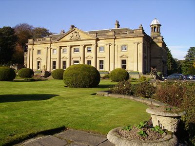
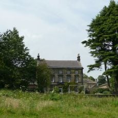
Wortley Hall, Grade II* listed mansion in Wortley, England
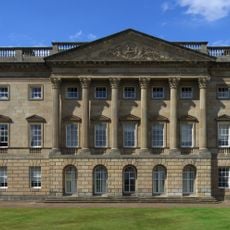
Wortley Hall is a sandstone mansion with a seven-bay south front, slate roofs, and a two-story main structure set within 26 acres of grounds. The estate now operates as an educational venue with 55 en-suite bedrooms, three self-catering cottages, and conference facilities across its gardens and woodlands.
The current structure was built between 1731 and 1761, with architect Giacomo Leoni overseeing major renovations from 1742 to 1746. Trade unionists later acquired the property and transformed it into an educational center in 1951.
Local trade unionists transformed the former aristocratic residence into an educational center in 1951, establishing it as a non-profit cooperative enterprise.
The venue is well set up for overnight stays and events with multiple accommodation options to suit different needs. Visitors exploring the gardens and woodlands should wear proper footwear, as the grounds are spread across the estate and can be uneven in places.
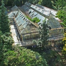
A walled garden dating from 1797 continues to grow organic fruit and vegetables for the on-site restaurants. This traditional growing method connects the property's long history with its current operation.
Location: Wortley
GPS coordinates: 53.49120,-1.53060
Latest update: December 8, 2025 19:58
Wentworth Castle
3.8 km
Wortley Top Forge
1.8 km
Barnes Hall
4.6 km
Wortley Top Forge
1.9 km
Church of St Leonard
527 m
Holy Trinity Church
2.9 km
Church of St Peter
3.7 km
Church of St John the Baptist
4.9 km
Church of St James
3.9 km
Milepost Approximately 20 Metres East Of Junction With Park Drive
4.6 km
Birdwell Obelisk
3.6 km
Duke Of Argyll's Monument
3.1 km
Queen Annes Obelisk
3.9 km
Stainborough Castle
3.6 km
Milepost At Mill Moor Plantation
1.4 km
Rotunda Temple
3.6 km
Stocksbridge Clock Tower
3.9 km
Huthwaite Hall
3 km
Milepost Approximately 350 Metres West Of Thurgoland Bridge
4.1 km
Milepost Opposite Junction With Bevan
4.7 km
Wayside cross at Howbrook crossroads
1.9 km
Milepost Approximately 40 Metres South East Of Junction With Penistone Road
3.6 km
Milepost Opposite Number 220 Approximately 200 Metres North West Of Junction With Haywood Lane
3.3 km
Conservatory And Linking Bridge At North West Corner Of Wentworth Castle
3.7 km
Milestone On North East Side Of Junction With Bank Lane
1.9 km
Milepost Approximately 150 Metres Nort West Of Entrance To Town End Farm
1.9 km
Milestone, Halifax Road, opp. Church
2.9 km
Milestone, just N of A629, Hallwood Road jct
3.4 kmVisited this place? Tap the stars to rate it and share your experience / photos with the community! Try now! You can cancel it anytime.
Discover hidden gems everywhere you go!
From secret cafés to breathtaking viewpoints, skip the crowded tourist spots and find places that match your style. Our app makes it easy with voice search, smart filtering, route optimization, and insider tips from travelers worldwide. Download now for the complete mobile experience.
A unique approach to discovering new places❞
— Le Figaro
All the places worth exploring❞
— France Info
A tailor-made excursion in just a few clicks❞
— 20 Minutes