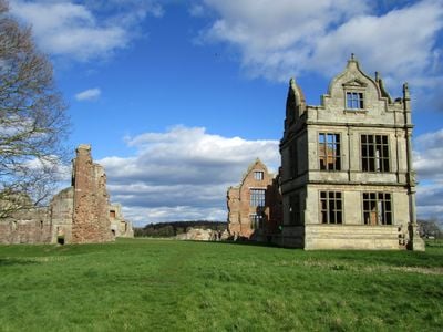
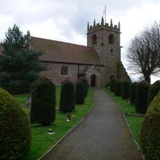
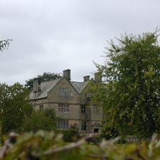
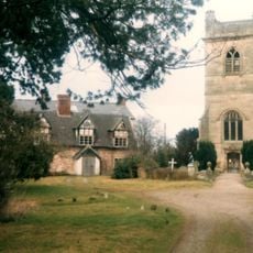
Moreton Corbet Castle, Medieval castle ruins in Moreton Corbet, England
Moreton Corbet Castle is a ruined medieval and Elizabethan-era complex near Shrewsbury. The site combines remains of a medieval stone fortress with a later mansion featuring a gatehouse and three-story south range with regularly spaced windows.
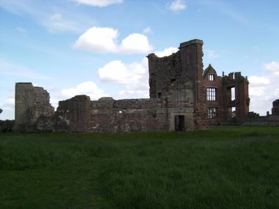
The original timber fortress built around 1100 was replaced with stone fortifications by 1200 under the Toret family's control. In 1644, Parliamentary forces captured the castle from Royalist defenders during a night assault.
The Elizabethan wing shows Italian Renaissance influences through its symmetrical design and classical architectural details. Visitors can still see these refined proportions in the surviving stonework today.
The site is open for free exploration during daylight hours and is easily accessible to visitors. Parking is limited but a layby near the main road provides space for vehicles.
The castle walls bear visible marks from musket fire during the 1644 night attack when Parliamentary troops captured the stronghold. These bullet holes remain clearly visible today and tell the story of the intense fighting that night.
Location: Moreton Corbet and Lee Brockhurst
Website: https://english-heritage.org.uk/visit/places/moreton-corbet-castle
GPS coordinates: 52.80450,-2.65240
Latest update: December 8, 2025 19:45
Acton Reynald Hall
2.6 km
Bury Walls
4.6 km
Church of St Mary
5.4 km
Church of St Mary the Virgin
2 km
Church of All Saints
4.1 km
Church of St Bartholomew
45 m
Church of All Saints
4.7 km
Church of St Peter
4.3 km
Church of St Andrew
913 m
Church of St Mary Magdalene
5 km
The Old Manor House
2.8 km
Moated site 140m east of St Mary's Church
2 km
The Well House And The Elephant And Castle Hotel
3.9 km
High Hatton Hall
4.8 km
Moreton Mill
1.4 km
Milepost Approximately 425 Metres To South Of Field House
3.3 km
The White House
2.7 km
The Manor House
4.1 km
Milepost Approximately 10 Metres To West Of Shawbury Bridge
1.9 km
Preston Farmhouse
2.8 km
Sundial Approximately 60 Metres To North East Of Church Of Saint Andrew
986 m
Mile Post Approximately 18 Metres South East Of Lodgebank
4.5 km
Moated site and associated ridge and furrow cultivation remains, 145m south of St Mary Magdalene's Church
5.1 km
Milepost Approximately 85 Metres To West Of Bridleway Gate
3.4 km
The Old Rectory
72 m
Milestone, Acton Reynald School wall S Grinshill turn
3.1 km
Milepost, Hadnall (N), by car sales
3.7 km
Milepost, Palms Hill, NW entrance to Pantulf House
5.4 kmVisited this place? Tap the stars to rate it and share your experience / photos with the community! Try now! You can cancel it anytime.
Discover hidden gems everywhere you go!
From secret cafés to breathtaking viewpoints, skip the crowded tourist spots and find places that match your style. Our app makes it easy with voice search, smart filtering, route optimization, and insider tips from travelers worldwide. Download now for the complete mobile experience.
A unique approach to discovering new places❞
— Le Figaro
All the places worth exploring❞
— France Info
A tailor-made excursion in just a few clicks❞
— 20 Minutes