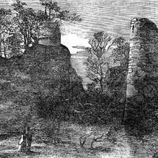
Bury Walls, Iron Age hillfort in Weston-under-Redcastle, England
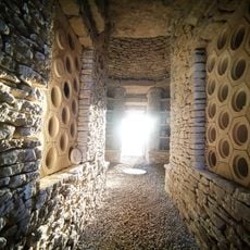
Bury Walls is a fortified settlement from the Iron Age with multiple overlapping banks and ditches that run across the elevated terrain. The defensive structure relies on the natural slope of the land, which adds extra protection to the site.
The fort was established during the Iron Age and shows evidence of long-term settlement through pottery finds. The multiple defensive lines suggest the community expanded and strengthened the fortifications as time went on.
The site shows how communities thousands of years ago protected their homes and lived together in the landscape. The way the banks and ditches are arranged tells of people who worked together and valued living close to one another.
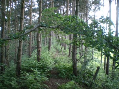
The site can be explored on foot using marked trails, and sturdy footwear is recommended due to the uneven ground. Information boards placed along the route help explain what you are seeing, making it easy to understand the remains without a guide.
The fort was positioned to dominate the surrounding landscape and could be seen from far away, suggesting it served as a symbol of power. This strategic placement reveals that the site was about more than just defense and protection.
Location: Weston-under-Redcastle
GPS coordinates: 52.84350,-2.63017
Latest update: December 14, 2025 18:07
Hawkstone Park
1.8 km
Hawkstone Hall
2.5 km
Moreton Corbet Castle
4.6 km
Soulton Long Barrow
4.7 km
Soulton Hall
4.3 km
Hodnet Hall
3.4 km
St Luke's Church, Hodnet
3.7 km
Wollerton Old Hall Garden
5.1 km
Church of St Peter
3.1 km
Church of St Andrew
3.8 km
Church of St Bartholomew
4.6 km
Church of St Luke
1.7 km
The Old Manor House
4.9 km
Rowland Hill Monument
1.7 km
Red Castle
2 km
High Hatton Hall
4 km
22, Marchamley
2.8 km
Moreton Mill
4.8 km
Lychgate approximately 35 metres to east of Church of St Luke
3.8 km
Disused windmill at NGR SJ 56652 29724
2.4 km
Hodnet Hall Dovecote
3.3 km
Sundial Approximately 60 Metres To North East Of Church Of Saint Andrew
3.8 km
Preston Farmhouse
4.8 km
Milepost Approximately 15 Metres To South West Of Stone Stone House
4.9 km
The White House
4.8 km
Mile Post Approximately 18 Metres South East Of Lodgebank
2.6 km
Milepost Approximately 85 Metres To West Of Bridleway Gate
3.7 km
The Old Rectory
4.5 kmVisited this place? Tap the stars to rate it and share your experience / photos with the community! Try now! You can cancel it anytime.
Discover hidden gems everywhere you go!
From secret cafés to breathtaking viewpoints, skip the crowded tourist spots and find places that match your style. Our app makes it easy with voice search, smart filtering, route optimization, and insider tips from travelers worldwide. Download now for the complete mobile experience.
A unique approach to discovering new places❞
— Le Figaro
All the places worth exploring❞
— France Info
A tailor-made excursion in just a few clicks❞
— 20 Minutes