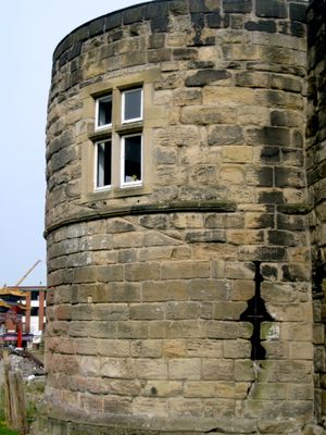
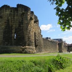
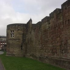
Morden Tower, Medieval tower in Newcastle upon Tyne, England
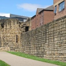
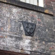
Morden Tower is a medieval tower in Newcastle upon Tyne that forms part of the historic Town Wall defensive system. It displays robust stone construction with narrow defensive openings designed to protect against attacks from different angles.
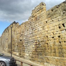
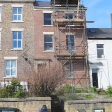
Built in the late 13th century, the tower was constructed as part of Newcastle's comprehensive defensive fortifications. Over subsequent centuries, most of the Town Wall was dismantled for urban development, yet this tower survived as a rare reminder of the medieval defensive network.
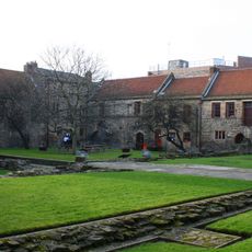
The tower served as a symbol of Newcastle's power and status as a fortified trading center through the Middle Ages. Visitors walking around it can sense how the structure shaped daily life and defense strategies of the medieval community.
The tower sits within walking distance of Newcastle's historic city center and is accessible year-round in an outdoor setting. Informational plaques at the site explain its structure and defensive role, making it easy to understand the fortifications.
This tower is one of only a handful of surviving sections from Newcastle's original medieval Town Wall. It stands quietly among modern buildings rather than as part of an obvious fortification, which is why many visitors overlook it despite its Grade I listed status.
The community of curious travelers
AroundUs brings together thousands of curated places, local tips, and hidden gems, enriched daily by 60,000 contributors worldwide.