Oxhey Woods, Local nature reserve near South Oxhey, England
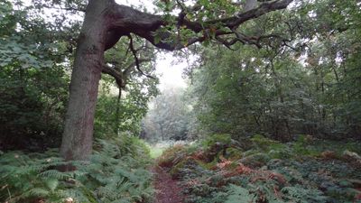
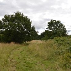
Oxhey Woods is a nature reserve near South Oxhey covering roughly 98 hectares of woodland with numerous paths winding through thick vegetation and mature trees. The site offers varied landscapes with different plant communities across its walking routes.
Parts of this woodland are ancient forests that date back thousands of years and hold important ecological value. This long-established landscape has supported forest habitats over many centuries.
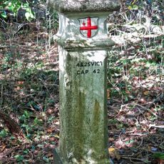
The woodland attracts school groups and local organizations who study the trees and plants found here as part of their regular work. Information boards throughout the site help visitors understand the different habitats they encounter.
The reserve has several entry points near Nairn Green, Oxhey Drive, and Prestwick Road where parking and picnic areas are available. The paths throughout are clearly marked and easy to walk at your own pace.
The woodland displays different wildflowers depending on the season, with bluebells appearing in spring and other blooms at different times through the year. These changing displays make each visit feel distinct.
GPS coordinates: 51.61600,-0.40140
Latest update: December 14, 2025 14:26
Heath Robinson Museum
2.8 km
Harrow Arts Centre
2.7 km
Oxhey Chapel
1.5 km
Eastbury Park
858 m
Queen's Head
2.8 km
Prestwick Road Meadows
943 m
Holy Trinity Church
2.5 km
St Anselm's Church
2.2 km
Northwood Police Station Including Police Lamp, Call Box, Boundary Fence And Gates
1.8 km
The Victory Public House
2.8 km
Northwood War Memorial
1.7 km
Pinner Police Station Including Stable Block, Boundary Wall, Gate Pier And Fences, Bollards And Police Lamps
2.5 km
London Coal Duty Marker On County Boundary Where Road Meets Potter Street Hill
360 m
The Gate Public House
2.6 km
Elm Park Court, And Entrance Arch
2.2 km
Northwood Library
1.7 km
Pinner War Memorial
2.8 km
Tooke's Folly At Pinner Hill Farm
1.3 km
Pinner Hill Golf Club House, And Boundary Wall Extending Northwards From Club House
511 m
34, 34A, 36, High Street
2.8 km
Haywood House
2.8 km
Coal Duty Boundary Post Outside Number 1 (The Hollies)
2.4 km
Milestone Outside The Oddfellows Arms Public House
2.6 km
London Coal Duty Marker On County Boundary About 140 Metres South Of Road
2 km
3, Waxwell Lane
2.5 km
London Coal Duty Marker On County Boundary On East Railway Embankment About 350 Metres South Of Road
1.6 km
London Coal and Wine Duty boundary post
2.4 km
Milestone, Rickmansworth Road, opp jct with Hills Lane
2 kmVisited this place? Tap the stars to rate it and share your experience / photos with the community! Try now! You can cancel it anytime.
Discover hidden gems everywhere you go!
From secret cafés to breathtaking viewpoints, skip the crowded tourist spots and find places that match your style. Our app makes it easy with voice search, smart filtering, route optimization, and insider tips from travelers worldwide. Download now for the complete mobile experience.
A unique approach to discovering new places❞
— Le Figaro
All the places worth exploring❞
— France Info
A tailor-made excursion in just a few clicks❞
— 20 Minutes