Eastbury Park, Victorian estate in Eastbury, England
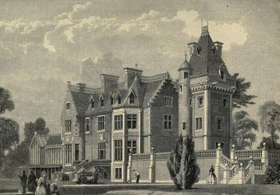
Eastbury Park is an estate with a Scottish Baronial style residence designed by architect David Bryce in the 1850s. The main building stood on land that would later become part of an RAF airfield used by Coastal Command.
The residence was built in 1857 for David Carnegie and passed to Frank Carew in 1887. The site was later taken over for military use and became an RAF airfield in 1938.
The building displayed Scottish Baronial details that wealthy Victorians used to showcase their status and refined taste during the mid-1800s.
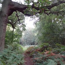
The site is now part of a developed area accessible from public roads, but there are no remaining structures or museum facilities to visit. Visitors can only explore the location where the building once stood and reflect on its history.
The main building was completely destroyed by fire in 1969 and survives only in historical records and memories. This event marked the end of a Victorian era on land that had become military property.
The community of curious travelers
AroundUs brings together thousands of curated places, local tips, and hidden gems, enriched daily by 60,000 contributors worldwide.