Portway, Roman road in Hampshire, England
The Portway is a Roman road that stretches across Hampshire's landscape and connects two former Roman settlements through the countryside. Its original construction consists of multiple layers of different materials bound together to create a durable thoroughfare.
The road was built during the Roman occupation of Britain and served as a key link in the network connecting administrative centers and settlements. It remained in use for many centuries after its construction and influenced how the region developed.
This ancient route served as a vital connection for traders and travelers moving between distant settlements during Roman times. The path it carved through the landscape continues to shape how people move and interact with Hampshire's countryside.
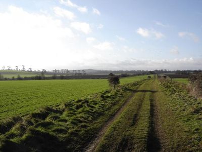
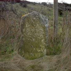
Visitors can walk along various sections of the original road where it remains visible in the modern landscape, particularly through woodland areas. The drier months offer the easiest walking conditions for exploring the route.
The original paved road surface lies just a few inches below the present ground level, remaining accessible to archaeologists digging beneath. This once smooth stone and gravel surface carried thousands of travelers before it became buried under soil and vegetation.
Location: Hampshire
GPS coordinates: 51.17003,-1.63378
Latest update: December 9, 2025 18:43
Thruxton Circuit
5 km
Amport House
4.9 km
Army Flying Museum
4.8 km
Wilbury House
3.5 km
Porton Down SSSI
5 km
St John the Baptist's Church, Allington
5.6 km
Church of St Michael
3.1 km
Church of St Nicholas
3.2 km
Church of St Mary
5.2 km
Church of St Peter
4.8 km
Church of St Peter and St Paul
5.4 km
Church of St Peter
4.1 km
Church of St Peter and St Paul
5.9 km
Church of St Andrew
4.1 km
Church of St Leonard
2 km
White Horse Inn
5.9 km
Kimpton Down Inn
5.9 km
Malet Arms
4.2 km
Amport Inn
6.1 km
Shipton Bellinger War Memorial
4.8 km
Cholderton War Memorial
3.4 km
Over Wallop War Memorial
3.9 km
Milestone At Turning To Roche Court
6.2 km
Milestone 50 Metres East Of Border Service Station On North Side Of Road
5.2 km
Milestone 30 Metres South West Of Junction With Craydown Lane
4.7 km
Milestone, Lopcombe Corner; 100m W Haynes Garage & caravan site
5.9 km
Milestone, Thruxton Village; opp. house named Gosling - relocated when by-pass built
5.4 km
Milestone, Thruxton Farm
2.9 kmVisited this place? Tap the stars to rate it and share your experience / photos with the community! Try now! You can cancel it anytime.
Discover hidden gems everywhere you go!
From secret cafés to breathtaking viewpoints, skip the crowded tourist spots and find places that match your style. Our app makes it easy with voice search, smart filtering, route optimization, and insider tips from travelers worldwide. Download now for the complete mobile experience.
A unique approach to discovering new places❞
— Le Figaro
All the places worth exploring❞
— France Info
A tailor-made excursion in just a few clicks❞
— 20 Minutes