Ringmoor stone row and cairn circle

Log in to your account

AroundUs is a community-driven map of interesting places, built by curious explorers like you. It grows with every review, story, and photo you share.
Connect to save your favorite spots, contribute locations, and create personalized routes.
Continue with Google
Continue with Apple
Continue with X
Continue with Facebook
Continue with email
By continuing, you accept our Terms and Conditions and our Privacy Policy
Create an account

Ringmoor stone row and cairn circle

Add to collection
Map
Suggest a change
Share

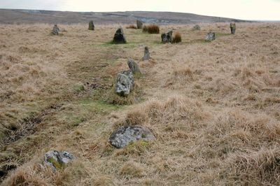
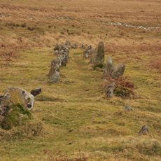
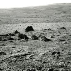
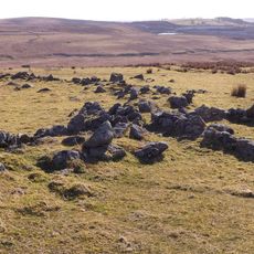
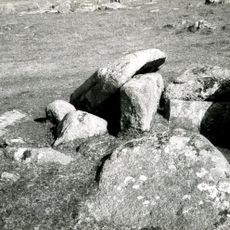
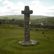
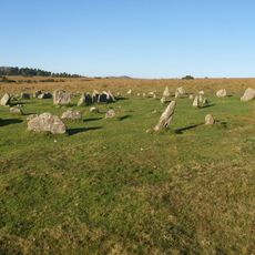
Ringmoor stone row and cairn circle, Bronze Age stone alignment in Dartmoor National Park, England.

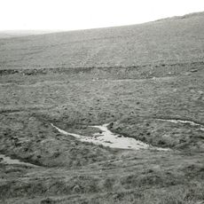
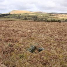
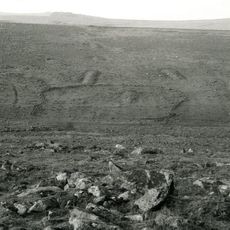
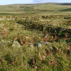
Ringmoor stone row is a prehistoric alignment of stones on Ringmoor Down in Dartmoor that stretches across the moorland in both single and double sections. A cairn circle sits at the southern end, with scattered stones marking the course throughout.

The stone row dates to the Bronze Age and formed part of early ceremonial or ritual activity on Dartmoor. Medieval communities later dismantled sections, taking stones for field boundaries and building purposes.

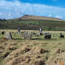
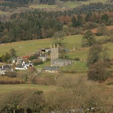
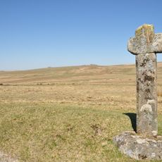
The stone row represents a significant example of prehistoric ceremonial structures, forming part of an extensive network of ancient monuments in the Upper Plym Valley.

The site is reached by walking from Burrator Reservoir across open moorland that is often wet and uneven underfoot. Sturdy footwear and a map or GPS are advisable as the terrain offers few marked trails.

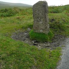
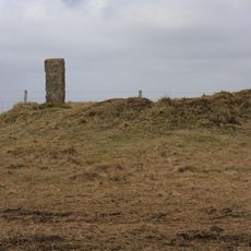
A lone standing stone marks the northern end and serves as a visible marker across the moorland. This isolated feature may have functioned as a waypoint or territorial marker in prehistoric times.

Location: Sheepstor

GPS coordinates: 50.47480,-4.02579

Latest update: December 14, 2025 16:44

Photos
Around this place
Ditsworthy Warren House
United Kingdom

Ditsworthy Warren House

2.1 km
Drizzlecombe
United Kingdom

Drizzlecombe

2.9 km
Yellowmead Down
United Kingdom

Yellowmead Down

2.3 km
Brisworthy stone circle
United Kingdom

Brisworthy stone circle

416 m
Church of St Leonard, Sheepstor
United Kingdom

Church of St Leonard, Sheepstor

1.8 km
Church of St Peter
United Kingdom

Church of St Peter

2.7 km
Brooke Monuments To The North Of Church Of St Leonard
United Kingdom

Brooke Monuments To The North Of Church Of St Leonard

1.9 km
Royal Oak Inn
United Kingdom

Royal Oak Inn

2.7 km
Boundary Stone Approximately 600 Metres North North West Of Blackaton Cross
United Kingdom

Boundary Stone Approximately 600 Metres North North West Of Blackaton Cross

2.2 km
Prehistoric and historic archaeological landscape at Trowlesworthy Warren
United Kingdom

Prehistoric and historic archaeological landscape at Trowlesworthy Warren

1.2 km
Blackaton Cross
United Kingdom

Blackaton Cross

2.8 km
Roman's Cross
United Kingdom

Roman's Cross

1.8 km
Double stone alignment with a terminal stone setting south of Great Trowlesworthy Tor
United Kingdom

Double stone alignment with a terminal stone setting south of Great Trowlesworthy Tor

2.3 km
Higher Meavy Bridge
United Kingdom

Higher Meavy Bridge

2.1 km
Longstone Manor House
United Kingdom

Longstone Manor House

2.7 km
Multi-period remains at Hentor Warren
United Kingdom

Multi-period remains at Hentor Warren

2.5 km
Partially enclosed stone hut circle settlement and post-medieval warren structures on the western slope of Little and Great Trow
United Kingdom

Partially enclosed stone hut circle settlement and post-medieval warren structures on the western slope of Little and Great Trow

1.9 km
Cairn with cist north of Gutter Tor
United Kingdom

Cairn with cist north of Gutter Tor

1.8 km
Prehistoric settlement, three round cairns and a post-medieval rabbit warren at Legis Tor
United Kingdom

Prehistoric settlement, three round cairns and a post-medieval rabbit warren at Legis Tor

1 km
Cairn with a cist east of Willings Walls Reave
United Kingdom

Cairn with a cist east of Willings Walls Reave

2 km
Village Cross
United Kingdom

Village Cross

2.7 km
Agglomerated enclosure with hut circles and later farmstead at Whittenknowles Rocks
United Kingdom

Agglomerated enclosure with hut circles and later farmstead at Whittenknowles Rocks

2.5 km
Bowl barrow at Emmets Post
United Kingdom

Bowl barrow at Emmets Post

2.7 km
Cadover Cross
United Kingdom

Cadover Cross

1.5 km
Marchant's Cross
United Kingdom

Marchant's Cross

2 km
Yellowmead stone circles, cairn and stone alignment
United Kingdom

Yellowmead stone circles, cairn and stone alignment

2.3 km
Cross S of Shaden Plantation
United Kingdom

Cross S of Shaden Plantation

2.6 km
Maj J. Bayly Memorial Cross, Sheepstor
United Kingdom

Maj J. Bayly Memorial Cross, Sheepstor

1.8 km
Show the full map
Reviews

Visited this place? Tap the stars to rate it and share your experience / photos with the community! Try now! You can cancel it anytime.

« Ringmoor stone row and cairn circle - Bronze Age stone alignment in Dartmoor National Park, England » is provided by Around Us (aroundus.com). Images and texts are derived from Wikimedia project under a Creative Commons license. You are allowed to copy, distribute, and modify copies of this page, under the conditions set by the license, as long as this note is clearly visible.

Discover hidden gems everywhere you go!

From secret cafés to breathtaking viewpoints, skip the crowded tourist spots and find places that match your style. Our app makes it easy with voice search, smart filtering, route optimization, and insider tips from travelers worldwide. Download now for the complete mobile experience.

Around Us App Screenshot

A unique approach to discovering new places

Le Figaro

All the places worth exploring

France Info

A tailor-made excursion in just a few clicks

20 Minutes