Yellowmead Down

Log in to your account

AroundUs is a community-driven map of interesting places, built by curious explorers like you. It grows with every review, story, and photo you share.
Connect to save your favorite spots, contribute locations, and create personalized routes.
Continue with Google
Continue with Apple
Continue with X
Continue with Facebook
Continue with email
By continuing, you accept our Terms and Conditions and our Privacy Policy
Create an account
Add to collection
Map
Suggest a change
Share

Yellowmead Down, Stone circle in Sheepstor, Devon, United Kingdom

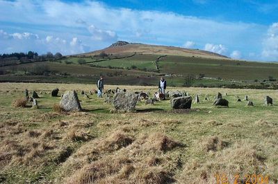
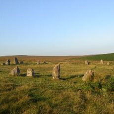
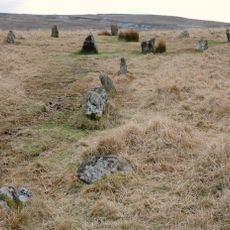
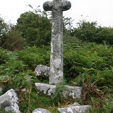
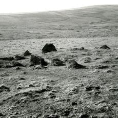
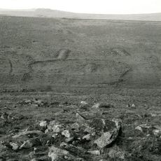
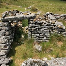
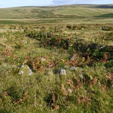
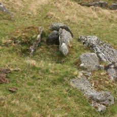
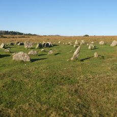
Yellowmead Down is a prehistoric site on open moorland in Devon featuring multiple stone circles alongside a distinct stone row. The formations display varied arrangements and sizes that visitors encounter directly within the wild landscape.

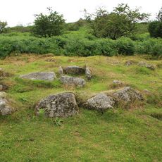
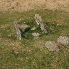
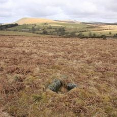
The site dates to the Bronze Age and remained hidden beneath thick heather for thousands of years before being rediscovered in the early 1900s. Vegetation burning revealed the stone formations to modern observers for the first time.

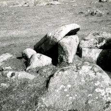
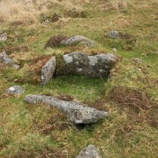
The stone circle features multiple rings that researchers study to understand prehistoric ceremonial practices and construction methods in ancient Britain.

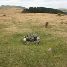
Access crosses moorland with uneven ground, so sturdy footwear is important for a safe visit. Visitors should prepare for changeable weather conditions that can develop quickly at this exposed elevation.

Beyond the concentric circles, a rare stone row extends over 90 feet (28 meters) with dozens of stones arranged in lines. This combined arrangement of circle and row is uncommon on the moor and raises questions about ancient ceremonies.

GPS coordinates: 50.49286,-4.01052

Latest update: December 14, 2025 12:22

Photos
Around this place
Burrator Reservoir
United Kingdom

Burrator Reservoir

2.2 km
Ditsworthy Warren House
United Kingdom

Ditsworthy Warren House

1.8 km
Drizzlecombe
United Kingdom

Drizzlecombe

1.8 km
Brisworthy stone circle
United Kingdom

Brisworthy stone circle

2.6 km
Ringmoor stone row and cairn circle
United Kingdom

Ringmoor stone row and cairn circle

2.3 km
Round cairn 190m east of Cross Gate
United Kingdom

Round cairn 190m east of Cross Gate

2.1 km
Church of St Leonard, Sheepstor
United Kingdom

Church of St Leonard, Sheepstor

1.5 km
Brooke Monuments To The North Of Church Of St Leonard
United Kingdom

Brooke Monuments To The North Of Church Of St Leonard

1.5 km
Leather Tor Bridge
United Kingdom

Leather Tor Bridge

2.2 km
Middleworth farmstead, 450m south east of Norsworthy Bridge
United Kingdom

Middleworth farmstead, 450m south east of Norsworthy Bridge

1.4 km
Roman's Cross
United Kingdom

Roman's Cross

1.5 km
Wayside cross 75m south east of Cross Gate
United Kingdom

Wayside cross 75m south east of Cross Gate

2.1 km
Cairn with a cist north of Whittenknowles Rocks
United Kingdom

Cairn with a cist north of Whittenknowles Rocks

1.2 km
Multi-period remains at Hentor Warren
United Kingdom

Multi-period remains at Hentor Warren

2.4 km
Prehistoric settlement, three round cairns and a post-medieval rabbit warren at Legis Tor
United Kingdom

Prehistoric settlement, three round cairns and a post-medieval rabbit warren at Legis Tor

2.3 km
Crazy Well Farmstead, 420m south of Crazy Well Pool
United Kingdom

Crazy Well Farmstead, 420m south of Crazy Well Pool

2.3 km
Cairn with cist north of Gutter Tor
United Kingdom

Cairn with cist north of Gutter Tor

726 m
Cairn with a cist east of Willings Walls Reave
United Kingdom

Cairn with a cist east of Willings Walls Reave

2.7 km
Three round cairns 370m ENE of Down Tor
United Kingdom

Three round cairns 370m ENE of Down Tor

2 km
Agglomerated enclosure with hut circles and later farmstead at Whittenknowles Rocks
United Kingdom

Agglomerated enclosure with hut circles and later farmstead at Whittenknowles Rocks

1.3 km
Longstone Manor House
United Kingdom

Longstone Manor House

1.9 km
Round cairn 100m south of Down Tor
United Kingdom

Round cairn 100m south of Down Tor

1.6 km
Keaglesborough Mine and Riddipit farmstead 850m north east of Norsworthy Bridge
United Kingdom

Keaglesborough Mine and Riddipit farmstead 850m north east of Norsworthy Bridge

2.3 km
Yellowmead stone circles, cairn and stone alignment
United Kingdom

Yellowmead stone circles, cairn and stone alignment

16 m
Cist south east of Roughtor Plantation
United Kingdom

Cist south east of Roughtor Plantation

676 m
Maj J. Bayly Memorial Cross, Sheepstor
United Kingdom

Maj J. Bayly Memorial Cross, Sheepstor

1.5 km
Riddipit hull 700m WSW of the northern end of Raddick Lane
United Kingdom

Riddipit hull 700m WSW of the northern end of Raddick Lane

2.5 km
Two Brothers Adit
United Kingdom

Two Brothers Adit

1.9 km
Show the full map
Reviews

Visited this place? Tap the stars to rate it and share your experience / photos with the community! Try now! You can cancel it anytime.

« Yellowmead Down - Stone circle in Sheepstor, Devon, United Kingdom » is provided by Around Us (aroundus.com). Images and texts are derived from Wikimedia project under a Creative Commons license. You are allowed to copy, distribute, and modify copies of this page, under the conditions set by the license, as long as this note is clearly visible.

Discover hidden gems everywhere you go!

From secret cafés to breathtaking viewpoints, skip the crowded tourist spots and find places that match your style. Our app makes it easy with voice search, smart filtering, route optimization, and insider tips from travelers worldwide. Download now for the complete mobile experience.

Around Us App Screenshot

A unique approach to discovering new places

Le Figaro

All the places worth exploring

France Info

A tailor-made excursion in just a few clicks

20 Minutes