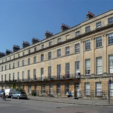
Norfolk Crescent, Georgian crescent in Bath, England
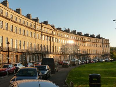
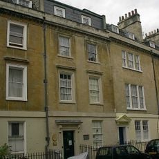
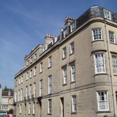
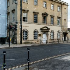
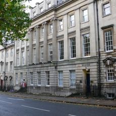
Norfolk Crescent is a Georgian residential crescent in Bath with nineteen houses arranged in an arc and displaying classical Ionic pilasters across its central section. The buildings form a unified frontage with carefully planned architectural design.
Construction took place between 1793 and 1822 and was interrupted by the Bath Bank financial crisis, which drove several builders into bankruptcy. This difficult period significantly delayed the project.
The five-story townhouses reflect the social patterns of Georgian Bath, when wealthy families sought homes combining architectural refinement with comfortable living spaces. You can see how the wealthy arranged their lives and homes through the details still visible in these houses.
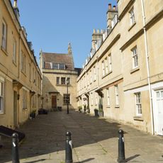
Some of the houses have been converted into apartments while others retain their original structure, meaning not all facades appear identical from the outside. The area is walkable and can be viewed while strolling through Bath.
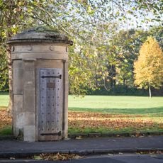
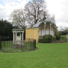
A preserved watchman's hut stands in the corner of the formal gardens and has received its own listed status. This small outbuilding reveals an often overlooked aspect of Georgian daily life.
Location: Bath and North East Somerset
GPS coordinates: 51.38250,-2.37000
Latest update: December 14, 2025 13:01
Royal Victoria Park, Bath
368 m
Victoria Bridge
250 m
Midland Bridge
215 m
Herschel Museum of Astronomy
213 m
1, 2 and 3 Nile Street and Monmouth Hotel
110 m
Odeon Bath
402 m
Elim Pentacostal Church
302 m
Holy Trinity Church
348 m
Cemetery Chapel Of Widcombe, Lyncombe And St James's Cemetery
400 m
Bandstand
317 m
Cumberland House
58 m
Victoria Gate
397 m
9, St Ann's Place
164 m
Star Gazers
206 m
8-18 Norfolk Crescent
22 m
1-8, Nelson Place West
95 m
1, St Ann's Place
155 m
2, 3 And 4, St Ann's Place
165 m
1-12, Queen's Parade
375 m
8, St Ann's Place
167 m
Watchman's Box
69 m
Stanier Bridge
128 m
Pair Of Vases Flanking Bandstand
320 m
Nos. 18a, 19 And 20 And Attached Railings
403 m
Boundary Wall To St James's Cemetery Including Milestone
296 m
5, 6 And 7, St Ann's Place
177 m
18, Queen Square
403 m
Milepost, Lower Bristol Road, W end of St James' Cemetery, opp. Pine way
301 mVisited this place? Tap the stars to rate it and share your experience / photos with the community! Try now! You can cancel it anytime.
Discover hidden gems everywhere you go!
From secret cafés to breathtaking viewpoints, skip the crowded tourist spots and find places that match your style. Our app makes it easy with voice search, smart filtering, route optimization, and insider tips from travelers worldwide. Download now for the complete mobile experience.
A unique approach to discovering new places❞
— Le Figaro
All the places worth exploring❞
— France Info
A tailor-made excursion in just a few clicks❞
— 20 Minutes