Clapton Stadium, Sports stadium in Lower Clapton, England.
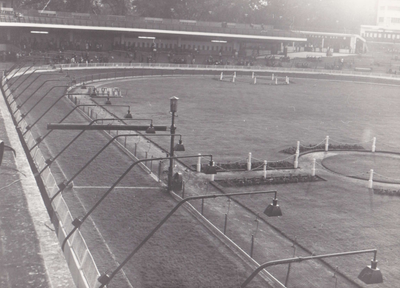
Clapton Stadium was a sports venue in Lower Clapton featuring concrete terracing on three sides and an oval track encircling the central football pitch. The facility accommodated various sporting competitions and could hold several thousand spectators.
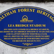
The site began as Whittles Athletic Ground for dog racing and became a major sporting venue following a major renovation in 1927. It closed in January 1974 to make way for residential housing development in East London.
This venue brought neighbors together through football matches and dog racing, creating shared moments that shaped how the local community spent their leisure time. Sports events here were central to the rhythm of everyday life in the area.
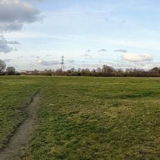
The stadium sat on Millfields Road and was easily accessible until its closure in 1974. Today, the site exists only in local memory and historical records, with no physical structures remaining.
The stadium sat on land with a surprising past, having once housed a fireworks factory before becoming a sports venue. The terracing was built from slag material sourced from an adjacent power station, giving the structure roots in the industrial landscape.
The community of curious travelers
AroundUs brings together thousands of curated places, local tips, and hidden gems, enriched daily by 60,000 contributors worldwide.