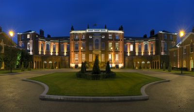
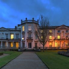
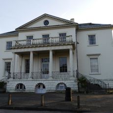
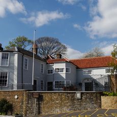
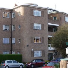
Roehampton House, Grade I listed building in London Borough of Wandsworth, England.
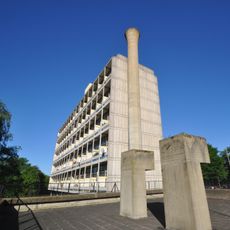
Roehampton House is a residential building in London featuring Georgian architectural elements with symmetrical wings, large sash windows, and detailed stone carvings on its exterior facades. The interior layout preserves classical room proportions from the early 1700s while the structure now accommodates modern apartments.
Thomas Archer designed this residence for merchant Thomas Cary between 1710 and 1712 as an elegant Georgian home. Sir Edwin Lutyens added north and south wings in 1910, expanding the building for early 20th-century use.
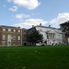
The building served as Queen Mary's Hospital during World War I, providing medical care and rehabilitation services for injured British soldiers.
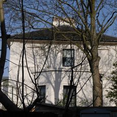
The building now houses private apartments and is not open for regular visits, though it can be viewed from the street. The best perspective on the facade and its details is available from the pavement, where you can observe the architectural features at leisure.
During World War I, the building served as Queen Mary's Hospital, providing medical care and rehabilitation for wounded British soldiers. This conversion to a hospital represented an important contribution to wartime support before returning to residential use later.
The community of curious travelers
AroundUs brings together thousands of curated places, local tips, and hidden gems, enriched daily by 60,000 contributors worldwide.