Prince Alfred

Log in to your account

AroundUs is a community-driven map of interesting places, built by curious explorers like you. It grows with every review, story, and photo you share.
Connect to save your favorite spots, contribute locations, and create personalized routes.
Continue with Google
Continue with Apple
Continue with X
Continue with Facebook
Continue with email
By continuing, you accept our Terms and Conditions and our Privacy Policy
Create an account
Add to collection
Map
Suggest a change
Share

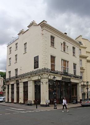
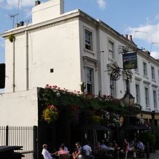
Prince Alfred, Victorian pub in Maida Vale, London.

The Prince Alfred is a Grade II listed pub featuring ornate wooden partitions with detailed carving and divided sections arranged under tall Victorian ceilings. The interior showcases craftsmanship typical of the period, with carefully preserved woodwork that maintains the appearance of a 19th century establishment.

The pub was constructed in 1856 and received Grade II listed status in 1970, recognizing its historical value. In 2022 its protection level was upgraded to Grade II in acknowledgment of the importance of its preserved Victorian interior.

The pub draws visitors interested in experiencing a traditional London drinking establishment with its original Victorian character intact. People come here to step into the social world of the 19th century and see how bars were designed to serve different classes of patrons.

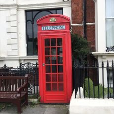
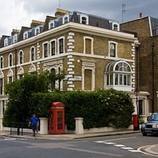
The pub sits on Formosa Street near Warwick Avenue tube station, making it straightforward to reach by public transport. Food and drinks are available from midday onwards, giving visitors flexibility in when they choose to visit.

The pub retains original Victorian snob screens, wooden dividers fitted with glass panels that once separated social classes. These fixtures remain mostly intact, offering a tangible reminder of how drinking establishments once reflected the rigid social hierarchies of the era.

Location: City of Westminster

Address: 5A Formosa Street, London, W9 1EE

Phone: +442072863287

Website: http://theprincealfred.com

GPS coordinates: 51.52444,-0.18484

Latest update: December 12, 2025 07:55

Photos
Around this place
Warwick Castle
United Kingdom

Warwick Castle

270 m
The Warrington
United Kingdom

The Warrington

330 m
Spanish and Portuguese Synagogue
United Kingdom

Spanish and Portuguese Synagogue

367 m
Canal Cafe Theatre
United Kingdom

Canal Cafe Theatre

384 m
St Mary Magdalene, Paddington
United Kingdom

St Mary Magdalene, Paddington

363 m
Colonnade Hotel
United Kingdom

Colonnade Hotel

19 m
St Mary Magdalene Church War Memorial
United Kingdom

St Mary Magdalene Church War Memorial

363 m
Warwick Avenue Bridge Over Regent's Canal
United Kingdom

Warwick Avenue Bridge Over Regent's Canal

349 m
Cabmen's Shelter Near Junction With Clifton Gardens
United Kingdom

Cabmen's Shelter Near Junction With Clifton Gardens

144 m
Westbourne Terrace Road Bridge
United Kingdom

Westbourne Terrace Road Bridge

362 m
British Waterway Board Canal Office
United Kingdom

British Waterway Board Canal Office

356 m
Number 33 And Front Garden Wall To 33
United Kingdom

Number 33 And Front Garden Wall To 33

310 m
1-5, Formosa Street W9
United Kingdom

1-5, Formosa Street W9

18 m
2 K2 Telephone Kiosks, To North Of The Warrington Hotel
United Kingdom

2 K2 Telephone Kiosks, To North Of The Warrington Hotel

349 m
23, Blomfield Road W9
United Kingdom

23, Blomfield Road W9

357 m
Junction House, Regents Canal
United Kingdom

Junction House, Regents Canal

340 m
176-186, Sutherland Avenue W9
United Kingdom

176-186, Sutherland Avenue W9

291 m
Number 34 And Gate Piers And Front Garden Wall To Number 34
United Kingdom

Number 34 And Gate Piers And Front Garden Wall To Number 34

314 m
Number 32 And Number 16 Warwick Avenue Including Front Garden Wall And Gatepiers
United Kingdom

Number 32 And Number 16 Warwick Avenue Including Front Garden Wall And Gatepiers

384 m
Numbers 30 And 31 Including Font Garden Wall And Gatepiers
United Kingdom

Numbers 30 And 31 Including Font Garden Wall And Gatepiers

383 m
46 And 47, Blomfield Road W9
United Kingdom

46 And 47, Blomfield Road W9

315 m
Numbers 38 And 39 Including Front Garden Wall And Gateways
United Kingdom

Numbers 38 And 39 Including Front Garden Wall And Gateways

329 m
48 And 49, Blomfield Road W9
United Kingdom

48 And 49, Blomfield Road W9

299 m
Numbers 40-45 Including Front Garden Wall And Gatepiers Of Numbers 40-44
United Kingdom

Numbers 40-45 Including Front Garden Wall And Gatepiers Of Numbers 40-44

334 m
K2 Telephone Kiosk Outside The Warrington Hotel
United Kingdom

K2 Telephone Kiosk Outside The Warrington Hotel

322 m
Number 24 And Front Garden Wall
United Kingdom

Number 24 And Front Garden Wall

348 m
Number 29 And 30 And Front Garden Wall
United Kingdom

Number 29 And 30 And Front Garden Wall

314 m
K2 Telephone Kiosk To East Side Of Junction With Formosa Street
United Kingdom

K2 Telephone Kiosk To East Side Of Junction With Formosa Street

183 m
Show the full map
Reviews

Visited this place? Tap the stars to rate it and share your experience / photos with the community! Try now! You can cancel it anytime.

« Prince Alfred - Victorian pub in Maida Vale, London » is provided by Around Us (aroundus.com). Images and texts are derived from Wikimedia project under a Creative Commons license. You are allowed to copy, distribute, and modify copies of this page, under the conditions set by the license, as long as this note is clearly visible.

Discover hidden gems everywhere you go!

From secret cafés to breathtaking viewpoints, skip the crowded tourist spots and find places that match your style. Our app makes it easy with voice search, smart filtering, route optimization, and insider tips from travelers worldwide. Download now for the complete mobile experience.

Around Us App Screenshot

A unique approach to discovering new places

Le Figaro

All the places worth exploring

France Info

A tailor-made excursion in just a few clicks

20 Minutes