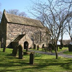
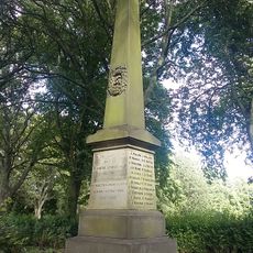
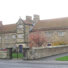
Church of St Helen, Medieval parish church in County Durham, England
Church of St Helen is a medieval parish church in County Durham featuring traditional stone construction with aisles, a crossing tower, and intricate masonry throughout. The interior displays carefully executed stonework and various architectural elements that reflect its long history.
The church was founded around 1150, marking over eight centuries of continuous presence in the region. The site experienced various architectural developments while serving as a spiritual center across the generations.
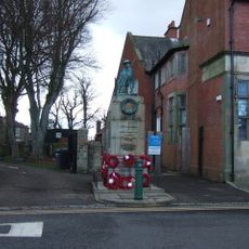
This place serves as a center for worship and community gatherings where local residents meet regularly for services and events. The building itself reflects the enduring religious importance that this site has held for the region across the centuries.
The church maintains regular opening hours for visitors wishing to explore the interior and examine the medieval architecture up close. Inside the building there is much to see, so time should be set aside to look around.
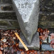
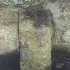
The building contains sections of original masonry from the 12th century around its crossing piers and tower. These preserved elements offer a direct look at construction techniques and craftsmanship methods from the medieval period.
Location: County Durham
Inception: 12 century
Website: http://sthelenschurch.co.uk
GPS coordinates: 54.63570,-1.70972
Latest update: December 14, 2025 18:42
Escomb Church
3.4 km
Gaunless Bridge
342 m
Bishop Auckland Town Hall Arts Centre
4.1 km
Church of St Andrew
3.4 km
Church of St Cuthbert
2.8 km
Church of St John
4.1 km
Church of St Anne
4.1 km
Bishop Auckland Cemetery Chapel
3.7 km
Lightfoot Institute
3.8 km
Newton Cap Bridge
3.9 km
Evenwood War Memorial
3.7 km
The Old Manor House Hotel
1 km
Bridge Over River Gaunless
4.1 km
The Old Hall
968 m
Remains of the Stockton and Darlington Railway
1 km
County Council Marker Stone In Front Of No. 13
2.7 km
St Helen Hall
111 m
Newton Cap Railway Viaduct Over River Wear
4 km
Shildon War Memorial
4 km
County Council Marker Stone In Front Of No. 77
1.4 km
Farm Buildings C.200 Metres North-West Of Green Field Farm
2.4 km
Milestone C.100 Metres North-East Of New Moor Lodge
3.4 km
Former Parish School And Wall Attached
2.7 km
11, Market Place
4.1 km
Drinking Fountain
4 km
Milestone, S of West Auckland, by Plant Hire building
2.3 km
High Etherley
2.8 km
Toft Hill
3.7 kmVisited this place? Tap the stars to rate it and share your experience / photos with the community! Try now! You can cancel it anytime.
Discover hidden gems everywhere you go!
From secret cafés to breathtaking viewpoints, skip the crowded tourist spots and find places that match your style. Our app makes it easy with voice search, smart filtering, route optimization, and insider tips from travelers worldwide. Download now for the complete mobile experience.
A unique approach to discovering new places❞
— Le Figaro
All the places worth exploring❞
— France Info
A tailor-made excursion in just a few clicks❞
— 20 Minutes