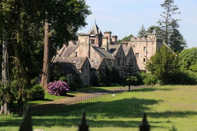
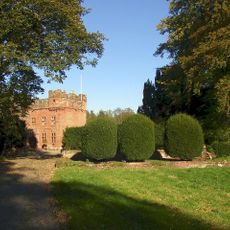
Crossrigg Hall, Grade II* listed mansion in Bolton, England
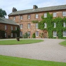
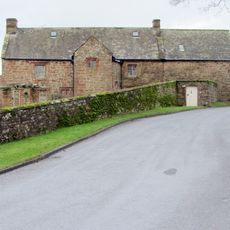
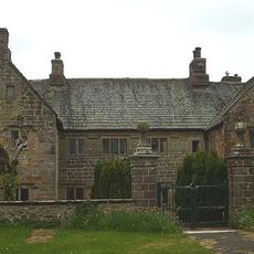
Crossrigg Hall is a substantial country house built from squared stone with a two-tone appearance created by different types of masonry used at different times. The building features slate roofs with graduated tiles, decorative stonework, and a prominent tower with crenellated walls added during a major renovation.
The house was designed in 1864 by Anthony Salvin, who drew on historical English building styles for his work. A significant expansion came in 1915 when J.H. Martindale added the prominent tower and other improvements that reshaped much of the building's appearance.
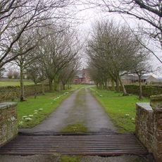
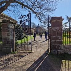
The name refers to its location near a crossroads in the countryside, reflecting the rural character of the area when it was built. Visitors can observe how the house was arranged to show the status and lifestyle of its inhabitants.
The house sits in the Bolton area and is visible from nearby roads, making it accessible to view from a distance. The building's exterior features are easy to observe, especially the contrasting stone colors that show different periods of construction work on the facade.
The building displays an unusual mix of pink and yellowish stone, a direct result of the two main construction periods that shaped its form. This visual contrast in the masonry clearly tells the story of how the house grew and changed over the decades.
Location: Bolton
Inception: 1864
Architects: Anthony Salvin
GPS coordinates: 54.61090,-2.61174
Latest update: December 14, 2025 13:03
Penrith Hoard
4.9 km
Maiden Way
3.6 km
Acorn Bank Garden & Watermill
4.3 km
St Laurence's Church, Morland
1.8 km
All Saints Church
3.4 km
Church of St Edmund
5 km
Church of St Michael
3.7 km
Church of St Cuthbert
1.9 km
Church of St Barnabas
4.5 km
Cliburn Mill Bridge
762 m
Bridge Over River Lyvennet To South Of Crossrigg Hall
120 m
Roman milestone, 180m north west of Spitals
2.7 km
Bridge To North West Of Newbiggin Hall
5 km
King's Arms Hotel
3 km
Foresters' Hall
3.6 km
Newbiggin Hall
5.1 km
Kirkby Thore Hall
3.9 km
Parish Boundary Stone
1.3 km
Acorn Bank House
4.2 km
Low Wall, Gate Piers, Railings, Gates, And Ha Ha Wall To Front Of Acorn Bank House
4.2 km
Entrance Arch, Front Wall Of Courtyard, And Dovecote To South East Of Acorn Bank House
4.2 km
Parish Boundary Stone To West Of Bridge Outside Littlebeck
4.7 km
Millrigg And Dwelling Adjoining To North West
4.1 km
Sundial In Front Of Acorn Bank House
4.2 km
Newby Hall And Area Wall To North
3.3 km
Bolton Bridge
3.6 km
Milepost, opp. large farm yard (Westviln) on NW edge of village
3.3 km
Milepost, Winderwath Farm
4.7 kmVisited this place? Tap the stars to rate it and share your experience / photos with the community! Try now! You can cancel it anytime.
Discover hidden gems everywhere you go!
From secret cafés to breathtaking viewpoints, skip the crowded tourist spots and find places that match your style. Our app makes it easy with voice search, smart filtering, route optimization, and insider tips from travelers worldwide. Download now for the complete mobile experience.
A unique approach to discovering new places❞
— Le Figaro
All the places worth exploring❞
— France Info
A tailor-made excursion in just a few clicks❞
— 20 Minutes