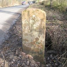
Maiden Way, Roman road in Cumbria and Northumberland, England.
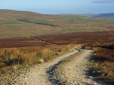
Maiden Way is a Roman road extending approximately 20 miles between Kirkby Thore and Carvoran, crossing the Pennines through steep terrain. The route linked multiple Roman military installations and demonstrates the engineering skill required to traverse difficult upland country.
This road was built during Roman occupation to connect the forts of Bravoniacum and Magnis, facilitating the movement of troops and supplies. An intermediate fort at Epiacum provided support along this demanding route.
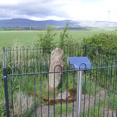
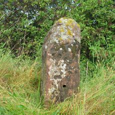
The name Maiden Way first appeared in records from the 12th century as Maydengathe, possibly connected to Maiden Castle on the Stainmore route. Today it remains a recognizable path through the landscape that walkers experience while exploring the Pennine region.
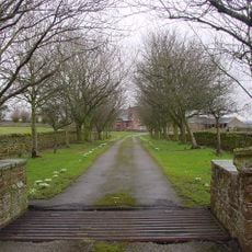
Visitors can best explore sections of this ancient route on foot, with the Pennine Way incorporating several segments of the original path. Good footwear is advisable, as the terrain is steep and weather conditions in the upland region can change quickly.
Recent LIDAR investigations revealed that the road actually extends further south than previously documented, reaching to Low Borrowbridge near Tebay. This discovery has significantly expanded our understanding of the original extent of this ancient military route.
Location: Cumbria
Location: Northumberland
GPS coordinates: 54.62501,-2.56087
Latest update: December 12, 2025 09:06
Penrith Hoard
3 km
Acorn Bank Garden & Watermill
3.6 km
Crossrigg Hall
3.6 km
St Margaret and St James' Church, Long Marton
3.2 km
All Saints Church
2.3 km
Church of St Cuthbert
4.6 km
Church of St Edmund
3.2 km
Church of St Michael
268 m
Church of All Saints
4.9 km
Church of St Cuthbert
3.6 km
Howgill Castle
4.5 km
Cliburn Mill Bridge
4 km
Bridge Over River Lyvennet To South Of Crossrigg Hall
3.7 km
Bridge To North West Of Newbiggin Hall
3.2 km
Roman milestone, 180m north west of Spitals
2 km
Newbiggin Hall
3.2 km
Kirkby Thore Hall
274 m
Foresters' Hall
67 m
King's Arms Hotel
3.1 km
Acorn Bank House
3.3 km
Parish Boundary Stone
3.6 km
Low Wall, Gate Piers, Railings, Gates, And Ha Ha Wall To Front Of Acorn Bank House
3.3 km
Milestone To North East Of Crackenthorpe Hall
4.5 km
Sundial In Front Of Acorn Bank House
3.3 km
Entrance Arch, Front Wall Of Courtyard, And Dovecote To South East Of Acorn Bank House
3.3 km
Millrigg And Dwelling Adjoining To North West
4 km
Bolton Bridge
2.2 km
Milepost, opp. large farm yard (Westviln) on NW edge of village
3.5 kmVisited this place? Tap the stars to rate it and share your experience / photos with the community! Try now! You can cancel it anytime.
Discover hidden gems everywhere you go!
From secret cafés to breathtaking viewpoints, skip the crowded tourist spots and find places that match your style. Our app makes it easy with voice search, smart filtering, route optimization, and insider tips from travelers worldwide. Download now for the complete mobile experience.
A unique approach to discovering new places❞
— Le Figaro
All the places worth exploring❞
— France Info
A tailor-made excursion in just a few clicks❞
— 20 Minutes