Maiden Castle, Iron Age promontory fort in City of Durham, England.
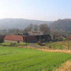
Maiden Castle is a promontory fort located on a raised peninsula overlooking the River Wear, protected by a series of earthen banks and ditches. The site takes advantage of steep natural slopes that form a natural barrier on multiple sides.
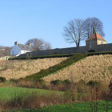
This fortification was constructed during the Iron Age and made use of the dramatic landscape for strategic advantage. Later in the medieval period, a stone wall was built inside the fort to reinforce its defenses.
Archaeological excavations revealed numerous artifacts, including pottery, coins, and tools, indicating the daily activities of ancient British communities at this location.
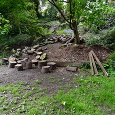
The grounds are open to the public with marked paths allowing visitors to walk around the earthworks and explore the landscape at their own pace. English Heritage manages the site as a protected monument, ensuring the paths and structures remain safe and accessible.
The fortification contains evidence of a stone wall from the Middle Ages, strengthening its interior structure according to archaeological findings.
Location: City of Durham
GPS coordinates: 54.76941,-1.56170
Latest update: December 12, 2025 12:06
Kingsgate Bridge
804 m
Dunelm House
782 m
Old Shire Hall
803 m
Church of St Oswald
743 m
St Cuthbert's Church, Durham
770 m
Durham Crown Court
679 m
The Victoria
634 m
Ramsey House
922 m
Charley's Cross At West Corner Of Junction With Church Street
827 m
Palatine Reception
673 m
Shincliffe Bridge
789 m
Maiden Castle bridge
188 m
The Dun Cow Public House
777 m
Barn To North-West Of Old Durham Farmhouse
573 m
Commemorative plaque to Ove Arup
769 m
28, North Bailey
921 m
Hatfield College Office Building
910 m
Wall on South Side of Steps Leading from Lane to River
860 m
Terrace Wall South Of Bow Lane And East Of Kinsgate
880 m
Kingsgate
917 m
Boundary Stone North Of School Of Agriculture
283 m
53 And 55, Old Elvet
900 m
Castle Wall Behind Nos. 16-22 And No.22a (st. Chad's)
892 m
26, North Bailey
922 m
Retaining Wall And Gazebo On West Side Of Old Durham Farmhouse
503 m
Castle Walls Terrace Wall North Of Bow Lane
883 m
27, North Bailey
922 m
52, Old Elvet
873 mVisited this place? Tap the stars to rate it and share your experience / photos with the community! Try now! You can cancel it anytime.
Discover hidden gems everywhere you go!
From secret cafés to breathtaking viewpoints, skip the crowded tourist spots and find places that match your style. Our app makes it easy with voice search, smart filtering, route optimization, and insider tips from travelers worldwide. Download now for the complete mobile experience.
A unique approach to discovering new places❞
— Le Figaro
All the places worth exploring❞
— France Info
A tailor-made excursion in just a few clicks❞
— 20 Minutes