Wor Barrow and two bowl barrows on Handley Down

Log in to your account

AroundUs is a community-driven map of interesting places, built by curious explorers like you. It grows with every review, story, and photo you share.
Connect to save your favorite spots, contribute locations, and create personalized routes.
By continuing, you accept our Terms and Conditions and our Privacy Policy

Wor Barrow and two bowl barrows on Handley Down

Add to collection
Map
Suggest a change
Share

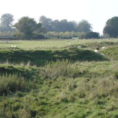
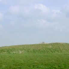
Wor Barrow and two bowl barrows on Handley Down, Ancient burial mounds in Handley Down, Dorset, England

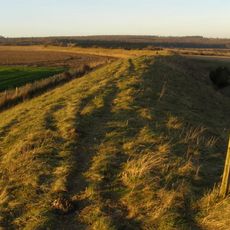
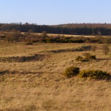
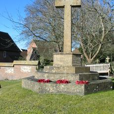
Wor Barrow and two adjacent bowl barrows on Handley Down are prehistoric burial structures made of compacted earth that rise from the open hillside. The Wor Barrow forms an elongated mound, while the two smaller structures beside it are rounded in shape.

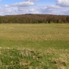
These barrows were built over 4000 years ago during the Neolithic period as communities established permanent burial grounds. This era marked a shift toward settled living and organized funeral practices in Britain.

The mounds served as places where communities gathered to remember their dead and establish their presence in the landscape. People would have visited these structures regularly as part of their relationship with the land and their ancestors.

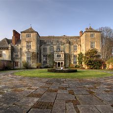
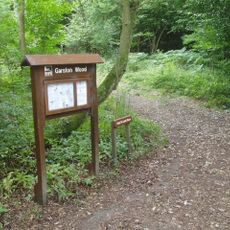
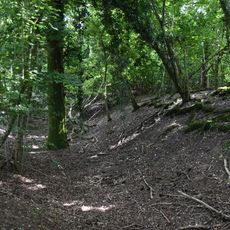
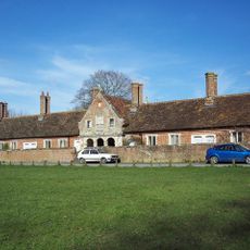
The site sits on open hillside and is reached via public footpaths from Sixpenny Handley village. The ground can be muddy after rain and sheep often graze the area, so wear suitable clothing and watch your step.

Excavations here uncovered different burial methods placed side by side, revealing that people of varying social status were interred within the same structures. This discovery shows that even in prehistoric times, social rank influenced how communities honored their dead.

Location: Sixpenny Handley and Pentridge

GPS coordinates: 50.95520,-1.98385

Latest update: December 14, 2025 18:43

Photos
Around this place
Cranborne Manor
United Kingdom

Cranborne Manor

5.8 km
Bokerley Dyke
United Kingdom

Bokerley Dyke

3.5 km
Church of St Giles, Wimborne St Giles
United Kingdom

Church of St Giles, Wimborne St Giles

5.7 km
Bronze Age and Romano-British enclosure on Martin Down, east of Bokerley Junction
United Kingdom

Bronze Age and Romano-British enclosure on Martin Down, east of Bokerley Junction

4.1 km
Garston Wood
United Kingdom

Garston Wood

2.2 km
Iron Age and Romano-British settlement remains on Woodcutts Common, 850m south east and 845m SSE of Arundell Cottages
United Kingdom

Iron Age and Romano-British settlement remains on Woodcutts Common, 850m south east and 845m SSE of Arundell Cottages

4.9 km
St Aldhelm's Chapel
United Kingdom

St Aldhelm's Chapel

5.6 km
Group of round barrows on Oakley Down
United Kingdom

Group of round barrows on Oakley Down

617 m
Two long barrows on Gussage Hill
United Kingdom

Two long barrows on Gussage Hill

4.1 km
Church of Holy Trinity, Bowerchalke
United Kingdom

Church of Holy Trinity, Bowerchalke

5.7 km
Church of St Andrew
United Kingdom

Church of St Andrew

4.7 km
Church of St Rumbold
United Kingdom

Church of St Rumbold

2.1 km
Church of St Mary
United Kingdom

Church of St Mary

1.7 km
Sixpenny Handley War Memorial
United Kingdom

Sixpenny Handley War Memorial

1.7 km
Milestone
United Kingdom

Milestone

5.7 km
Milestone
United Kingdom

Milestone

922 m
Milestone 200 Metres North East Of Martin Drove End
United Kingdom

Milestone 200 Metres North East Of Martin Drove End

5.6 km
Camp in Mistlebury Wood
United Kingdom

Camp in Mistlebury Wood

2.7 km
Almshouses Including Front Wall
United Kingdom

Almshouses Including Front Wall

5.7 km
Milestone
United Kingdom

Milestone

2.4 km
Packhorse Bridge Approximately 35M South Of Ryall's Farmhouse.
United Kingdom

Packhorse Bridge Approximately 35M South Of Ryall's Farmhouse.

5.7 km
Milestone
United Kingdom

Milestone

2.5 km
Milestone
United Kingdom

Milestone

5.3 km
Milestone Opposite Junction With Track To Kites Nest Farm
United Kingdom

Milestone Opposite Junction With Track To Kites Nest Farm

5.7 km
Milestone, just SW of Yew Trees Garage;
United Kingdom

Milestone, just SW of Yew Trees Garage;

917 m
Milestone, 400m SW of entrance road to Chapel Down farm, NE of Cashmoor
United Kingdom

Milestone, 400m SW of entrance road to Chapel Down farm, NE of Cashmoor

4.1 km
Milestone, Vernditch Chase
United Kingdom

Milestone, Vernditch Chase

4 km
Milestone, Blackheath Down; 10m N of crossroads with major bridleway - Stony Lane.
United Kingdom

Milestone, Blackheath Down; 10m N of crossroads with major bridleway - Stony Lane.

5.7 km
Show the full map
Reviews

Visited this place? Tap the stars to rate it and share your experience / photos with the community! Try now! You can cancel it anytime.

« Wor Barrow and two bowl barrows on Handley Down - Ancient burial mounds in Handley Down, Dorset, England » is provided by Around Us (aroundus.com). Images and texts are derived from Wikimedia project under a Creative Commons license. You are allowed to copy, distribute, and modify copies of this page, under the conditions set by the license, as long as this note is clearly visible.

Discover hidden gems everywhere you go!

From secret cafés to breathtaking viewpoints, skip the crowded tourist spots and find places that match your style. Our app makes it easy with voice search, smart filtering, route optimization, and insider tips from travelers worldwide. Download now for the complete mobile experience.

Around Us App Screenshot

A unique approach to discovering new places

Le Figaro

All the places worth exploring

France Info

A tailor-made excursion in just a few clicks

20 Minutes