Stone circle on Withypool Hill 670m ESE of Portford Bridge
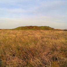
Stone circle on Withypool Hill 670m ESE of Portford Bridge, Stone circle in Withypool and Hawkridge, England
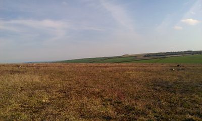
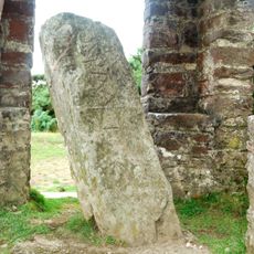
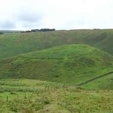
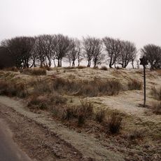
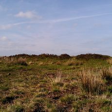
The stone circle on Withypool Hill is a prehistoric monument within Exmoor National Park in England. The surviving gritstones form a ring whose original shape can still be traced across the moorland, though only a fraction of the markers remain visible today.
The stone circle belongs to a tradition stretching across several millennia of prehistory. Its rediscovery in the 19th century led to a survey by archaeologist Harold St George Gray in 1905.
The monument represents one of only two known prehistoric stone circles on Exmoor, joining numerous similar structures across Britain dating from 3300 to 900 BCE.
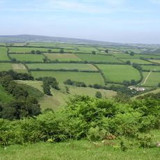
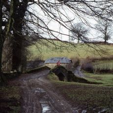
The monument lies roughly 670 meters east of Portford Bridge on open moorland. Walking paths within Exmoor National Park lead nearby, but the ground is uneven and requires sturdy footwear for access.
Most of the stones are unusually small and barely rise above the turf. Originally the markers stood close together, forming an almost continuous low wall of stone.
Location: Withypool and Hawkridge
Part of: stone circles in the British Isles and Brittany
GPS coordinates: 51.09630,-3.66041
Latest update: December 5, 2025 22:31
Tarr Steps
3.7 km
Caratacus Stone
5.2 km
Landacre Bridge
2.8 km
Cow Castle
5.3 km
Ashwick House
6.3 km
Church of St Mary Magdalene, Winsford
6.7 km
Withypool Bridge
1.3 km
South Exmoor SSSI
4.2 km
Alderman's Barrow at N of Almsworthy Common
8 km
Church of St Andrew
1.5 km
Church of St Petrock
7 km
Church of St Giles
4.3 km
Church of Saint Peter
6.3 km
Church of Saint Mary
6.7 km
Church of St Mary Magdalene
4.6 km
Round barrow cemetery incorporating Wambarrows on Winsford Hill
3.8 km
The Royal Oak Inn
6.7 km
Bridge Over Winn Brook
6.8 km
Exford Bridge At Ngr Ss 8525 3836
4.3 km
Lyncombe packhorse bridge
4.3 km
Bowl barrow and round cairn on Withypool Hill, 850m and 820m east of Portford Bridge
235 m
Winsford Smithy Bridge
6.7 km
Middle Lee Farmhouse
7.7 km
West Molland Barton
7.4 km
Remains Of Churchyard Cross, About One Metre South Of South Aisle, Church Of St Mary Magdalene
4.6 km
Stone
5.3 km
Old Vicarage Bridge
6.8 km
Barn And Shippon Approximately 20 Metres To South West Of West Lee Farmhouse
7.8 kmVisited this place? Tap the stars to rate it and share your experience / photos with the community! Try now! You can cancel it anytime.
Discover hidden gems everywhere you go!
From secret cafés to breathtaking viewpoints, skip the crowded tourist spots and find places that match your style. Our app makes it easy with voice search, smart filtering, route optimization, and insider tips from travelers worldwide. Download now for the complete mobile experience.
A unique approach to discovering new places❞
— Le Figaro
All the places worth exploring❞
— France Info
A tailor-made excursion in just a few clicks❞
— 20 Minutes