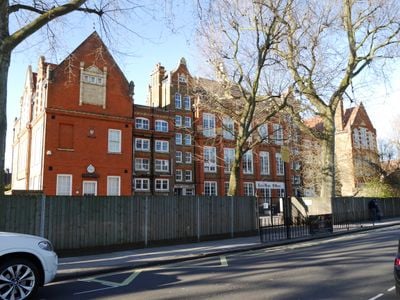
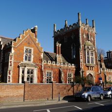
Peterborough School, former school in Fulham, London
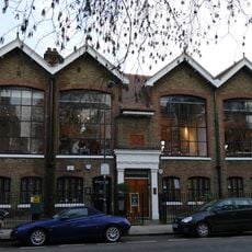
Peterborough School is a Grade II listed building in Hammersmith and Fulham, London. Designed by architect T. J. Bailey in the early 1900s for the London Board School, the structure features sturdy brickwork and tall windows typical of Edwardian educational buildings.
Built in 1903 or 1904 as a London Board School, the building served as a primary school for over a century. After closure in 2007, it was repurposed to house Queensmill School, which serves children with different needs, and the French school École Marie d'Orliac.
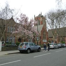
Located on Clancarty Road in Fulham, the building is easily accessible by public transport with buses and nearby stations connecting the area. The surrounding neighborhood features quiet streets and residential buildings, making it pleasant to walk through and observe.
The school counted notable alumni including television presenter Janet Street-Porter and boxer George Groves among its former students, reflecting its role in many life stories. Its protected status as a listed building allows visitors today to see a genuine example of early 20th-century London school architecture.
The community of curious travelers
AroundUs brings together thousands of curated places, local tips, and hidden gems, enriched daily by 60,000 contributors worldwide.