·

Enable Location

We need your location to show you interesting places around you

Discover nearby places

Find interesting locations and hidden gems around you

Precise directions

Get accurate directions and distances to places

Your location is never shared with other users. It's only used when you tap the location button.

Log in to your account

Start exploring — it's free

Trusted by 62,650 travelers worldwide

Continue with Google
Continue with Apple
or

We will send you a code to connect

By continuing, you accept our Terms and Conditions and our Privacy Policy

Check your inbox

We've sent a pincode in your inbox. Please enter the code below.

Colney Heath Local Nature Reserve

Colney Heath Local Nature Reserve

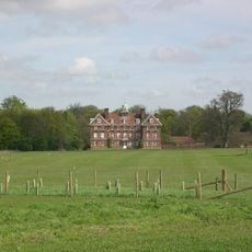
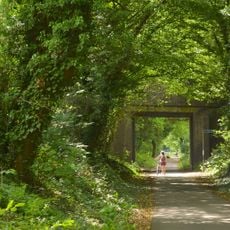
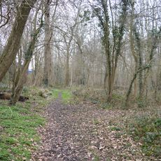
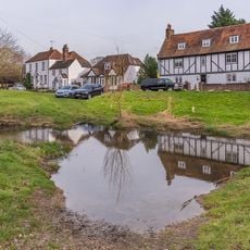
Colney Heath Local Nature Reserve is a nature reserve near Colney Heath in Hertfordshire, England. The roughly 22-hectare area features acid grassland and woodland with the River Colne flowing through it, offering walking paths across different habitats.

The area was acquired by the local parish council in the 1950s and 1960s and has been a protected natural space since then. It is recognized as a Hertfordshire Heritage site and today supports rare acid heathland, a botanical feature uncommon in the region.

The name reflects the heathland that grows in this place. Visitors can observe how the local community cares for the land to protect its natural features and support native plants and animals.

The reserve is accessible from High Street or Church Lane and offers straightforward walking paths through the grasslands and woods. Bring sturdy shoes as some paths can become muddy after rain, and plan around 75 minutes for a leisurely walk.

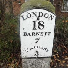
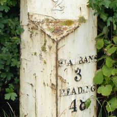
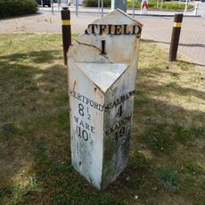
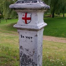
A small historical marker called a London Coal-Tax Post sits in the northeast corner of the reserve and recalls the industrial past of the region. This relic shows how the landscape was once used for resources and trade in earlier times.

The community of curious travelers

AroundUs brings together thousands of curated places, local tips, and hidden gems, enriched daily by 60,000 contributors worldwide.

Start exploring
GPS coordinates
51.73800,-0.26060
Latest update
February 9, 2026 07:43
Around this place
Tyttenhanger House
United Kingdom

Tyttenhanger House

1.6 km
Alban Way
United Kingdom

Alban Way

1.6 km
Oxleys Wood
United Kingdom

Oxleys Wood

3 km
Church of St John the Evangelist
United Kingdom

Church of St John the Evangelist

2.1 km
The Plough Inn
United Kingdom

The Plough Inn

1.2 km
Church of St Mark
United Kingdom

Church of St Mark

625 m
Church of St Peter
United Kingdom

Church of St Peter

2.9 km
Church of St Mary the Virgin
United Kingdom

Church of St Mary the Virgin

2.4 km
Main Gates,Octagonal Lodge,Walls,East Lodge And Service Gates To North Mymms Park
United Kingdom

Main Gates,Octagonal Lodge,Walls,East Lodge And Service Gates To North Mymms Park

2.4 km
The Green Dragon Public House
United Kingdom

The Green Dragon Public House

3 km
The Golden Lion Public House
United Kingdom

The Golden Lion Public House

2.9 km
Gaussen Tomb In Churchyard Of Church Of St Mary The Virgin
United Kingdom

Gaussen Tomb In Churchyard Of Church Of St Mary The Virgin

2.4 km
Salisbury Hall
United Kingdom

Salisbury Hall

3 km
Telfords Bridge
United Kingdom

Telfords Bridge

2.9 km
The Comet Public House
United Kingdom

The Comet Public House

2.7 km
Mural Located In Former Lee Valley Water Company Offices And Free-Standing Sculpture On West Side Of Entrance Drive
United Kingdom

Mural Located In Former Lee Valley Water Company Offices And Free-Standing Sculpture On West Side Of Entrance Drive

2.6 km
The Bull Public House
United Kingdom

The Bull Public House

2.9 km
Milepost On North Side Of Road, South Of Oaklands College
United Kingdom

Milepost On North Side Of Road, South Of Oaklands College

2.4 km
London Colney War Memorial
United Kingdom

London Colney War Memorial

2.9 km
North Mymms Park With Adjoining Garden Walls And Ha Ha
United Kingdom

North Mymms Park With Adjoining Garden Walls And Ha Ha

2.2 km
Holly Cottage
United Kingdom

Holly Cottage

2.5 km
Milestone On Verge At Junction With Haseldine Road
United Kingdom

Milestone On Verge At Junction With Haseldine Road

2.9 km
1-5, High Street
United Kingdom

1-5, High Street

2.9 km
Colne House
United Kingdom

Colne House

2.9 km
Tomb On South Side Of Chancel Of Church Of St Mary The Virgin
United Kingdom

Tomb On South Side Of Chancel Of Church Of St Mary The Virgin

2.4 km
Milepost Approximately 70 Metres East North East Of The Three Horseshoes Public House
United Kingdom

Milepost Approximately 70 Metres East North East Of The Three Horseshoes Public House

2 km
Milepost To West Of Comet Roundabout, Opposite Comet Public House
United Kingdom

Milepost To West Of Comet Roundabout, Opposite Comet Public House

2.7 km
London Coal Duty Marker On South Side Of Road Near Telford's Bridge
United Kingdom

London Coal Duty Marker On South Side Of Road Near Telford's Bridge

2.9 km
Show the full map
« Colney Heath Local Nature Reserve » is provided by Around Us (aroundus.com). Images and texts are derived from Wikimedia project under a Creative Commons license. You are allowed to copy, distribute, and modify copies of this page, under the conditions set by the license, as long as this note is clearly visible.

Discover hidden gems everywhere you go!

From secret cafés to breathtaking viewpoints, skip the crowded tourist spots and find places that match your style. Our app makes it easy with voice search, smart filtering, route optimization, and insider tips from travelers worldwide. Download now for the complete mobile experience.

Around Us App Screenshot

A unique approach to discovering new places

Le Figaro

All the places worth exploring

France Info

A tailor-made excursion in just a few clicks

20 Minutes

Around Us
Travel Guide & Maps
Download

Send to your phone

QR Code
1

Open the camera app on your mobile.

2

Point at the QR code with your camera. A notification will appear.

3

Tap the notification to open the link.