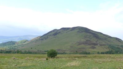
Conic Hill, Mountain summit in Stirling, Scotland.
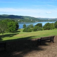
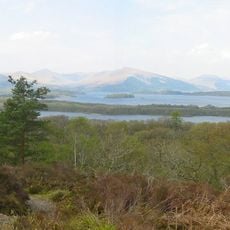
Conic Hill is a mountain summit in Stirling standing at 361 meters (1,185 feet), from which you can see Loch Lomond spread below and views extending toward Glasgow. On clear days, the sight line reaches as far as Goat Fell on the Isle of Arran across the water.
Conic Hill formed along the Highland Boundary Fault, a major geological fault line that created its distinctive steep summit. The sharp peak with scattered stones marks where this fault line passes through the landscape.
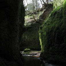
The name Conic Hill originates from the Gaelic word 'còinneach', reflecting the Scottish linguistic heritage through its reference to the moss-covered landscape.
The mountain is reached by marked walking trails starting from the car park at the base, making the route straightforward to follow. The nearby village of Balmaha offers regular bus and ferry connections, simplifying how you get to and from the area.
In 2013, eight people from Deafblind Scotland made the summit with help from rangers and guides, showing the hill can be reached by visitors with various abilities. This event highlighted how outdoor spaces can be made welcoming for those facing physical challenges.
Location: Stirling
Elevation above the sea: 361 m
Part of: Southern Uplands
GPS coordinates: 56.09706,-4.52458
Latest update: December 7, 2025 19:26
Buchanan Castle
4.8 km
Inchconnachan
5.6 km
Balloch Castle
10 km
Finnich Glen
9.8 km
Buchanan Old House
4.3 km
Ross Priory
4.9 km
Balloch Country Park
10.1 km
Luss Parish Church
7 km
Loch Lomond National Nature Reserve
2.4 km
Dalnair House
8 km
Drumquhassle
7.2 km
Avonlea and Ivy Bank
7 km
War Memorial, Luss
7.1 km
Hogback of Luss
7 km
Rossdhu House
7.4 km
Elmbank, Luss
7 km
Rossdhu, South Lodge
9.4 km
Gartmore Parish Church, Main Street, Gartmore
10.3 km
Luss, Lonaig Bank And Marylon
7 km
Chapelarroch Farm Bridge
9.3 km
Couligarton Aqueduct Bridge No 3
8 km
Rowardennan Youth Hostel (Formerly Rowardennan Lodge), Rowardennan
10 km
Designed landscape at Balloch Castle
10.1 km
Endrick Viaduct
7.8 km
Altskeith
9.6 km
Couligarton Aqueduct Bridge No 2
8.3 km
Rossbank Farm, Farmsteading, North West Range
10.6 km
Castle Burn aqueduct bridge
7.7 kmVisited this place? Tap the stars to rate it and share your experience / photos with the community! Try now! You can cancel it anytime.
Discover hidden gems everywhere you go!
From secret cafés to breathtaking viewpoints, skip the crowded tourist spots and find places that match your style. Our app makes it easy with voice search, smart filtering, route optimization, and insider tips from travelers worldwide. Download now for the complete mobile experience.
A unique approach to discovering new places❞
— Le Figaro
All the places worth exploring❞
— France Info
A tailor-made excursion in just a few clicks❞
— 20 Minutes