Naphill Common

Log in to your account

AroundUs is a community-driven map of interesting places, built by curious explorers like you. It grows with every review, story, and photo you share.
Connect to save your favorite spots, contribute locations, and create personalized routes.
Continue with Google
Continue with Apple
Continue with X
Continue with Facebook
Continue with email
By continuing, you accept our Terms and Conditions and our Privacy Policy
Create an account
Add to collection
Map
Suggest a change
Share

Naphill Common, Protected woodland area in Buckinghamshire, England

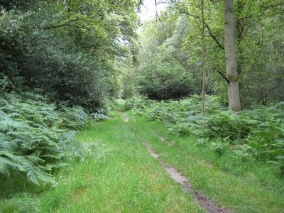
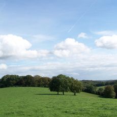
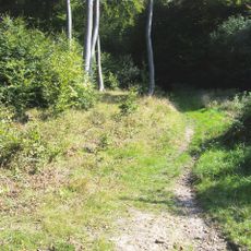
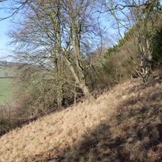
Naphill Common is a woodland area of about 71 hectares with numerous oak and beech trees, acid heath sections, wet areas, and several ponds spread throughout the site. The different habitats create varied terrain with both forested and open ground.

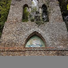
The site shows traces of Roman settlement and later medieval iron smelting activities, evidenced by pottery fragments found dating from the 12th to 15th centuries. These archaeological remains reveal early human activity across different periods.

The common maintains traditional usage rights where local residents can gather firewood and exercise customary land practices passed down through generations. These long-established customs continue to shape how the space functions today.

The site is accessible through several entry points including Forge Road and Chapel Lane, with marked paths and bridleways crossing the area. Wear appropriate footwear as paths can become muddy, especially after wet weather.

The area contains ancient pollard oaks and beeches whose gnarled trunks provide specialized habitats for rare invertebrates and uncommon lichen species. These old trees are living witnesses to centuries of management and support distinctive wildlife.

GPS coordinates: 51.66775,-0.78607

Latest update: December 14, 2025 18:07

Photos
Around this place
Chiltern Hills
United Kingdom

Chiltern Hills

9 km
Hughenden Manor
United Kingdom

Hughenden Manor

2.8 km
St Lawrence's Church, West Wycombe
United Kingdom

St Lawrence's Church, West Wycombe

2.7 km
St Michael and All Angels Church, Hughenden
United Kingdom

St Michael and All Angels Church, Hughenden

2.9 km
National Trust - Hughenden
United Kingdom

National Trust - Hughenden

2.7 km
St Paul's Church, West Wycombe
United Kingdom

St Paul's Church, West Wycombe

2.7 km
Disraeli Monument
United Kingdom

Disraeli Monument

3.1 km
The Swan
United Kingdom

The Swan

2.9 km
Bradenham Woods, Park Wood and The Coppice
United Kingdom

Bradenham Woods, Park Wood and The Coppice

1.7 km
Buttlers Hangings
United Kingdom

Buttlers Hangings

2.6 km
Church of St John the Evangelist
United Kingdom

Church of St John the Evangelist

3 km
Church of St Botolph, Bradenham
United Kingdom

Church of St Botolph, Bradenham

1.2 km
Dashwood Mausoleum
United Kingdom

Dashwood Mausoleum

2.6 km
Bradenham Manor
United Kingdom

Bradenham Manor

1.2 km
Speen Church (Baptist)
United Kingdom

Speen Church (Baptist)

2.5 km
The George And Dragon Inn
United Kingdom

The George And Dragon Inn

2.8 km
Monument To Disraeli Family, In Churchyard Against East Wall Of North Chapel
United Kingdom

Monument To Disraeli Family, In Churchyard Against East Wall Of North Chapel

2.9 km
The Cascade West Wycombe Park
United Kingdom

The Cascade West Wycombe Park

3 km
Island Temple, West Wycombe Park
United Kingdom

Island Temple, West Wycombe Park

2.9 km
The Church Loft
United Kingdom

The Church Loft

2.8 km
West Wycombe War Memorial
United Kingdom

West Wycombe War Memorial

2.6 km
The Red Lion
United Kingdom

The Red Lion

1.7 km
North Lodge West Wycombe Park
United Kingdom

North Lodge West Wycombe Park

2.7 km
Daphnes Temple West Wycombe Park
United Kingdom

Daphnes Temple West Wycombe Park

2.7 km
L Plan Range Of Farm Buildings To North East Of Church Farmhouse
United Kingdom

L Plan Range Of Farm Buildings To North East Of Church Farmhouse

2.8 km
The Cave
United Kingdom

The Cave

2.7 km
Stone Sign Post At East End Of Village Junction Of Roads To London Oxford And Aylesbury
United Kingdom

Stone Sign Post At East End Of Village Junction Of Roads To London Oxford And Aylesbury

2.7 km
Milestone, Chiltern View; houses near Saunderton, at jct. with Hill View
United Kingdom

Milestone, Chiltern View; houses near Saunderton, at jct. with Hill View

3 km
Show the full map
Reviews

Visited this place? Tap the stars to rate it and share your experience / photos with the community! Try now! You can cancel it anytime.

« Naphill Common - Protected woodland area in Buckinghamshire, England » is provided by Around Us (aroundus.com). Images and texts are derived from Wikimedia project under a Creative Commons license. You are allowed to copy, distribute, and modify copies of this page, under the conditions set by the license, as long as this note is clearly visible.

Discover hidden gems everywhere you go!

From secret cafés to breathtaking viewpoints, skip the crowded tourist spots and find places that match your style. Our app makes it easy with voice search, smart filtering, route optimization, and insider tips from travelers worldwide. Download now for the complete mobile experience.

Around Us App Screenshot

A unique approach to discovering new places

Le Figaro

All the places worth exploring

France Info

A tailor-made excursion in just a few clicks

20 Minutes