Old Sarum Castle, Medieval fortress ruins in Salisbury, England
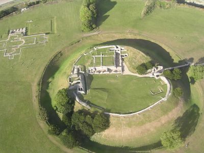
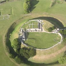
Old Sarum Castle is a ruined castle set on a large, flat-topped hill just north of Salisbury, in Wiltshire, England. The remains include stone walls, earthwork ramparts, and the outline of a royal palace at the center of the hill.
People settled on this hill long before the Normans arrived, but it was William the Conqueror who built a castle here after 1066 and turned the site into a major center of royal power. By the 13th century, water shortages and conflicts between the garrison and the clergy pushed the population down to the valley, and the site was gradually left behind.
Visitors walking the old walls can look down directly at the spire of Salisbury Cathedral, which was built with stone taken from this very site after the clergy left. That view makes the connection between the two places easy to see and understand.
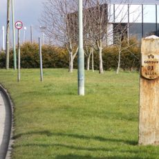
The site is managed by English Heritage, and an entry fee applies, so it is worth checking their website before visiting. The climb to the hilltop is steady but not long, and the top is mostly flat and easy to walk around once you arrive.
The hill was in use long before the Normans came: Iron Age people built a large fort here, and the earthwork banks you can still walk along today are partly the work of those early inhabitants. The Norman castle was built right inside those older defenses, which is why the layout of the site feels so layered.
The community of curious travelers
AroundUs brings together thousands of curated places, local tips, and hidden gems, enriched daily by 60,000 contributors worldwide.