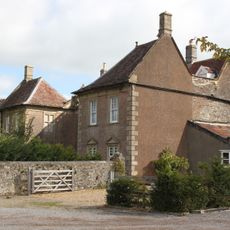
Cholwell House, Manor house in Temple Cloud with Cameley, United Kingdom
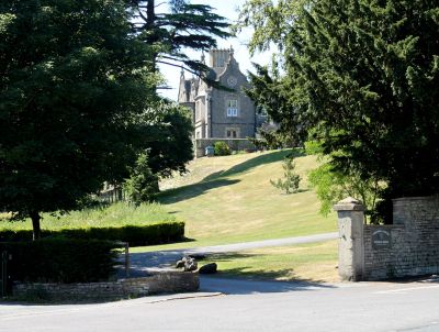
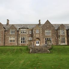
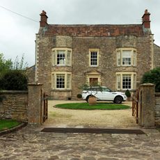
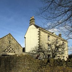
Cholwell House is an 1855 Neo-Jacobean manor with rock-faced pennant stone walls, freestone details, and concrete tile roofs topped by ashlar chimneys across three bays. The building combines sturdy external materials with ornate interior craftsmanship throughout its structure.
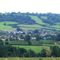
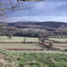
The land belonged to Bath Abbey around 1150 and passed through the Marisco family and Knights Templar before the Mogg family acquired it in 1726. The manor house itself was built in 1855, replacing earlier structures on this long-settled site.
The interior shows decorative ceilings with ribs and bosses, while the staircase window displays stained glass with carved wooden patterns above. These crafted details reflect the Victorian taste for ornate design and reveal the care taken in the house's creation.
The building now functions as a nursing home and is not open for interior visits. It is best appreciated from outside where you can see the stone walls and architectural details of the property from the road.
During World War II, the house served as an evacuation shelter for infants from a London children's organization moved to safety in the countryside. This unexpected wartime role shows how private homes were repurposed for public care during the conflict.
Location: Temple Cloud with Cameley
GPS coordinates: 51.32683,-2.55103
Latest update: December 7, 2025 20:46
Ston Easton Park
4.8 km
Church of St Mary, Litton
4.7 km
Sutton Court
2.8 km
Church of St James, Cameley
1.4 km
Burledge Hill
3.5 km
Folly Farm, Somerset
1.9 km
Church of St Augustine, Clutton
571 m
Church of St Nicholas and the Blessed Virgin Mary, Stowey
1.9 km
Church of the Holy Trinity, Paulton
3.9 km
Church of St Leonard, Chelwood
4.3 km
Highbury Hill
2 km
Church of St Margaret, Hinton Blewett
2.8 km
Long Dole Wood and Meadows SSSI
2.7 km
Church of All Saints, Farmborough
4.8 km
Church of St John the Baptist
3.6 km
Church of Holy Trnity
3.2 km
Church of Holy Trinity
2.9 km
Railway Hotel
915 m
Knole Hill Farmhouse
4.2 km
Milestone At Ngr St 6280 5498 On Roadside
4 km
Conygre House
4.4 km
Hunstrete House, Flank Wall And West Wing
4.4 km
Arcade About 200 Metres North West Of Hunstrete House
4.4 km
The Old Parsonage
3.4 km
Milestone, Bath Road, Farmborough village, jct with Hunstrete Road
4.7 km
Milestone, Red Hill, N of Clutton
2 km
Milestone, High Street, just S of Eastover Road jct
2.9 km
Milestone, Hallatrow, Wells Road, at Hart's Lane jct
2.6 kmVisited this place? Tap the stars to rate it and share your experience / photos with the community! Try now! You can cancel it anytime.
Discover hidden gems everywhere you go!
From secret cafés to breathtaking viewpoints, skip the crowded tourist spots and find places that match your style. Our app makes it easy with voice search, smart filtering, route optimization, and insider tips from travelers worldwide. Download now for the complete mobile experience.
A unique approach to discovering new places❞
— Le Figaro
All the places worth exploring❞
— France Info
A tailor-made excursion in just a few clicks❞
— 20 Minutes