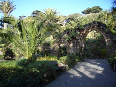
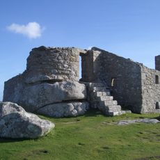
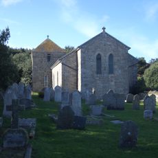
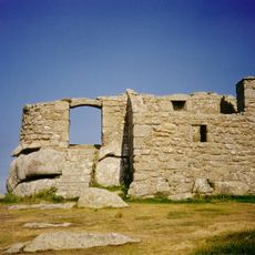
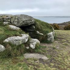
Tresco Priory, Monastery ruins in Tresco, United Kingdom
Tresco Priory is a monastic ruin situated within the Abbey Gardens on the island of Tresco, surrounded by extensive plant collections. The standing stonework reveals the layout of the medieval buildings that once occupied this site.
The monastery was established in the 10th century and became an important religious center on the islands. After suffering raids from sea raiders, the site later received royal protection and was rebuilt.
The priory was dedicated to Saint Nicholas and served as a center for monastic life in the island community. The religious community that once lived here left traces that visitors can still sense when walking among the ruins today.
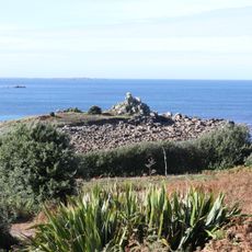
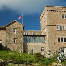
The ruins are located within the expansive gardens and are accessible during the spring through fall months. Visitors should expect uneven ground and exposed stone structures, so sturdy footwear and careful walking are advisable.
The priory was founded by a Benedictine order whose network extended across England, making this remote island location part of a larger monastic system. This connection to other major abbeys gave the settlement significance beyond what its isolated position might suggest.
Location: Tresco
Architectural style: Gothic architecture
GPS coordinates: 49.94744,-6.33013
Latest update: December 14, 2025 16:47
Tresco Abbey Gardens
238 m
Cromwell's Castle
2.2 km
King Charles's Castle
2.2 km
Halangy Down
2.4 km
Grimsby Old Blockhouse
1.2 km
St Nicholas's Church, Tresco
1.2 km
Innisidgen
3 km
Bant's Carn
2.5 km
All Saints' Church, Bryher
1.6 km
Oliver's Battery
760 m
Halangy Down transmitting station
2.4 km
Coastguard's Look Out Tower
2.8 km
Valhalla Museum
181 m
Taylor's Island
2.9 km
Bar Point
2.5 km
Post-medieval smugglers' cache at Tresco Abbey, Tresco
93 m
The Smith Monument On Abbey Hill
427 m
Mid-16th century blockhouse and ramparts with adjacent walling and occupation deposits at Block House Point
1.2 km
Tresco Abbey
66 m
Ashvale Farmhouse
2.9 km
Prehistoric field systems, settlement and cairns, with post-medieval boundary and shelter on Northwethel
2.1 km
Post-medieval kelp pit on the western coast of Tinkler's Hill, St Martin's
3.1 km
Entrance Grave, Samson
2.5 km
Two entrance graves, a prehistoric field system, and Civil War fieldworks and blockhouse on Innisidgen Hill and Helvear Down, St
3.1 km
Broad Ledge
803 m
Prehistoric linear boundary on Puffin Island
1.5 km
Hulman
1.2 km
Carn Near
876 mVisited this place? Tap the stars to rate it and share your experience / photos with the community! Try now! You can cancel it anytime.
Discover hidden gems everywhere you go!
From secret cafés to breathtaking viewpoints, skip the crowded tourist spots and find places that match your style. Our app makes it easy with voice search, smart filtering, route optimization, and insider tips from travelers worldwide. Download now for the complete mobile experience.
A unique approach to discovering new places❞
— Le Figaro
All the places worth exploring❞
— France Info
A tailor-made excursion in just a few clicks❞
— 20 Minutes