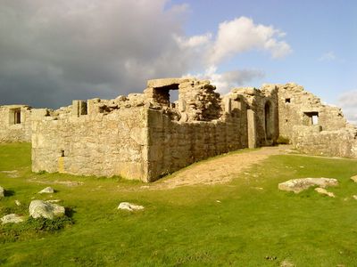
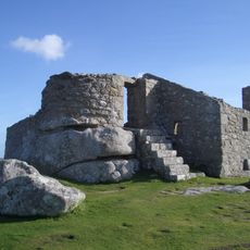
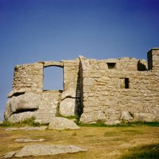
King Charles's Castle, Tudor artillery castle on Tresco Island, England
Description
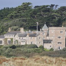
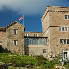
King Charles's Castle is a stone fortification on Tresco Island with an unusual polygonal shape and gun positions facing outward from the front. Residential rooms sit behind these defenses and overlook New Grimsby Harbour and the surrounding waters.
History
The fortress was built between 1550 and 1554 under Edward VI to defend against French threats to the Isles of Scilly. Its construction marked an important step in strengthening English control over these strategic waters.
Culture
The castle displays Tudor military design with its distinctive polygonal shape and gun placements that controlled the waters around Tresco Island. This layout reflects how the fortress was meant to protect the islands from seaborne attacks during a tense period in English history.
Practical
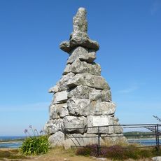
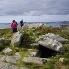
The fortress sits on the highest western point of Castle Down and requires sturdy footwear to reach it. From this location, coastal walking paths branch out in different directions for further exploration.
Did you know?
The construction required around 540 oak trees transported from South Wales, revealing the enormous resources needed for such military buildings. Sourcing timber across these distances was itself a major logistical undertaking for the period.
AroundUs brings together thousands of curated places, local tips, and hidden gems, enriched daily by 60,000 contributors worldwide. Discover all places nearby (Tresco).
Tresco Abbey Gardens
2.2 km
Cromwell's Castle
165 m
Round Island Lighthouse
2.5 km
Halangy Down
4.6 km
Grimsby Old Blockhouse
1.6 km
St Nicholas's Church, Tresco
1.2 km
Tresco Priory
2.2 km
Bant's Carn
4.7 km
All Saints' Church, Bryher
1.2 km
St Martin's Church, St Martin's
4.6 km
Oliver's Battery
2.8 km
Halangy Down transmitting station
4.6 km
Methodist Church
4.7 km
Seal Rock
3.5 km
Valhalla Museum
2.2 km
Bar Point
4.6 km
Post-medieval smugglers' cache at Tresco Abbey, Tresco
2.3 km
The Smith Monument On Abbey Hill
2 km
Mid-16th century blockhouse and ramparts with adjacent walling and occupation deposits at Block House Point
1.6 km
Tresco Abbey
2.2 km
Ashvale Farmhouse
3.4 km
Prehistoric field systems, settlement and cairns, with post-medieval boundary and shelter on Northwethel
1.3 km
Entrance Grave, Samson
3.8 km
Broad Ledge
3 km
Post-medieval kelp pit on the western coast of Tinkler's Hill, St Martin's
3.4 km
Prehistoric linear boundary on Puffin Island
2.7 km
Hulman
2.9 km
Carn Near
2.9 kmDiscover hidden gems everywhere you go!
From secret cafés to breathtaking viewpoints, skip the crowded tourist spots and find places that match your style. Our app makes it easy with voice search, smart filtering, route optimization, and insider tips from travelers worldwide. Download now for the complete mobile experience.
A unique approach to discovering new places❞
— Le Figaro
All the places worth exploring❞
— France Info
A tailor-made excursion in just a few clicks❞
— 20 Minutes