Harridge Wood, Nature reserve in Somerset, England
Harridge Wood is a woodland reserve in Somerset featuring clay slopes crossed by streams that support ferns, wildflowers, and various woodland plants throughout the area. The terrain creates different habitats within the forest, from wetter ground near the water to drier hilltops where different plants thrive.
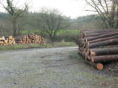
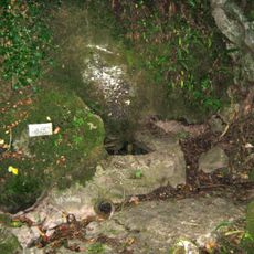
Mining for coal took place in this woodland during medieval times through the 1700s, leaving traces of past work across the landscape. These former mines have been reclaimed by nature and now form part of the woodland floor.
The woodland stands as a testament to Somerset's industrial heritage while maintaining natural spaces for community recreation and environmental education.
You can walk through the woodland on marked trails that lead to different parts of the reserve. Parking is available near the entrance, and comfortable walking shoes are recommended since trails can become muddy after rain.
The woodland provides shelter for bat colonies and is home to European badgers and otters that visitors occasionally spot during visits. These animals are not easy to see but their presence makes the woodland an important refuge for species that need quiet, undisturbed spaces.
GPS coordinates: 51.23160,-2.50178
Latest update: December 14, 2025 18:02
Downside Abbey
2.7 km
Stoke Lane Slocker
1.9 km
Church of St. Andrew, Holcombe
3.1 km
Church of St James, Ashwick
1.4 km
Ashwick Court
1.4 km
Church of St Vigor, Stratton-on-the-Fosse
2.8 km
Church of St Michael
1.8 km
Church of the Holy Trinity
3.7 km
Former Christ Church
2.4 km
Abbey Church of St Gregory the Great, Downside Abbey
2.7 km
The King's Arms
2.6 km
Milepost At Ngr St 6545 4995 On Roadside
1.8 km
Chilcompton War Memorial
3.4 km
Milepost At Ngr St 6484 4869 On Roadside
574 m
Holcombe War Memorial, Somerset
2.6 km
Manor House
1.8 km
Milepost At Ngr St 6300 4654
2.6 km
Church St Benedict (Roman Catholic)
2.8 km
Milepost At Ngr St6222 4787
2.9 km
Knatchbull Arms
1.9 km
Milestone, 20 Metres West Of Tadhill Farmhouse
3.8 km
Milestone On Roadside At Ngr St 6548 4540
2.8 km
Boundary Stone At St6389946560
2 km
Oakhill Methodist Church And Adjacent Gate Piers And Gate Of Forecourt Walls
1.7 km
Mendip Lodge
3.9 km
Milepost At Ngr St 6608 5143 On Roadside
3.4 km
Milestone, near radio mast and Warren Farm
3.4 km
Milepost, near old railway bridge between Old Down and Gurney Slade
3.7 kmVisited this place? Tap the stars to rate it and share your experience / photos with the community! Try now! You can cancel it anytime.
Discover hidden gems everywhere you go!
From secret cafés to breathtaking viewpoints, skip the crowded tourist spots and find places that match your style. Our app makes it easy with voice search, smart filtering, route optimization, and insider tips from travelers worldwide. Download now for the complete mobile experience.
A unique approach to discovering new places❞
— Le Figaro
All the places worth exploring❞
— France Info
A tailor-made excursion in just a few clicks❞
— 20 Minutes