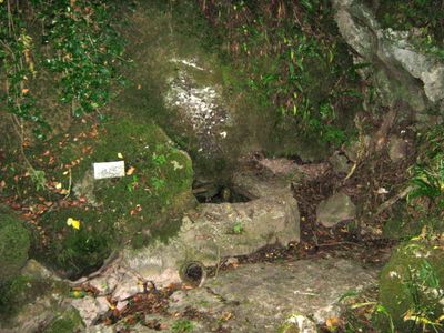
Stoke Lane Slocker, Limestone cave in Stoke St Michael, England.
Stoke Lane Slocker is a limestone cave in the Mendip Hills that extends through multiple levels and contains several distinct chambers along with water passages. The system features various interconnected spaces with different rock formations and geological characteristics.
The cave system began to be explored systematically in the early 1900s, with investigations continuing over several decades and gradually revealing new areas. Major discoveries of previously unknown chambers mark important moments in its exploration history.
The cave earned its character through names given to distinct chambers and geological features during early explorations. Visitors can observe how these named formations, like specific rock structures, reflect how explorers understood the space.
Access to the site requires specialized equipment and training due to the presence of water passages and challenging terrain. Visitors should prepare for technically demanding conditions and take proper safety precautions.
Various sections contain traces from earlier times, including bone finds and deposits of ash. These discoveries show that the cave has been used by humans and animals for a long period.
Location: Stoke St Michael
GPS coordinates: 51.22530,-2.47581
Latest update: December 14, 2025 13:06
Downside Abbey
3.5 km
Church of St Giles, Leigh-on-Mendip
2.4 km
Torr Works
3.9 km
Cranmore Tower
2.6 km
Asham Wood
3.9 km
Church of St. Andrew, Holcombe
3.3 km
Harridge Wood
1.9 km
Church of St James, Ashwick
3.3 km
Ashwick Court
3.4 km
Church of St Vigor, Stratton-on-the-Fosse
3.5 km
Church of St Michael
638 m
St James' Church
3.8 km
Church of All Saints, Downhead
2.6 km
The Bell Inn
2.3 km
Abbey Church of St Gregory the Great, Downside Abbey
3.7 km
The King's Arms
3.4 km
Milepost At Ngr St 6545 4995 On Roadside
2.9 km
Milepost At Ngr St 6484 4869 On Roadside
2.4 km
Manor House
697 m
Holcombe War Memorial, Somerset
2.2 km
Church St Benedict (Roman Catholic)
3.6 km
Oakhill Methodist Church And Adjacent Gate Piers And Gate Of Forecourt Walls
3.3 km
Milestone, 20 Metres West Of Tadhill Farmhouse
1.9 km
Milestone On Roadside At St 6528 4407
3.7 km
Milestone On Roadside At Ngr St 6548 4540
2.5 km
Boundary Stone At St6389946560
3.1 km
Knatchbull Arms
723 m
Milepost, village of Dean
3.4 kmVisited this place? Tap the stars to rate it and share your experience / photos with the community! Try now! You can cancel it anytime.
Discover hidden gems everywhere you go!
From secret cafés to breathtaking viewpoints, skip the crowded tourist spots and find places that match your style. Our app makes it easy with voice search, smart filtering, route optimization, and insider tips from travelers worldwide. Download now for the complete mobile experience.
A unique approach to discovering new places❞
— Le Figaro
All the places worth exploring❞
— France Info
A tailor-made excursion in just a few clicks❞
— 20 Minutes