Chest opened
+${chestReward.xp} XP
Explorer
NOUVEAU ×${chestReward.collectible.quantity}
tapez pour fermer

See the monuments around you in AR Open chests in the app

Around Us is built for your phone — point your camera at the streets and discover the monuments and places around you in augmented reality. Around Us is built for your phone — chests unlock when you walk, explore and capture nearby places.

•

Enable Location

We need your location to show you interesting places around you

Discover nearby places

Find interesting locations and hidden gems around you

Precise directions

Get accurate directions and distances to places

Your location is never shared with other users. It's only used when you tap the location button.

Glassmine Falls

Log in to your account

Start exploring — it's free

Trusted by 88,705 travelers worldwide

Continue with Google
Continue with Apple
or

We will send you a code to connect

By continuing, you accept our Terms and Conditions and our Privacy Policy

Check your inbox

We've sent a pincode in your inbox. Please enter the code below.

Glassmine Falls
Discussion Reviews 1 Photos
3.6k Popularity

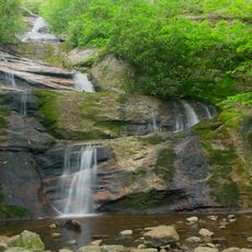
Glassmine Falls, Cascading waterfall in Buncombe County, North Carolina

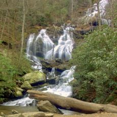
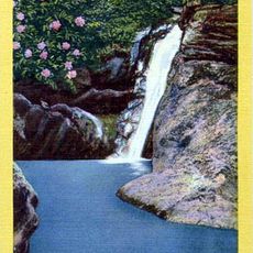
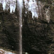
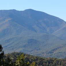
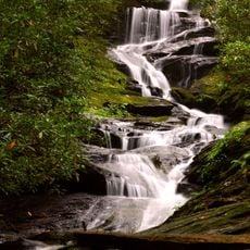
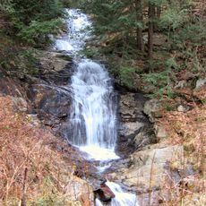
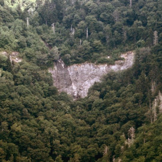
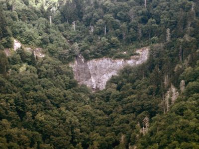
Glassmine Falls is a waterfall in Buncombe County that plunges down a rocky cliff face of Blackstock Knob Mountain into the North Fork Swannanoa River valley. The water drops in stages over rough stone surfaces, creating a cascading flow through the mountainous terrain.

The name comes from an old mica mine at the base where miners extracted a mineral they called glass. This mining activity took place during the economic development of the Appalachian region.

The waterfall forms part of the Blue Ridge Parkway system, which preserves natural and historical features across the Appalachian Mountains.

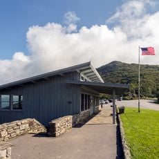
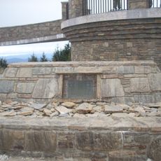
The waterfall can be viewed from an observation platform at mile marker 361.2 on the Blue Ridge Parkway near Craggy Gardens. This accessible location lets visitors see the falls without strenuous hiking.

The falls display varying water volumes depending on recent rainfall, becoming a thin trickle during extended dry spells. Visitors hoping to see it at full force should time their visit after rain.

The community of curious travelers

AroundUs brings together thousands of curated places, local tips, and hidden gems, enriched daily by 60,000 contributors worldwide.
Start exploring
Location
GPS coordinates
35.73544,-82.33127
Latest update
September 12, 2026 07:02
Around this place
Mount Mitchell
United States of America

Mount Mitchell

4.2 mi
Black Mountain College
United States of America

Black Mountain College

7.3 mi
Western North Carolina
United States of America

Western North Carolina

10.1 mi
Mount Craig
United States of America

Mount Craig

4.9 mi
Catawba Falls
United States of America

Catawba Falls

10.3 mi
Andrews Geyser
United States of America

Andrews Geyser

7.7 mi
Mitchell Falls
United States of America

Mitchell Falls

3.8 mi
Zebulon B. Vance Birthplace
United States of America

Zebulon B. Vance Birthplace

9.6 mi
Douglas Falls
United States of America

Douglas Falls

2.6 mi
Celo Knob
United States of America

Celo Knob

9.3 mi
Roaring Fork Falls
United States of America

Roaring Fork Falls

8.1 mi
Walker Falls
United States of America

Walker Falls

1.9 mi
Blue Ridge Assembly Historic District
United States of America

Blue Ridge Assembly Historic District

10.4 mi
Setrock Creek Falls
United States of America

Setrock Creek Falls

5.9 mi
United States of America

Whiteoak Creek Falls

8.9 mi
Black Mountain Downtown Historic District
United States of America

Black Mountain Downtown Historic District

8.3 mi
Intheoaks
United States of America

Intheoaks

8.6 mi
Dr. John G. & Nannie H. Barrett Farm
United States of America

Dr. John G. & Nannie H. Barrett Farm

9.6 mi
Thomas Chapel A.M.E. Zion Church
United States of America

Thomas Chapel A.M.E. Zion Church

8.2 mi
Welsford Parker Artz House
United States of America

Welsford Parker Artz House

11.2 mi
Rafael Guastavino, Sr., Estate
United States of America

Rafael Guastavino, Sr., Estate

9.6 mi
Old Fort Commercial Historic District
United States of America

Old Fort Commercial Historic District

11.2 mi
Brigman-Chambers House
United States of America

Brigman-Chambers House

9.2 mi
Carter-Swain House
United States of America

Carter-Swain House

9.8 mi
Mount Mitchell State Park
United States of America

Mount Mitchell State Park

4.5 mi
Mount Mitchell Museum
United States of America

Mount Mitchell Museum

4.3 mi
Elisha Mitchell's tomb
United States of America

Elisha Mitchell's tomb

4.2 mi
Craggy Gardens Visitor Center
United States of America

Craggy Gardens Visitor Center

3.6 mi
Show the full map
Reviews
Share your experience

No review yet

Discussions
Start a discussion...

No discussion yet

« Glassmine Falls - Cascading waterfall in Buncombe County, North Carolina » is provided by Around Us (aroundus.com). Images and texts are derived from Wikimedia project under a Creative Commons license. You are allowed to copy, distribute, and modify copies of this page, under the conditions set by the license, as long as this note is clearly visible.

Discover hidden gems everywhere you go!

From secret cafés to breathtaking viewpoints, skip the crowded tourist spots and find places that match your style. Our app makes it easy with voice search, smart filtering, route optimization, and insider tips from travelers worldwide. Download now for the complete mobile experience.
Around Us App Screenshot
❝

A unique approach to discovering new places❞

— Le Figaro

❝

All the places worth exploring❞

— France Info

❝

A tailor-made excursion in just a few clicks❞

— 20 Minutes

Around Us
Travel Guide & Maps
Download

Send to your phone

QR Code
1

Open the camera app on your mobile.

2

Point at the QR code with your camera. A notification will appear.

3

Tap the notification to open the link.