Enable Location

We need your location to show you interesting places around you

Discover nearby places

Find interesting locations and hidden gems around you

Precise directions

Get accurate directions and distances to places

Your location is never shared with other users. It's only used when you tap the location button.

Newaygo County

Log in to your account

Start exploring — it's free

Trusted by 62,402 travelers worldwide

Continue with Google
Continue with Apple
or

We will send you a code to connect

By continuing, you accept our Terms and Conditions and our Privacy Policy

Check your inbox

We've sent a pincode in your inbox. Please enter the code below.

Newaygo County, County in Michigan, United States

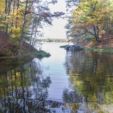
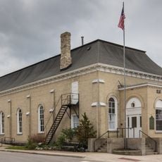
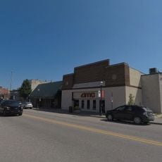
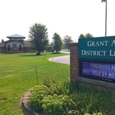
Newaygo County is an administrative division in western Michigan that contains numerous natural lakes, rivers, and streams across its landscape. The county includes White Cloud as its central administrative hub and comprises several smaller communities throughout the region.

The county was established in 1851 as settlers moved into western Michigan, taking its name from a Chippewa leader from the early decades of the region's development. This formation reflected the broader expansion and administrative organization of Michigan during that era.

Annual festivals like the Memorial Weekend Arts Festival and Baby Food Festival bring together local and visiting communities around agriculture and crafts. These events shape how people connect with their surroundings and celebrate shared traditions.

The area is best explored during warmer months when water activities and outdoor access are at their peak. Planning visits around local festivals or scheduling time for water-based recreation helps visitors make the most of the region.

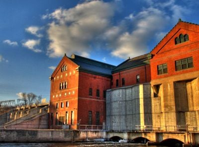
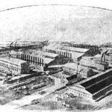
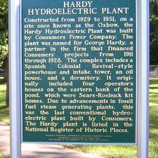
The Muskegon River draws fishing enthusiasts who come seeking steelhead and salmon in its waters year after year. Few visitors realize this river runs through a region with significant engineering history tied to its hydroelectric development.

The community of curious travelers

AroundUs brings together thousands of curated places, local tips, and hidden gems, enriched daily by 60,000 contributors worldwide.

Start exploring
Location
Inception
1851
Capital city
White Cloud
Shares border with
Lake County, Kent County, Mecosta County, Montcalm County, Osceola County, Mason County, Oceana County, Muskegon County
GPS coordinates
43.55000,-85.80000
Latest update
December 7, 2025 19:26
Around this place
United States of America

Michigan's Adventure

44.8 km
Shivering Timbers
United States of America

Shivering Timbers

44.9 km
Thunderhawk
United States of America

Thunderhawk

44.8 km
Owasippe Scout Reservation
United States of America

Owasippe Scout Reservation

42.3 km
Wolverine Wildcat
United States of America

Wolverine Wildcat

44.9 km
White Pine Trail State Park
United States of America

White Pine Trail State Park

31.5 km
Zach's Zoomer
United States of America

Zach's Zoomer

45.2 km
Mad Mouse
United States of America

Mad Mouse

44.8 km
Marlborough Historic District
United States of America

Marlborough Historic District

34.8 km
Newaygo State Park
United States of America

Newaygo State Park

17.7 km
Big Dipper
United States of America

Big Dipper

45.2 km
Corkscrew
United States of America

Corkscrew

45.1 km
Grant Depot and Water Tower
United States of America

Grant Depot and Water Tower

24 km
Nisbett Building
United States of America

Nisbett Building

30.5 km
Jared H. Gay House
United States of America

Jared H. Gay House

43.3 km
Fremont High School
United States of America

Fremont High School

14.7 km
Elk Rapids Township Hall
United States of America

Elk Rapids Township Hall

41 km
John C. and Augusta Lewis House
United States of America

John C. and Augusta Lewis House

47 km
Jim Crow Museum of Racist Memorabilia
United States of America

Jim Crow Museum of Racist Memorabilia

29.8 km
Thoroughbred Golf Club
United States of America

Thoroughbred Golf Club

45.3 km
Big Rapids Community Library
United States of America

Big Rapids Community Library

30.2 km
AMC Classic Big Rapids 4
United States of America

AMC Classic Big Rapids 4

30.4 km
White Cloud Community Library
United States of America

White Cloud Community Library

1.9 km
Hardy Hydroelectric Plant‎ historical marker
United States of America

Hardy Hydroelectric Plant‎ historical marker

15.6 km
Old Mecosta County Jail Historical Marker
United States of America

Old Mecosta County Jail Historical Marker

30.6 km
Grant Area District Library
United States of America

Grant Area District Library

24 km
Croton Township Library
United States of America

Croton Township Library

16.7 km
First United Methodist Church Historical Marker
United States of America

First United Methodist Church Historical Marker

30.5 km
Show the full map
Administrative divisions
« Newaygo County - County in Michigan, United States » is provided by Around Us (aroundus.com). Images and texts are derived from Wikimedia project under a Creative Commons license. You are allowed to copy, distribute, and modify copies of this page, under the conditions set by the license, as long as this note is clearly visible.

Discover hidden gems everywhere you go!

From secret cafés to breathtaking viewpoints, skip the crowded tourist spots and find places that match your style. Our app makes it easy with voice search, smart filtering, route optimization, and insider tips from travelers worldwide. Download now for the complete mobile experience.

Around Us App Screenshot

A unique approach to discovering new places

Le Figaro

All the places worth exploring

France Info

A tailor-made excursion in just a few clicks

20 Minutes

Around Us
Travel Guide & Maps
Download

Send to your phone

QR Code
1

Open the camera app on your mobile.

2

Point at the QR code with your camera. A notification will appear.

3

Tap the notification to open the link.