Chest opened
+${chestReward.xp} XP
Explorer
NOUVEAU ×${chestReward.collectible.quantity}
tapez pour fermer
Chest locked

Open chests in the app

Around Us is built for your phone — chests unlock when you walk, explore and capture nearby places.

Enable Location

We need your location to show you interesting places around you

Discover nearby places

Find interesting locations and hidden gems around you

Precise directions

Get accurate directions and distances to places

Your location is never shared with other users. It's only used when you tap the location button.

Agrihan

Log in to your account

Start exploring — it's free

Trusted by 72,895 travelers worldwide

Continue with Google
Continue with Apple
or

We will send you a code to connect

By continuing, you accept our Terms and Conditions and our Privacy Policy

Check your inbox

We've sent a pincode in your inbox. Please enter the code below.

Agrihan
Discussion Reviews 1 Photos
13.5k Popularity

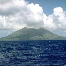
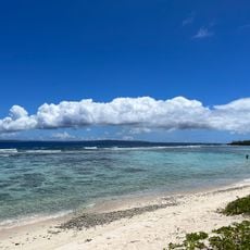
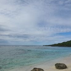
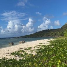
Agrihan, Volcanic island and mountain in Northern Mariana Islands, United States.

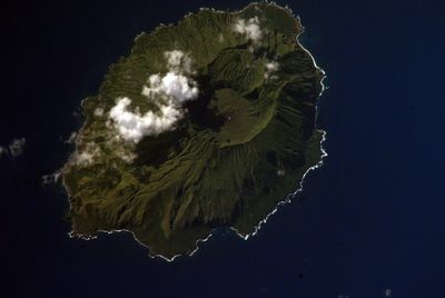
Agrihan is a volcanic island in the Northern Mariana Islands dominated by a dormant volcano that rises 965 meters above sea level. The island has an elongated oval shape and features a crater inside.

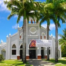
Spanish missionary work beginning in 1669 brought the first foreign contact to the island. The native Chamorro population was subsequently relocated to other islands by the end of that century.

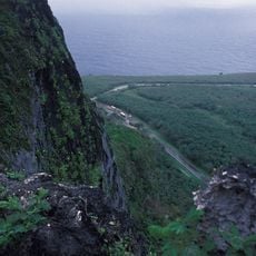
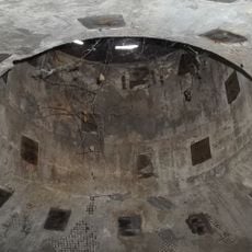
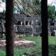
The island once supported coconut plantations during German colonial times, which shaped the economic life of the Northern Islands. This agricultural heritage left marks on the landscape that visitors can still recognize today.

Access requires permits from the Northern Islands Mayor's Office due to potential volcanic activity. Visits are typically limited to authorized research and monitoring teams.

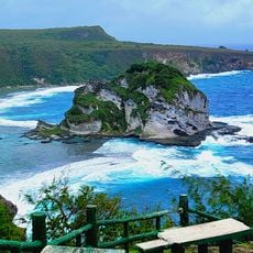
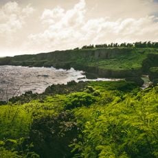
The volcano stands as the highest point in the Mariana arc, rising dramatically from ocean depths. This extreme relief makes it a remarkable geological feature when viewed from the surrounding waters.

The community of curious travelers

AroundUs brings together thousands of curated places, local tips, and hidden gems, enriched daily by 60,000 contributors worldwide.

Start exploring
Elevation above the sea
965 m
Part of
Northern Mariana Islands
GPS coordinates
18.76806,145.67361
Latest update
December 7, 2025 20:26
Around this place
Suicide Cliff
United States of America

Suicide Cliff

388.9 km
Banzai Cliff
United States of America

Banzai Cliff

387.7 km
Military Air Transport Service
United States of America

Military Air Transport Service

405.8 km
Mount Tapochau
United States of America

Mount Tapochau

398.8 km
American Memorial Park
United States of America

American Memorial Park

395.4 km
East Field
United States of America

East Field

400.9 km
NMI Museum of History and Culture
United States of America

NMI Museum of History and Culture

397 km
Japanese Lighthouse
United States of America

Japanese Lighthouse

395.9 km
Sugar King Park
United States of America

Sugar King Park

397 km
Japanese Hospital
United States of America

Japanese Hospital

397.1 km
Catholic Belltower
United States of America

Catholic Belltower

397.1 km
Japanese 20mm Cannon Blockhouse
United States of America

Japanese 20mm Cannon Blockhouse

407.1 km
Japanese Jail Historic and Archeological District
United States of America

Japanese Jail Historic and Archeological District

380.5 km
Santa Remedios Church
United States of America

Santa Remedios Church

392.6 km
Alamagan (volcano)
United States of America

Alamagan (volcano)

131 km
American Saipan Memorial
United States of America

American Saipan Memorial

395.2 km
Pau Pau Beach
United States of America

Pau Pau Beach

391.5 km
Ladder Beach
United States of America

Ladder Beach

407.5 km
Micro Beach
United States of America

Micro Beach

395.1 km
Obyan Beach
United States of America

Obyan Beach

407.7 km
Landing Beaches; Aslito/Isely Field; & Marpi Point, Saipan Island
United States of America

Landing Beaches; Aslito/Isely Field; & Marpi Point, Saipan Island

406.5 km
Bird Island Beach
United States of America

Bird Island Beach

390.7 km
Unai Baput
United States of America

Unai Baput

401.6 km
Unai Makpe
United States of America

Unai Makpe

389.5 km
Old man by the sea
United States of America

Old man by the sea

396.3 km
Joeten-Kiyu Public Library
United States of America

Joeten-Kiyu Public Library

401.9 km
Wing Beach
United States of America

Wing Beach

389.6 km
Jeffrey´s Beach
United States of America

Jeffrey´s Beach

395.6 km
Show the full map
Reviews
Share your experience

No review yet

Discussions
Start a discussion...

No discussion yet

« Agrihan - Volcanic island and mountain in Northern Mariana Islands, United States » is provided by Around Us (aroundus.com). Images and texts are derived from Wikimedia project under a Creative Commons license. You are allowed to copy, distribute, and modify copies of this page, under the conditions set by the license, as long as this note is clearly visible.

Discover hidden gems everywhere you go!

From secret cafés to breathtaking viewpoints, skip the crowded tourist spots and find places that match your style. Our app makes it easy with voice search, smart filtering, route optimization, and insider tips from travelers worldwide. Download now for the complete mobile experience.

Around Us App Screenshot

A unique approach to discovering new places

Le Figaro

All the places worth exploring

France Info

A tailor-made excursion in just a few clicks

20 Minutes

Around Us
Travel Guide & Maps
Download

Send to your phone

QR Code
1

Open the camera app on your mobile.

2

Point at the QR code with your camera. A notification will appear.

3

Tap the notification to open the link.