Enable Location

We need your location to show you interesting places around you

Discover nearby places

Find interesting locations and hidden gems around you

Precise directions

Get accurate directions and distances to places

Your location is never shared with other users. It's only used when you tap the location button.

Mount Tapochau

Log in to your account

Start exploring — it's free

Trusted by 62,628 travelers worldwide

Continue with Google
Continue with Apple
or

We will send you a code to connect

By continuing, you accept our Terms and Conditions and our Privacy Policy

Check your inbox

We've sent a pincode in your inbox. Please enter the code below.

Mount Tapochau

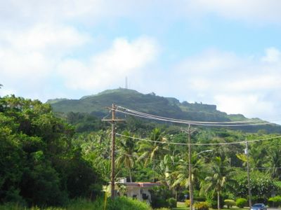
Mount Tapochau, Mountain summit in Saipan, Northern Mariana Islands.

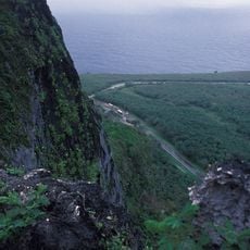
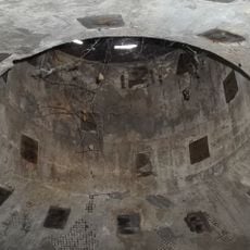
Mount Tapochau reaches about 474 meters and stands as the highest point on Saipan island, with expansive views from the summit across the entire island and surrounding waters. The mountain's upper sections consist of limestone formations and contain deposits of phosphate, manganese, and sulfur beneath the surface.

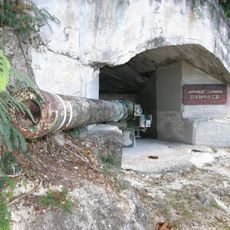
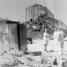
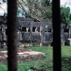
During World War II, the mountain served as a crucial military observation post that allowed forces to monitor activity across a wide area of the Pacific. The strategic location made it essential for controlling information flow about enemy movements in the region.

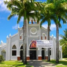
A concrete statue of Jesus Christ at the summit draws local Christian communities each year on Good Friday for pilgrimage and prayer. The climb has become a meaningful annual tradition for families and believers across the island.

The road to the top has loose rocks and potholes, so a sturdy vehicle is recommended and it's best to avoid driving during or after rain. The path becomes slippery when wet, making travel conditions easier during drier periods.

Beneath the surface lies a mix of phosphate, manganese ore, and sulfur deposits that give the peak geological significance. These mineral resources have shaped how people understand the island's natural wealth and past economic activities.

The community of curious travelers

AroundUs brings together thousands of curated places, local tips, and hidden gems, enriched daily by 60,000 contributors worldwide.

Start exploring
Elevation above the sea
474 m
GPS coordinates
15.18620,145.74374
Latest update
December 8, 2025 13:41
Around this place
Suicide Cliff
United States of America

Suicide Cliff

12.4 km
Banzai Cliff
United States of America

Banzai Cliff

13.7 km
North Field
United States of America

North Field

17 km
Military Air Transport Service
United States of America

Military Air Transport Service

8.2 km
House of Taga
United States of America

House of Taga

27.7 km
American Memorial Park
United States of America

American Memorial Park

4.2 km
Guam National Wildlife Refuge
United States of America

Guam National Wildlife Refuge

195.7 km
Rota Latte Stone Quarry
United States of America

Rota Latte Stone Quarry

124.4 km
East Field
United States of America

East Field

4.1 km
Northwest Rota
United States of America

Northwest Rota

123.7 km
NMI Museum of History and Culture
United States of America

NMI Museum of History and Culture

3.1 km
Japanese Lighthouse
United States of America

Japanese Lighthouse

3.1 km
Chugai' Pictograph Site
United States of America

Chugai' Pictograph Site

125.9 km
Sugar King Park
United States of America

Sugar King Park

3 km
Japanese Coastal Defense Gun
United States of America

Japanese Coastal Defense Gun

134 km
Japanese Hospital
United States of America

Japanese Hospital

3.1 km
Nanyo Kohatsu Kabushiki Kaisha Sugar Mill
United States of America

Nanyo Kohatsu Kabushiki Kaisha Sugar Mill

134 km
Catholic Belltower
United States of America

Catholic Belltower

3.5 km
Laulau Kattan Latte Site
United States of America

Laulau Kattan Latte Site

129.3 km
Japanese 20mm Cannon Blockhouse
United States of America

Japanese 20mm Cannon Blockhouse

9.5 km
Japanese Jail Historic and Archeological District
United States of America

Japanese Jail Historic and Archeological District

18.5 km
Santa Remedios Church
United States of America

Santa Remedios Church

6.3 km
Toves House
United States of America

Toves House

202.4 km
American Saipan Memorial
United States of America

American Saipan Memorial

4.4 km
Mount Taipingot
United States of America

Mount Taipingot

135.6 km
Landing Beaches; Aslito/Isely Field; & Marpi Point, Saipan Island
United States of America

Landing Beaches; Aslito/Isely Field; & Marpi Point, Saipan Island

8 km
Joeten-Kiyu Public Library
United States of America

Joeten-Kiyu Public Library

5.3 km
Suicide Cliff
United States of America

Suicide Cliff

29.1 km
Show the full map
« Mount Tapochau - Mountain summit in Saipan, Northern Mariana Islands » is provided by Around Us (aroundus.com). Images and texts are derived from Wikimedia project under a Creative Commons license. You are allowed to copy, distribute, and modify copies of this page, under the conditions set by the license, as long as this note is clearly visible.

Discover hidden gems everywhere you go!

From secret cafés to breathtaking viewpoints, skip the crowded tourist spots and find places that match your style. Our app makes it easy with voice search, smart filtering, route optimization, and insider tips from travelers worldwide. Download now for the complete mobile experience.

Around Us App Screenshot

A unique approach to discovering new places

Le Figaro

All the places worth exploring

France Info

A tailor-made excursion in just a few clicks

20 Minutes

Around Us
Travel Guide & Maps
Download

Send to your phone

QR Code
1

Open the camera app on your mobile.

2

Point at the QR code with your camera. A notification will appear.

3

Tap the notification to open the link.