Sugar King Park

Log in to your account

AroundUs is a community-driven map of interesting places, built by curious explorers like you. It grows with every review, story, and photo you share.
Connect to save your favorite spots, contribute locations, and create personalized routes.
Continue with Google
Continue with Apple
Continue with X
Continue with Facebook
Continue with email
By continuing, you accept our Terms and Conditions and our Privacy Policy
Create an account

Sugar King Park

Add to collection
Map
Suggest a change
Share

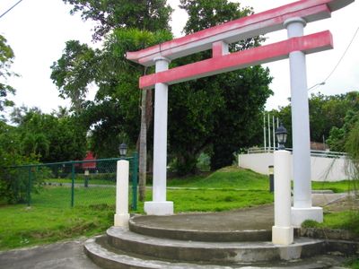
Sugar King Park, Historical park in Garapan, Northern Mariana Islands

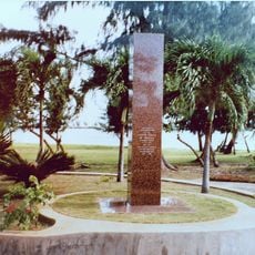
Sugar King Park is a public green space in Garapan that houses several preserved structures and objects, including a historic locomotive, commemorative statues, and a shrine building with a prayer bell. The features are arranged across the grounds and create a layered experience as visitors walk through the site.

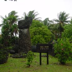
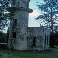
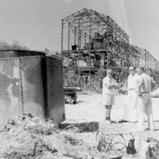
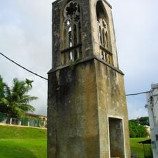
The park developed from a period when sugar cane production became the island's major industry through Japanese investment in the 1920s. The shrine was originally built in 1914 as one of the earliest structures of its kind in the South Seas territories and was reconstructed decades later.

The space reflects how Japanese religious traditions were established on the island and remain visible through the shrine structures and guardian statues that visitors encounter. These elements shape how people experience the park as a place where different cultural influences intersect today.

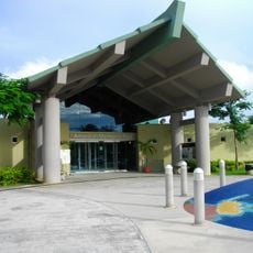
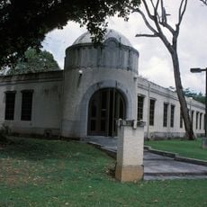
The park is a walkable outdoor location where all objects are easily visible, making it straightforward to explore at your own pace. The site sits near a museum that visitors can check for additional information about what is on display.

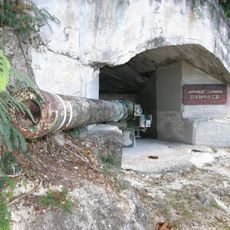
The locomotive displayed here dates to the sugar industry era and was carefully restored in recent years by crew members from a naval vessel. This object bridges the island's industrial past with modern preservation efforts.

Location: Garapan

GPS coordinates: 15.20201,145.72075

Latest update: December 13, 2025 17:08

Photos
Around this place
Suicide Cliff
United States of America

Suicide Cliff

12.7 km
Banzai Cliff
United States of America

Banzai Cliff

14 km
North Field
United States of America

North Field

17 km
Military Air Transport Service
United States of America

Military Air Transport Service

9 km
Mount Tapochau
United States of America

Mount Tapochau

3 km
House of Taga
United States of America

House of Taga

28.2 km
American Memorial Park
United States of America

American Memorial Park

1.6 km
Guam National Wildlife Refuge
United States of America

Guam National Wildlife Refuge

196 km
Rota Latte Stone Quarry
United States of America

Rota Latte Stone Quarry

125 km
East Field
United States of America

East Field

7.1 km
Northwest Rota
United States of America

Northwest Rota

122.5 km
NMI Museum of History and Culture
United States of America

NMI Museum of History and Culture

131 m
Japanese Lighthouse
United States of America

Japanese Lighthouse

1.6 km
Chugai' Pictograph Site
United States of America

Chugai' Pictograph Site

126.5 km
Japanese Coastal Defense Gun
United States of America

Japanese Coastal Defense Gun

134.4 km
Japanese Hospital
United States of America

Japanese Hospital

148 m
Nanyo Kohatsu Kabushiki Kaisha Sugar Mill
United States of America

Nanyo Kohatsu Kabushiki Kaisha Sugar Mill

134.4 km
Catholic Belltower
United States of America

Catholic Belltower

621 m
Laulau Kattan Latte Site
United States of America

Laulau Kattan Latte Site

129.7 km
Japanese 20mm Cannon Blockhouse
United States of America

Japanese 20mm Cannon Blockhouse

10.3 km
Japanese Jail Historic and Archeological District
United States of America

Japanese Jail Historic and Archeological District

16.5 km
Santa Remedios Church
United States of America

Santa Remedios Church

5.8 km
Toves House
United States of America

Toves House

202.8 km
American Saipan Memorial
United States of America

American Saipan Memorial

1.8 km
Mount Taipingot
United States of America

Mount Taipingot

136 km
Landing Beaches; Aslito/Isely Field; & Marpi Point, Saipan Island
United States of America

Landing Beaches; Aslito/Isely Field; & Marpi Point, Saipan Island

9.6 km
Joeten-Kiyu Public Library
United States of America

Joeten-Kiyu Public Library

5.2 km
Suicide Cliff
United States of America

Suicide Cliff

30 km
Show the full map
Reviews

Visited this place? Tap the stars to rate it and share your experience / photos with the community! Try now! You can cancel it anytime.

« Sugar King Park - Historical park in Garapan, Northern Mariana Islands » is provided by Around Us (aroundus.com). Images and texts are derived from Wikimedia project under a Creative Commons license. You are allowed to copy, distribute, and modify copies of this page, under the conditions set by the license, as long as this note is clearly visible.

Discover hidden gems everywhere you go!

From secret cafés to breathtaking viewpoints, skip the crowded tourist spots and find places that match your style. Our app makes it easy with voice search, smart filtering, route optimization, and insider tips from travelers worldwide. Download now for the complete mobile experience.

Around Us App Screenshot

A unique approach to discovering new places

Le Figaro

All the places worth exploring

France Info

A tailor-made excursion in just a few clicks

20 Minutes