Putnam County

Log in to your account

AroundUs is a community-driven map of interesting places, built by curious explorers like you. It grows with every review, story, and photo you share.
Connect to save your favorite spots, contribute locations, and create personalized routes.
By continuing, you accept our Terms and Conditions and our Privacy Policy
Add to collection
Map
Suggest a change
Share

Putnam County, Administrative county in northern Missouri, United States.
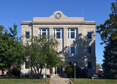
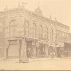
Putnam County extends across 520 square miles of terrain with fields, small towns, and water bodies covering northern Missouri's landscape.

The Missouri State Legislature established Putnam County on February 28, 1845, incorporating sections from Adair and Sullivan counties.

Multiple municipalities within the county maintain local schools, libraries, and community centers that serve the educational needs of 4,681 residents.

The county headquarters operates from Unionville, which provides administrative services and maintains records for property, taxes, and local regulations.

The county borders Iowa and contains remnants of territory from the former Dodge County, which dissolved following an 1851 Supreme Court ruling.

Location: Missouri

Inception: February 28, 1845

Capital city: Unionville

Shares border with: Appanoose County, Sullivan County, Schuyler County, Adair County, Mercer County, Wayne County

Website: http://nemr.net/~putco

GPS coordinates: 40.48000,-93.02000

Latest update: March 4, 2025 05:48

Around this place
Show the full map
Thousand Hills State Park
United States of America

Thousand Hills State Park

46.5 km
Capt. Thomas C. Harris House
United States of America

Capt. Thomas C. Harris House

48.1 km
Appanoose County Courthouse
United States of America

Appanoose County Courthouse

30.8 km
Bear Creek Baptist Church
United States of America

Bear Creek Baptist Church

42.7 km
St. Mary's Church
United States of America

St. Mary's Church

60.4 km
Masonic Temple
United States of America

Masonic Temple

48.8 km
Trinity Episcopal Church
United States of America

Trinity Episcopal Church

48.9 km
Second Baptist Church
United States of America

Second Baptist Church

30.6 km
West Grove United Methodist Church
United States of America

West Grove United Methodist Church

47.8 km
Nelson Round Barn
United States of America

Nelson Round Barn

37.3 km
Journal Printing Company Building
United States of America

Journal Printing Company Building

48.8 km
Kirksville Courthouse Square Historic District
United States of America

Kirksville Courthouse Square Historic District

48.7 km
Adair County Courthouse
United States of America

Adair County Courthouse

48.8 km
Wayne County Courthouse
United States of America

Wayne County Courthouse

39.9 km
Cabins Historic District
United States of America

Cabins Historic District

41.4 km
William P. Hall House
United States of America

William P. Hall House

41.8 km
Courthouse Square Historic District
United States of America

Courthouse Square Historic District

30.9 km
Drake Public Library
United States of America

Drake Public Library

30.7 km
United States Post Office
United States of America

United States Post Office

30.7 km
Porter Hall
United States of America

Porter Hall

30.3 km
Dr. E. Sanborn Smith House
United States of America

Dr. E. Sanborn Smith House

49.3 km
Orie J. Smith Black and White Stock Farm Historic District
United States of America

Orie J. Smith Black and White Stock Farm Historic District

48.3 km
W.H. Tedford House
United States of America

W.H. Tedford House

39.9 km
Russell Octagon House
United States of America

Russell Octagon House

47.2 km
Stratton House
United States of America

Stratton House

31.1 km
Sturdivant-Sawyer House
United States of America

Sturdivant-Sawyer House

30.3 km
Unionville Square Historic District
United States of America

Unionville Square Historic District

1.6 km
Thousand Hills State Park Petroglyphs Archeological Site
United States of America

Thousand Hills State Park Petroglyphs Archeological Site

45.8 km
Show the full map

Reviews

Visited this place? Tap the stars to rate it and share your experience / photos with the community! Try now! You can cancel it anytime.

Administrative divisions
« Putnam County - Administrative county in northern Missouri, United States » is provided by Around Us (aroundus.com). Images and texts are derived from Wikimedia project under a Creative Commons license. You are allowed to copy, distribute, and modify copies of this page, under the conditions set by the license, as long as this note is clearly visible.

Discover hidden gems everywhere you go!

From secret cafés to breathtaking viewpoints, skip the crowded tourist spots and find places that match your style. Our app makes it easy with voice search, smart filtering, route optimization, and insider tips from travelers worldwide. Download now for the complete mobile experience.

Around Us App Screenshot

A unique approach to discovering new places

Le Figaro

All the places worth exploring

France Info

A tailor-made excursion in just a few clicks

20 Minutes